



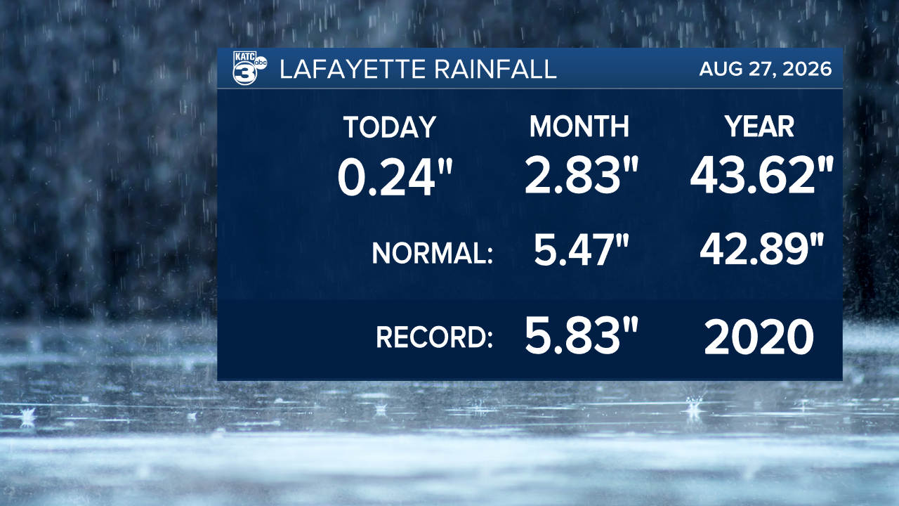
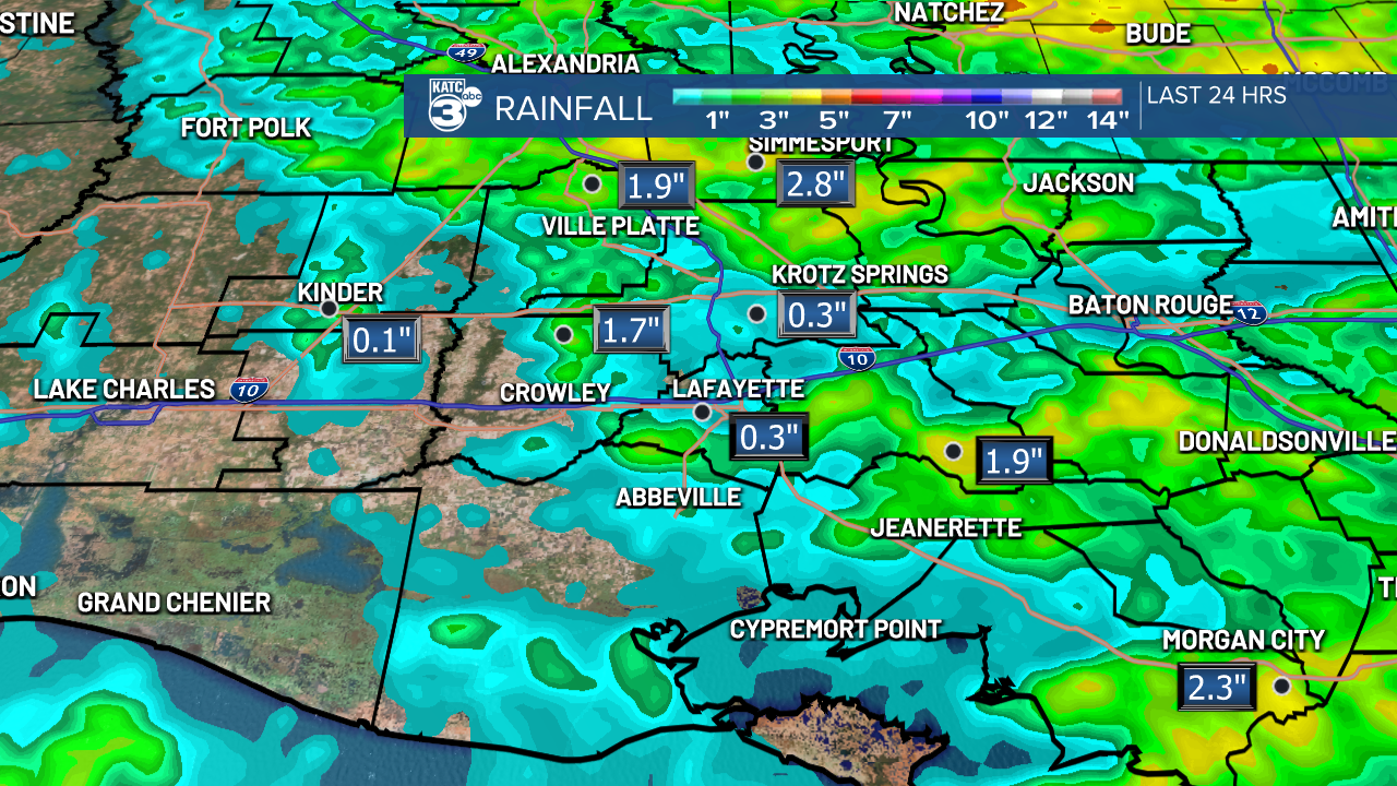
We kicked off the day with rain, but things cleared up beautifully this afternoon, giving us a few moments of sunshine! The airport recorded nearly a quarter inch of rain, and most areas saw totals between 1-3 inches. Thankfully, we're still sitting pretty with a surplus for the year!
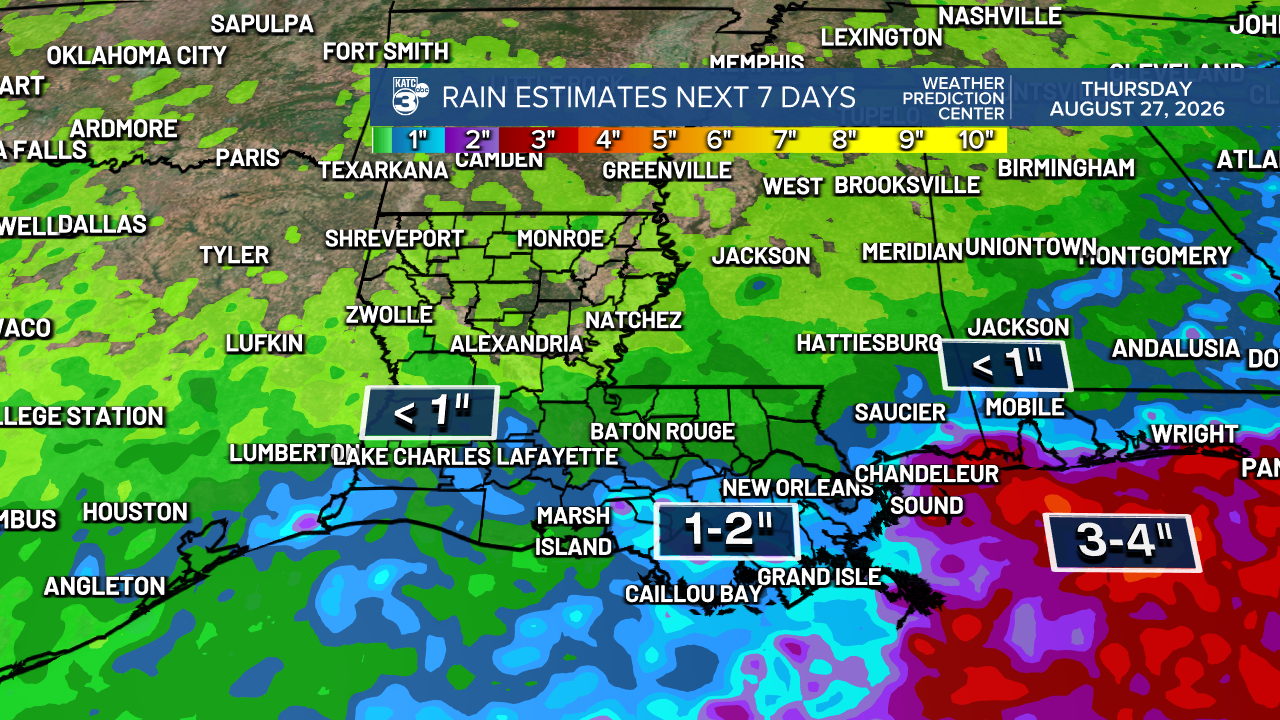
Looking ahead, the next seven days we stay relatively dry, with rainfall amounts expected to stay under an inch. Meanwhile, southeast Louisiana may see between 1-2 inches, while the Gulf might catch the bulk of it with 3-4 inches.
Today's temperatures reached the upper 80s—a welcome change from the sweltering upper 90s we've been experiencing!
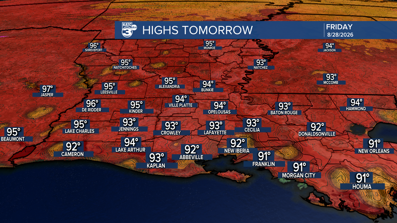
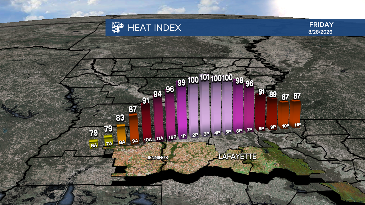
Tomorrow, we’ll soar back into the 90s, but the good news is that the heat index should keep it around 100°—so we can thankfully say no heat alerts for now!
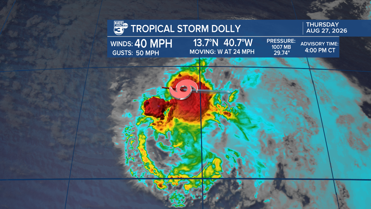
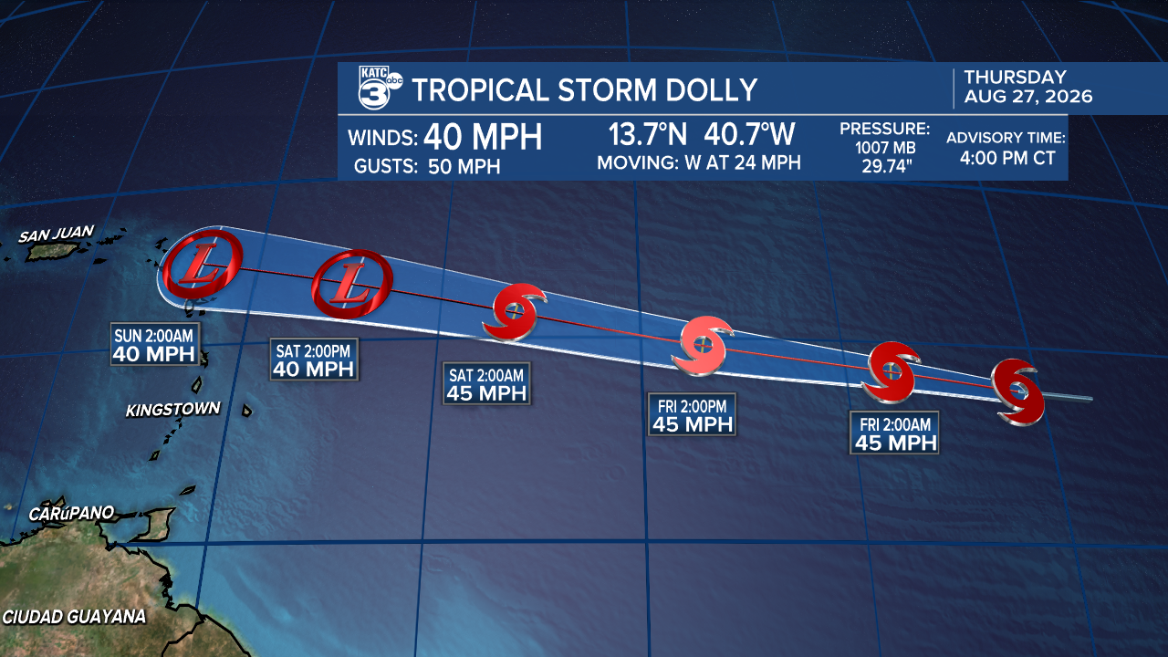
Dolly has emerged as the fourth named tropical system in the Atlantic, bringing sustained winds of 40 mph as it rapidly moves west at 24 mph. However, it’s facing some challenging conditions, including strong wind shear and dry air, which are expected to weaken the storm as it approaches the Lesser Antilles—often referred to as the graveyard for tropical disturbances.
As Dolly loses strength, residents in the islands should stay alert for gusty winds and heavy rain.
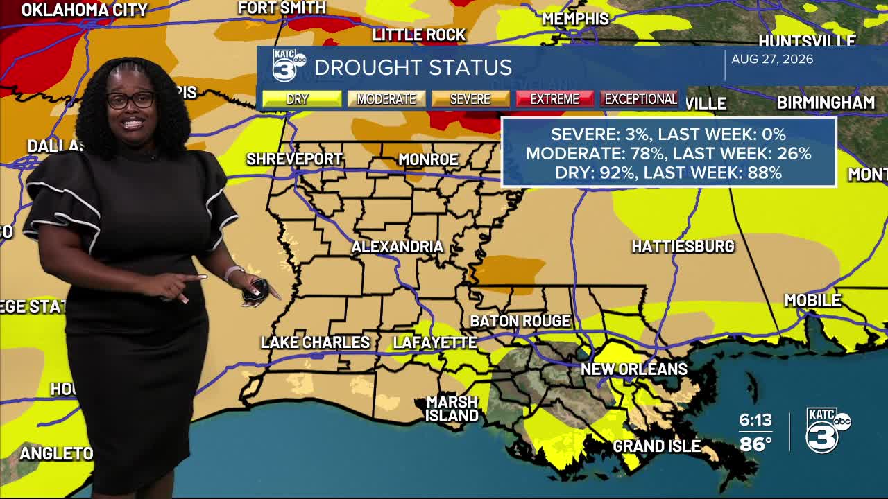
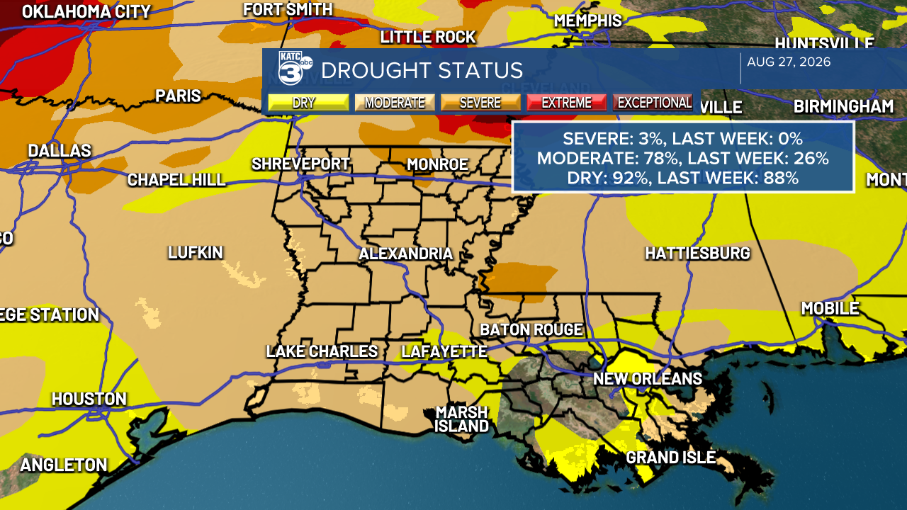
Drought conditions have increased throughout our state. Currently, severe drought affects 3% of our area, while moderate drought has spiked to a staggering 78%.
With little to no rainfall expected over the next week, these dry conditions are likely to worsen. Please remember that several burn bans are still in effect across Louisiana.
Follow Meteorologist Breyanna Lewis for further updates.
See the KATC 10 Day Forecast for the latest.

