


Summer in Acadiana is bringing us not just the sweltering heat, but also the potential for severe storms (again) tomorrow.
The SPC has issued a marginal (1/4) to slight (2/5) risk for isolated severe storms for areas east of I-49, while those further west may miss out on the rain.
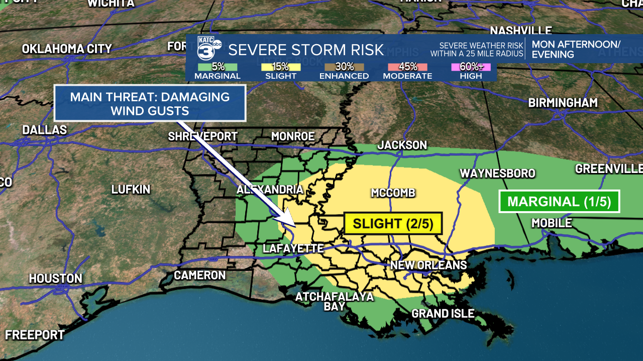
If storms turn severe, the main threat is damaging downburst wind gusts. Stay alert for any Severe Thunderstorm Watches or Warnings that may be issued.
Expect scattered storms throughout Acadiana, with a few pockets of heavy rain.

Timing looks to be after 4 PM, and rainfall amounts range from a tenth of an inch to as much as three inches in some spots by early Tuesday morning.


Even with the rain, burn bans are still in effect as dry conditions are set to return in a few days.

The heat is not going anywhere, with highs in the mid to upper 90s.

Feels like temperatures are set to rise near 111°; this prompted another Heat Advisory through Monday. We can expect temperatures to decrease by a few degrees later in the week.


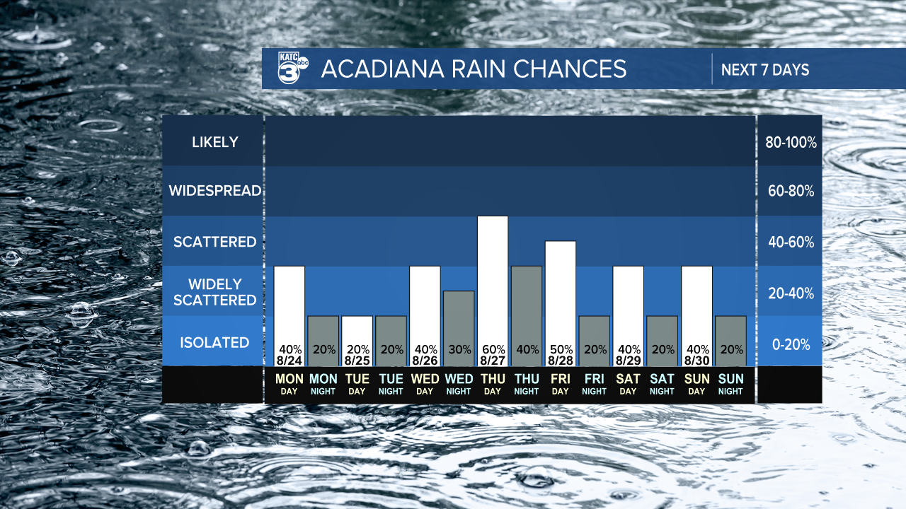
As for rain, there’s a chance for showers and storms each day, with the highest likelihood coming this Thursday. So, make sure to keep your umbrella handy!
Follow Meteorologist Breyanna Lewis for further updates.
See the KATC 10 Day Forecast for the latest.

