

It'll be an active weekend with a threat for severe weather and heavy rain!
Timeline: The timeline is not exact, just a rough estimate. The rain moves in around 9 AM for western parishes, tapering off by about 2 PM. Hit or miss showers continue throughout the afternoon.
As we move into Sunday, a line of storms, brought in by a cold front, will start affecting western parishes around 1 AM and push through the rest of Acadiana after daybreak. Expect a few lingering showers, but most of the day should be dry after the storms.
Severe Weather Risk: All of Acadiana is under a slight risk (2/5) for severe weather.

This means we could see damaging winds, isolated tornadoes, and hail. If you have Halloween and fall decorations outside, be sure to secure them!

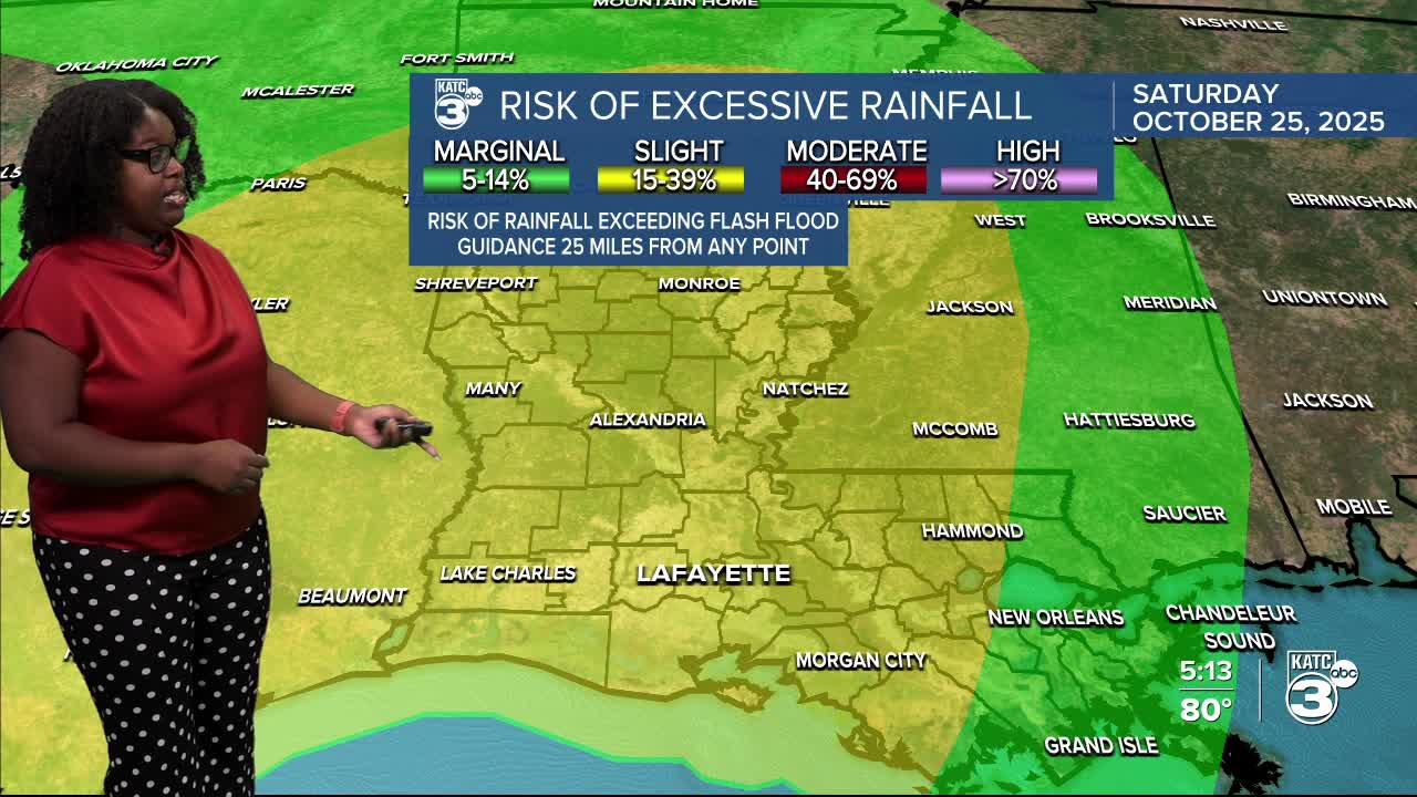
Rainfall and Flooding: We’re looking at widespread rainfall, with total amounts expected to range from 1 to 4 inches, and some areas may receive up to 6 inches.


Although we’re not currently under a flood watch, many areas in Texas are.

Plan Ahead: With early Halloween plans and various events happening this weekend, it’s essential to stay informed. Be sure to have your weather alerts turned on.
Follow Meteorologist Breyanna Lewis for further updates.
See the KATC 10 Day Forecast for the latest.
