

Starting after midnight, a Wind Advisory goes into effect as we brace for windy conditions. A cold front is on its way, bringing scattered showers along with it.

Expect north winds up to 25 mph with gusts between 35 and 40 mph.

Make sure to secure any loose items outside—like trash cans or any holiday decorations you might still have out!
Also, a Gale Watch Warning will be in effect at midnight for our coastal waters, stretching from Cameron to Intracoastal City.
The cold front brings a few showers and even a chance of an isolated thunderstorm, but nothing severe is on the horizon. According to the HRRR model, we could see between 0.10" and 0.25" of rain.
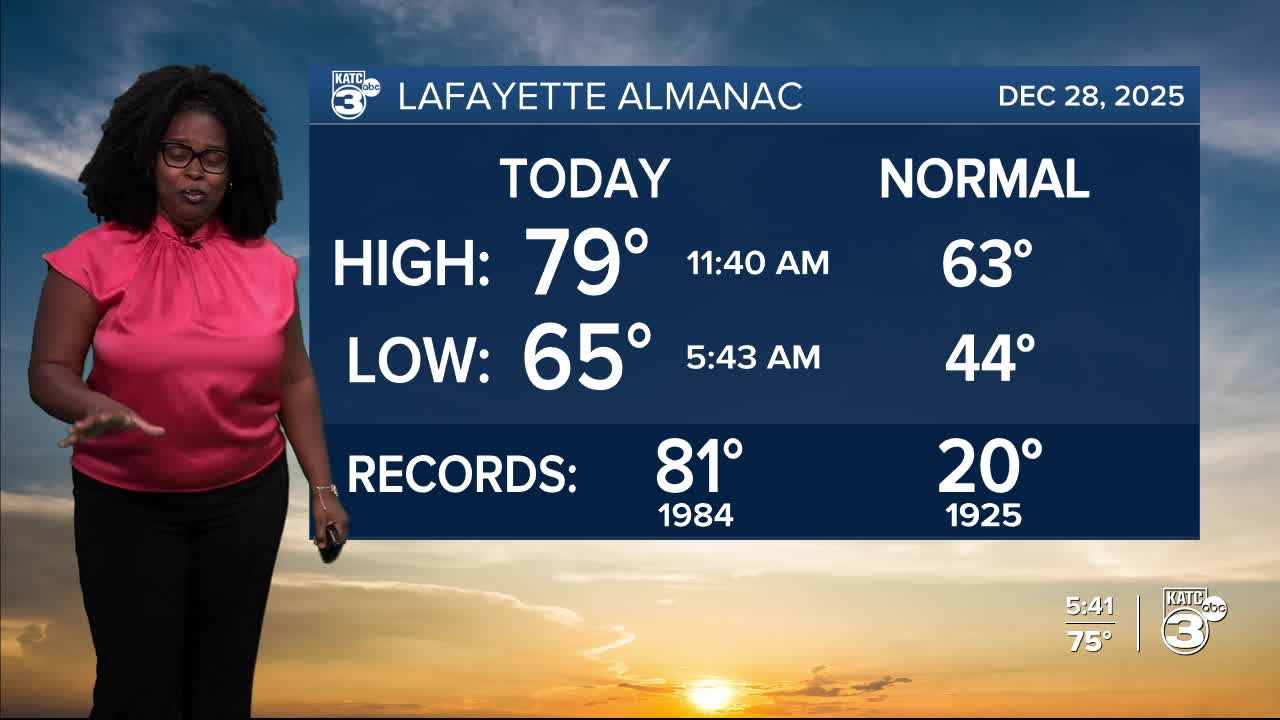
After a very muggy and warm week, temperatures take a nosedive behind tonight's cold front. Prepare for freezing temperatures early Tuesday and Wednesday.
Temperatures will plummet by 15-30° after the front. Tonight will feel chilly with lows in the 40s, a stark contrast to the mid-60s we had this morning.

Go ahead and dust off the winter gear! Monday's highs will barely hit the low 50s.

Winds will remain slightly elevated through Monday night, leading to wind chills in the 20s.

Overnight temperatures are likely in the low 30s, and Tuesday's highs manage to reach the upper 40s to low 50s.


While winds calm down on Tuesday night, prepare for temperatures to dip below freezing between 6-8 hours after midnight. Expect the coldest morning of the week on Wednesday with wake-up temperatures in the mid to upper 20s! Protect the 4 P's: people, pets, exposed pipes, and plants!

Temperatures gradually warm up to the mid to upper 50s by Wednesday afternoon.
For those not a fan of the cold, you’ll be pleased to know that milder temperatures in the 70s are expected to return by the end of the week.
Follow Meteorologist Breyanna Lewis for further updates.
See the KATC 10 Day Forecast for the latest.
