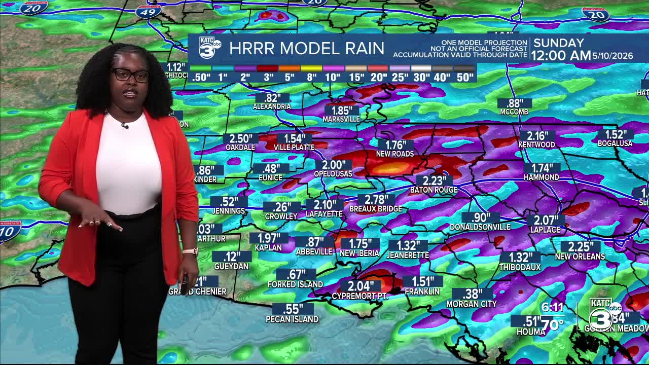


The rain is not letting up for this festival and Mother’s Day weekend! A series of upper-level disturbances is keeping the rain coming, with most areas receiving up to 4” of rain and some spots with 6” within the last 12 hours.

Tomorrow, we’re under a marginal (1/4) to slight (2/4) risk of excessive rain, so expect heavy downpours with anticipated rainfall totals of up to 3” in some areas.

Minor street flooding and low-lying drainage flooding are likely to occur.

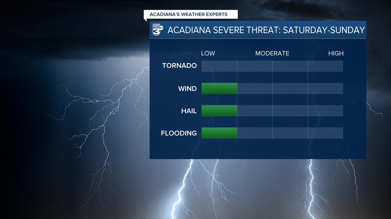
The weather also brings a marginal (1/5) risk of severe weather, with strong winds, flooding, and large hail as primary threats.


The storms are on their own timing, coming in waves throughout the day tomorrow and Sunday. We should get a brief break on Saturday evening. If you have outdoor plans this weekend, it’s definitely a good idea to have a plan B. Keep those umbrellas and rain boots handy.

Early Monday morning, a cold front will finally sweep in, clearing the skies and letting us enjoy a dry stretch next week!
Since Wednesday, we’ve seen a significant amount of storm activity across the region. In Mississippi alone, there have been at least 23 tornado reports. Louisiana has a mix of hail, flooding, and wind damage reports. Here’s a summary of what we know so far:
Flood:
- Opelousas (St. Landry): Significant street flooding observed on Vine Street in the usual trouble spots.
- Eunice (St. Landry): Photo shared showing substantial street flooding with water levels above the curbs.
- Basile (Evangeline): Acadia Fire Department reports flooded roads at the intersection of Soileau St. and Ryan St.
- Alexandria (Rapides): Broadcast media outlet shares a photo of flooding on Broadway Ave.
Wind damage:
- Bunkie (Avoyelles): Reports of wind damage to a gas station at the corner of Hwy 29 and Hwy 71. // NWS surveyed a swath of wind damage from 8:00 AM to 8:30 AM spanning from Bunkie to Plaucheville. This destruction was caused by straight-line winds, with speeds estimated between 60 and 90 mph. There was widespread damage to trees and powerlines, including snapped utility poles. Around 20 structures were affected, including one home in Plaucheville that had part of its roof removed.
Hail:
- Dupont (Avoyelles): 1.5-inch hail reported.
- Plaucheville (Avoyelles): Quarter-sized hail reported by local media.

Follow Meteorologist Breyanna Lewis for further updates.
See the KATC 10 Day Forecast for the latest.
