
Scattered showers and storms continue this afternoon and evening, becoming widespread as a cold front moves in tonight. There's a small risk of gusty winds and localized flooding, which the SPC has highlighted majority of Acadiana under a marginal (1/5) risk.

Timing-wise, expect showers and storms to stick around into the night, clearing out by Sunday morning. We might see a few lingering showers along the coast throughout Sunday.
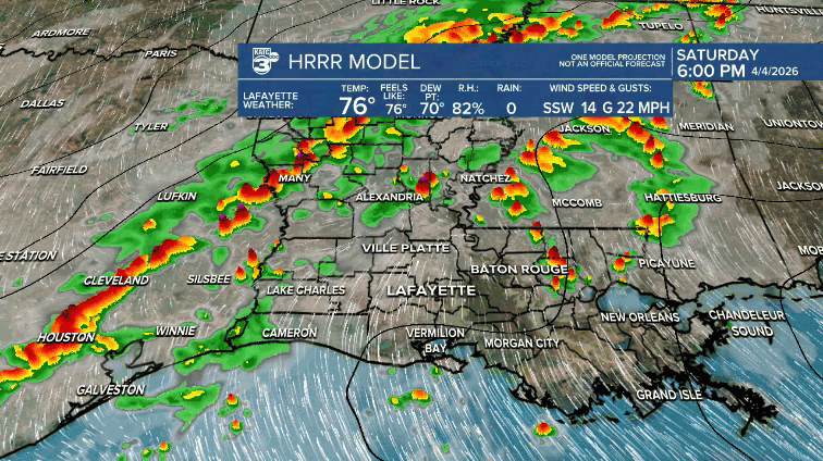
The WPC has placed most of our state under a marginal (1/4) risk for flash flooding.

Rainfall amounts could range from 0.25" to 3", with some areas possibly receiving up to 4". These storms may bring heavy rain and/or training thunderstorms, leading to localized street flooding.

On the bright side, behind the front, we’ll have breezy winds and cooler temperatures to wrap up the first weekend of April. At least we can look forward to a dry Monday and Tuesday before more upper-level disturbances move in.

Follow Meteorologist Breyanna Lewis for further updates.
See the KATC 10 Day Forecast for the latest.
