


The last weekend of the month is shaping up to be quite nice!
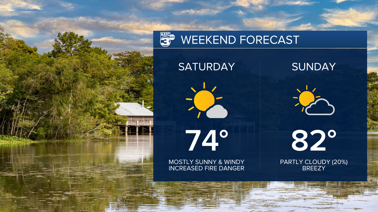
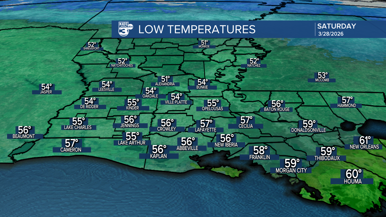
After a cold front passes through tonight, expect lows in the 50s.
Tomorrow's highs will be a bit cooler, topping out in the low 70s, but per usual, we’ll be back to the low 80s on Sunday. Also for this weekend, there is an elevated fire danger risk.

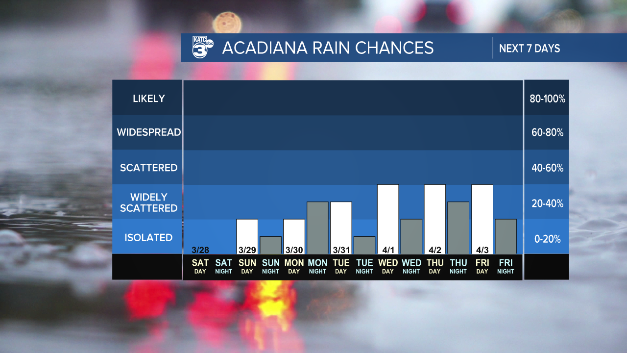
Isolated showers (20%) will trickle in on Sunday, but nothing significant is expected. Looking ahead, next week could bring a more unsettled pattern with daily chances for showers and storms!
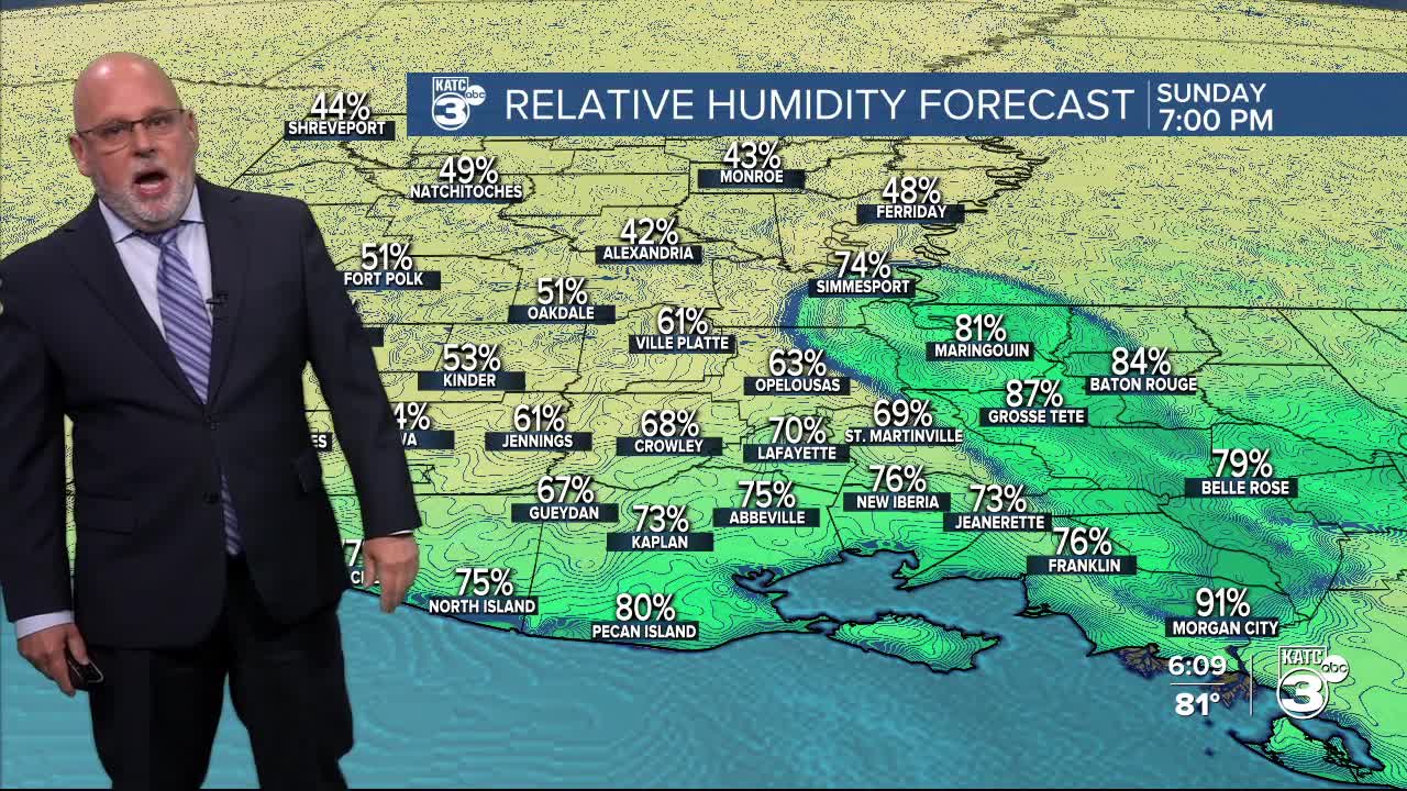
This weekend brings an increased fire danger due to a dry cold front moving in tonight, which will lead to lower humidity levels and gusty winds.
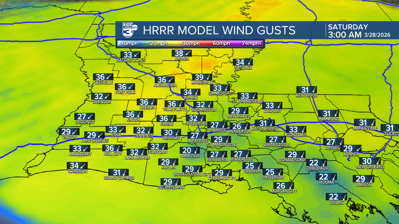
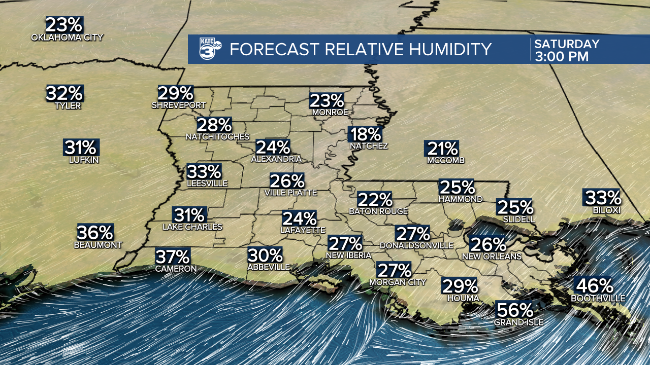
With no rain in sight, these conditions create a perfect environment for fire development.
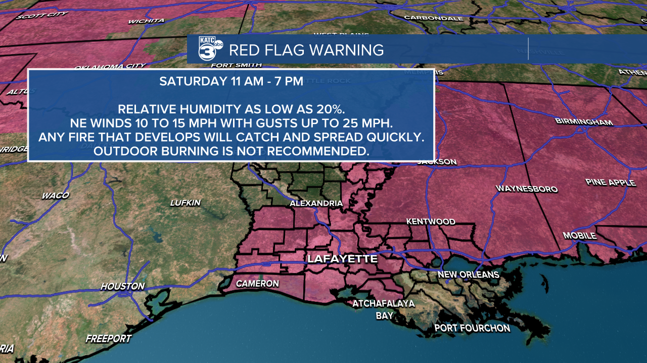
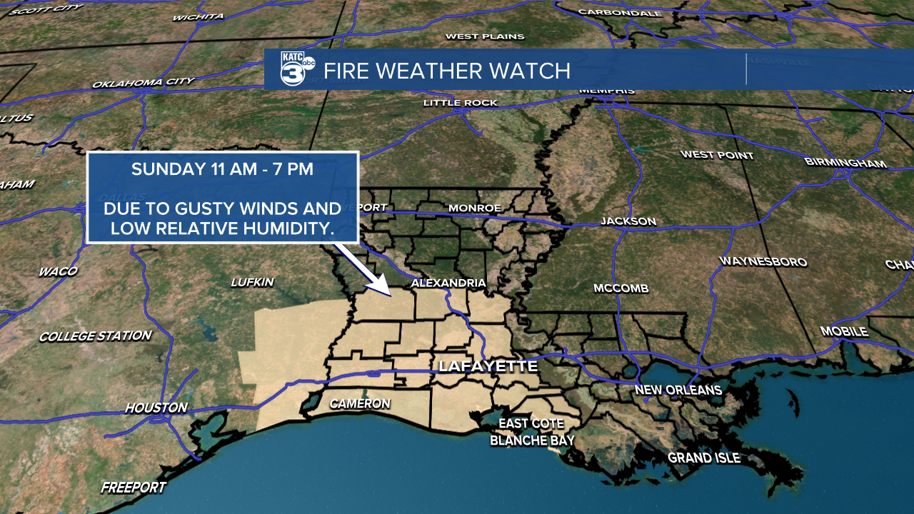
A RED FLAG WARNING is in effect for tomorrow, followed by a FIRE WEATHER WATCH on Sunday. Take precautions to prevent fires.
By the end of the weekend, we should see humidity levels rising as we head into next week.
Follow Meteorologist Breyanna Lewis for further updates.
See the KATC 10 Day Forecast for the latest.
