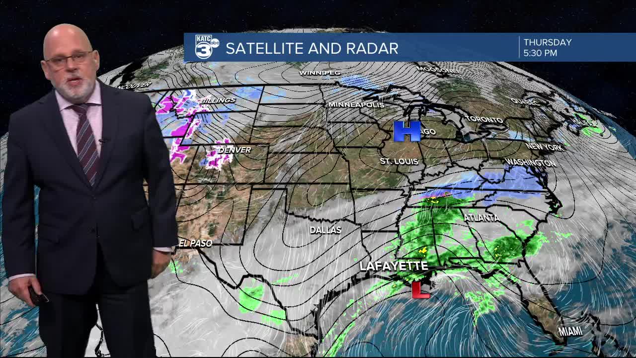


It's been raining off and on since yesterday as a coastal low drifts east. We’ve seen some heavy downpours, with most of southern Louisiana receiving between 1 and 5 inches of rain, and some areas even exceeding 6 inches!

A flash flood warning was issued earlier but has now expired. While we’ll catch a break tonight, scattered showers will return Friday and Saturday.

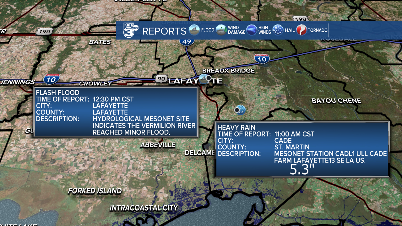
We've received reports from Lafayette and St. Martin parishes, where the Vermilion River has reached minor flood stage, and a mesonet station in Cade recorded just over 5 inches of rain!
The good news? A cold front is making its way in late Saturday to clear the skies, giving us some much-needed sunshine mixed with clouds!
Looks like chilly temperatures continue through the weekend. Tonight, expect temperatures to dip into the upper 30s and low 40s, with a little wind chill making it feel like the mid-30s.
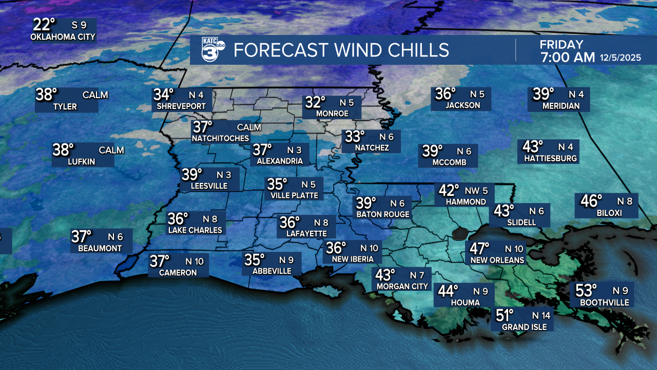
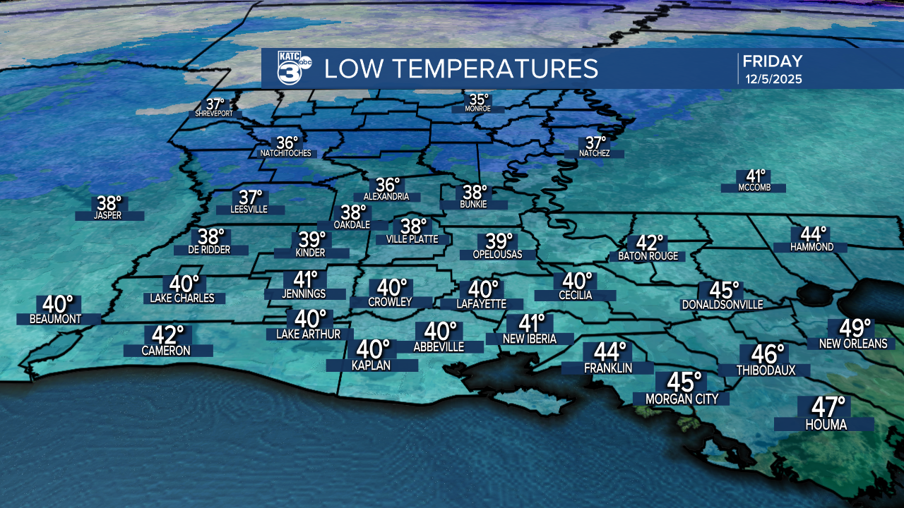
Tomorrow's highs will barely make it out of the 40s, so bundle up!

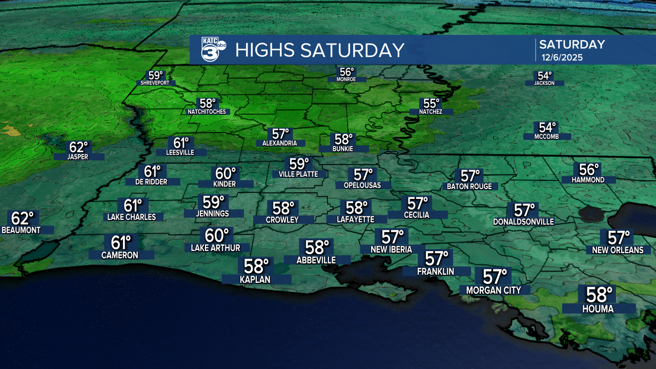
Now on to some good news! A slight warm-up is on the horizon! Friday night is expected to be a few degrees warmer, with Saturday warming up into the 50s and 60s!

As we move towards Sunday, we’ll enjoy even warmer temperatures before a cold front comes through. But don’t worry—by the end of the 10-day forecast, we’re looking at a bounce back into the 70s with sunny skies!
Follow Meteorologist Breyanna Lewis for further updates.
See the KATC 10 Day Forecast for the latest.
