



We're anticipating a surge of tropical moisture combined with a stalled frontal boundary, which means widespread showers and storms are on the horizon late this weekend into early next week.
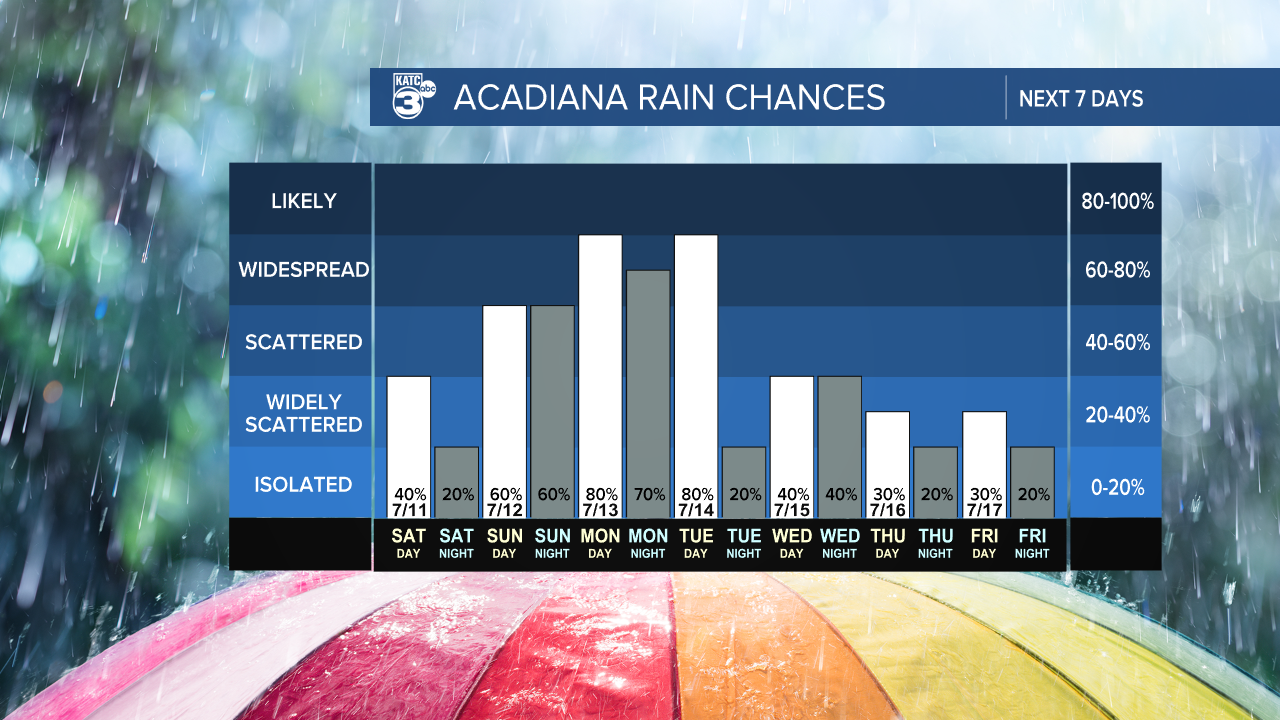
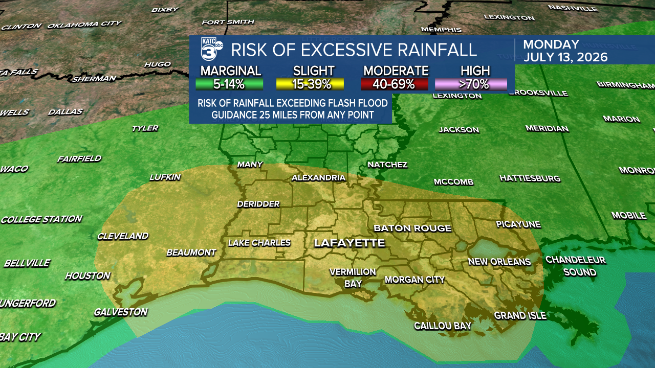
The WPC has issued a marginal (1/4) to slight (2/5) risk for heavy rain on Sunday and Monday. This could lead to elevated flood risks each day, so please stay alert for any watches or warnings.
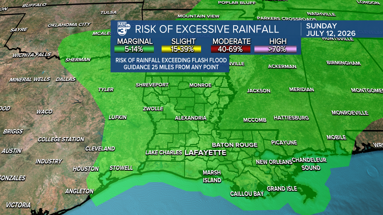
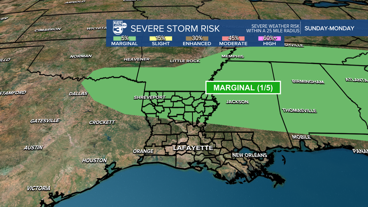
We are not under a severe threat for now, but it is a marginal (1/4) risk, covering northern Louisiana on Sunday.
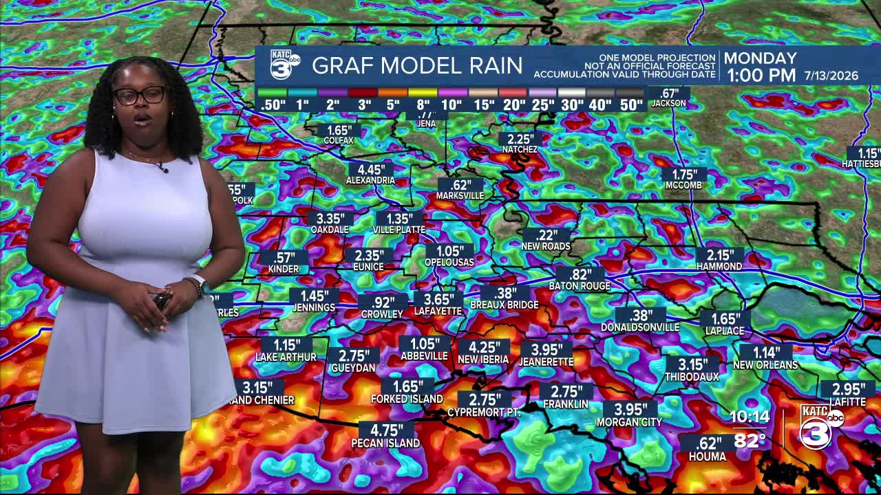
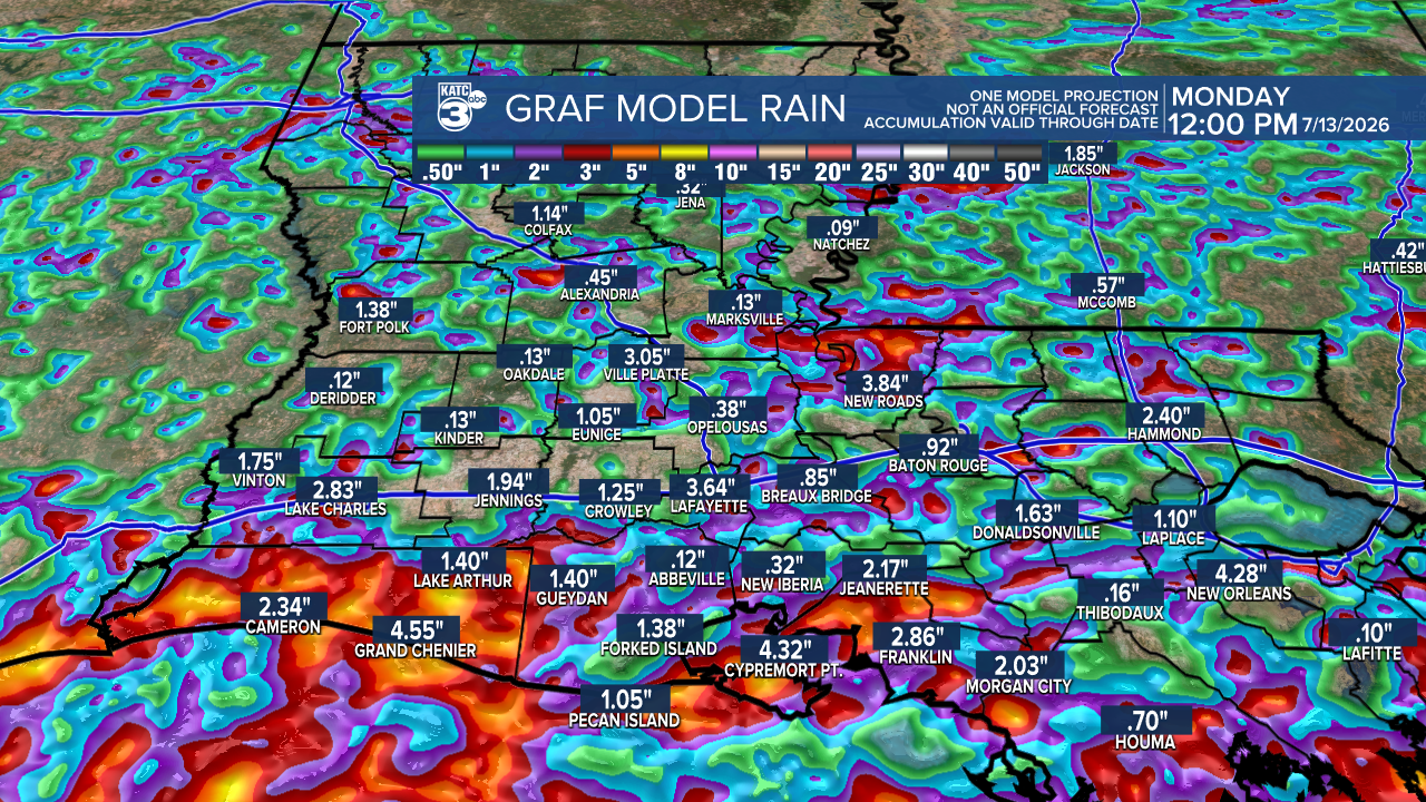
The latest GRAF models suggest rainfall totals up to 4 inches, with some areas possibly seeing as much as 5 inches. Temperatures will be below average in the low 80s during this time.
Follow Meteorologist Breyanna Lewis for further updates.
See the KATC 10 Day Forecast for the latest.

