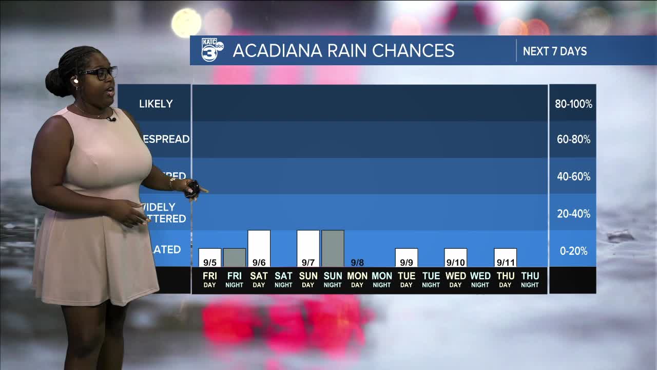


We have dry air in the mid to upper levels of the atmosphere, which will help keep rain chances low through tomorrow. A slight uptick of moisture is expected as a frontal boundary moves in on Sunday, bringing the potential for hit or miss showers.

Behind this frontal boundary, dew points are likely to fall into the 50s, which will lower overnight temperatures into the low 60s. It looks like we'll be in for a cool night ahead!

Overnight temperatures remain in the low 70s.

Tomorrow, highs are expected to reach the low 90s under mostly sunny skies—perfect weather for football!

For the rest of the weekend, rain chances will range between 10% and 20%.

See the KATC 10 Day Forecast for the latest.
Follow Meteorologist Breyanna Lewis for further updates.
