


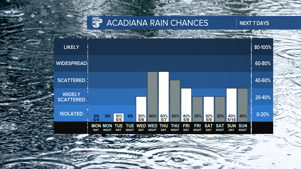
As we enjoy this peaceful weather for a few more days, it's forecasted to become active and possibly severe. An approaching cold front on Wednesday night brings higher rain chances.
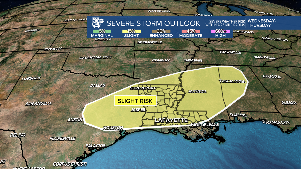
The SPC has placed us under a slight risk (2/5) for severe weather. The main concerns will be damaging winds and large hail, with a lower risk for tornadoes. We’ll definitely have a clearer picture as we get closer to mid-week, so stay tuned!
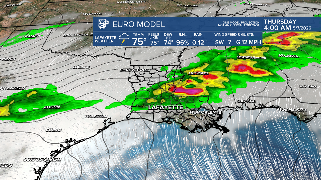
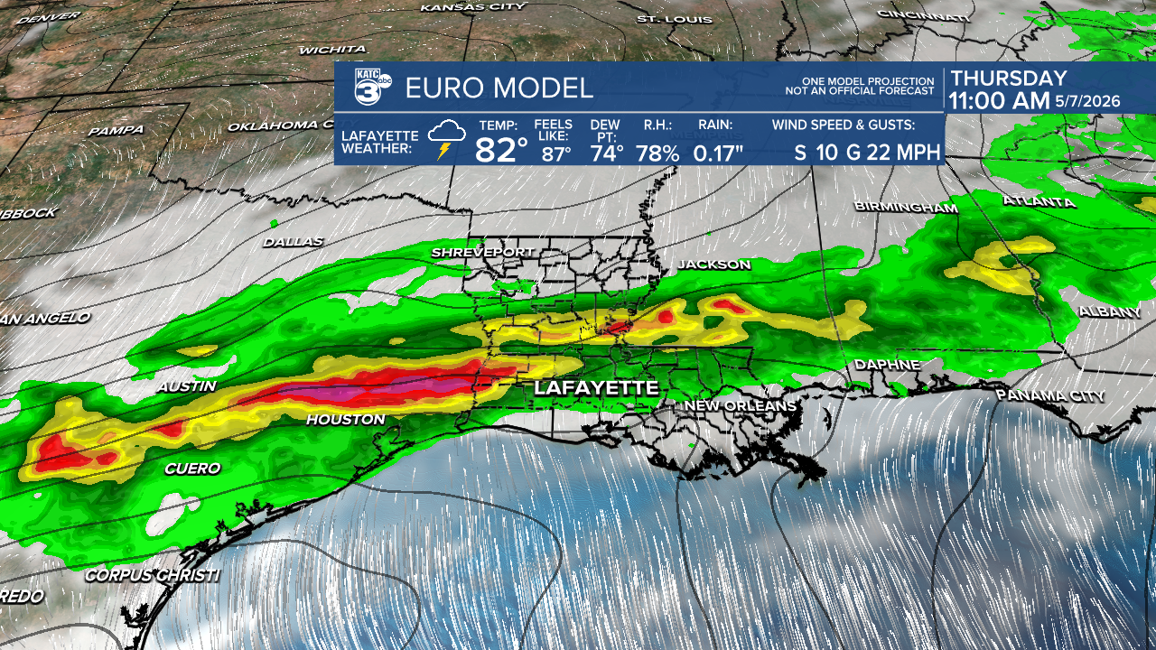
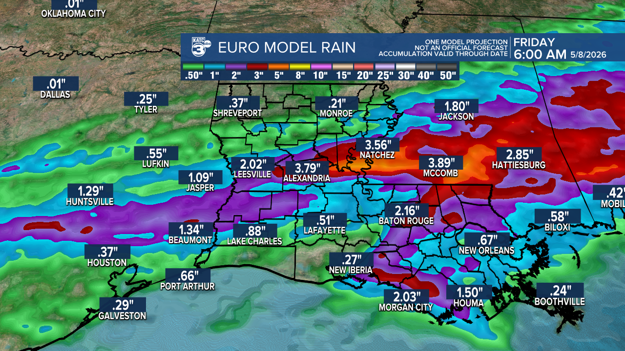
In terms of rainfall, we could see up to 2 inches, with localized areas possibly receiving as much as 3 inches or higher. Expect the rain to begin rolling in during the evening and nighttime hours.

Even after the cold front passes, scattered showers will linger into the Mother's Day weekend.
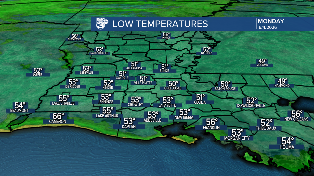
On a brighter note, temperatures will be a bit warmer tonight, with lows in the low 50s.
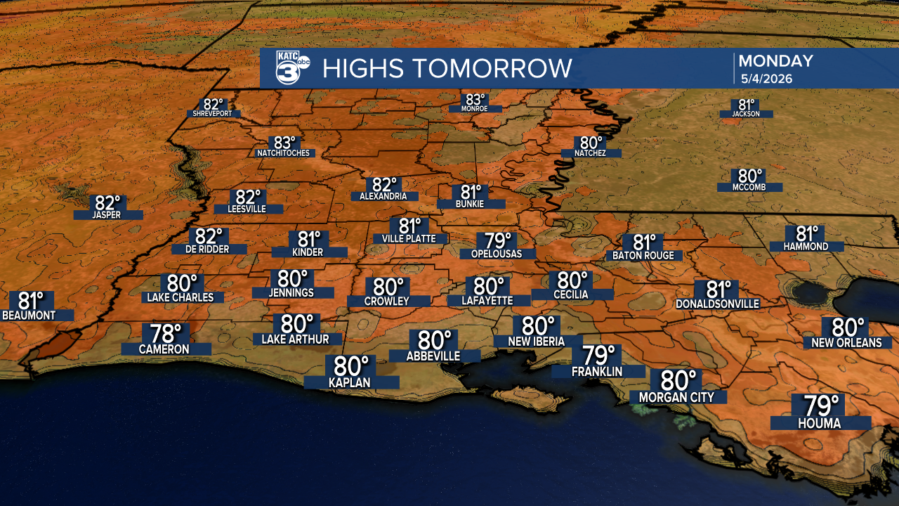
Tomorrow's forecast looks great too, with highs reaching the upper 70s to low 80s and mostly sunny skies!
Follow Meteorologist Breyanna Lewis for further updates.
See the KATC 10 Day Forecast for the latest.
