


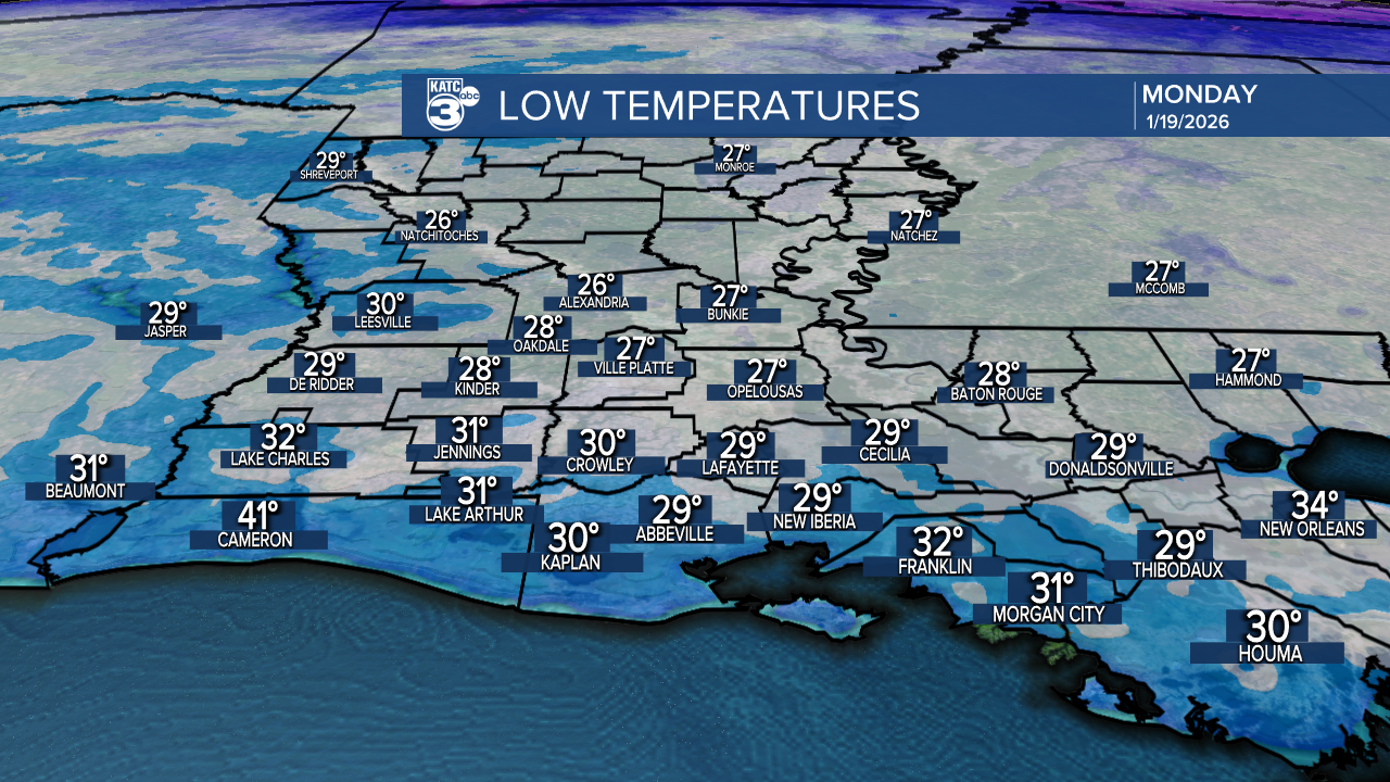
Frosty conditions and another light freeze are expected tonight with temperatures in the upper 20s to low 30s. If you're north of I-10, prepare for some sub-freezing temperatures lasting anywhere from 2 to 11 hours!
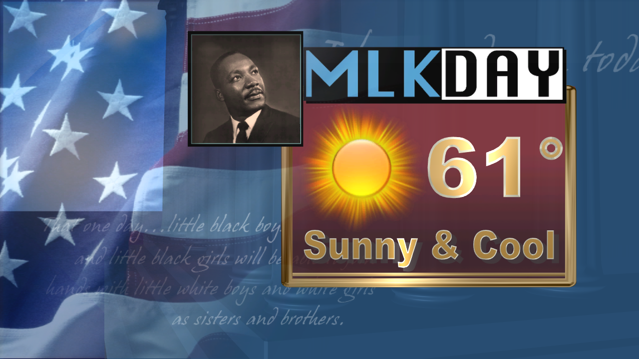
Tomorrow is MLK Day, and we're looking at a beautiful day ahead. Expect sunny skies and temperatures climbing into the low 60s!
In the short term, dry conditions will prevail through Tuesday. However, a coastal low on Wednesday is expected to bring scattered to widespread showers across Louisiana.


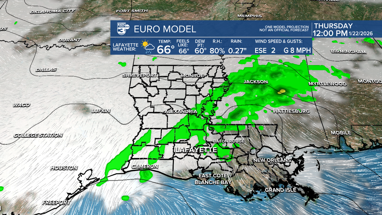
A marginal (1/5) risk for flash flooding is in place for parts of Vermilion and Jeff Davis this Wednesday.

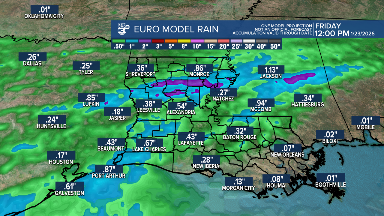
We could see rainfall totals up to 1 inch.
By the end of the week, temperatures rise into the upper 60s, just before temperatures take another nosedive.
Just when you thought snow in the southeast for the second year in a row was enough, the latest forecast shows a potentially significant winter weather event approaching.
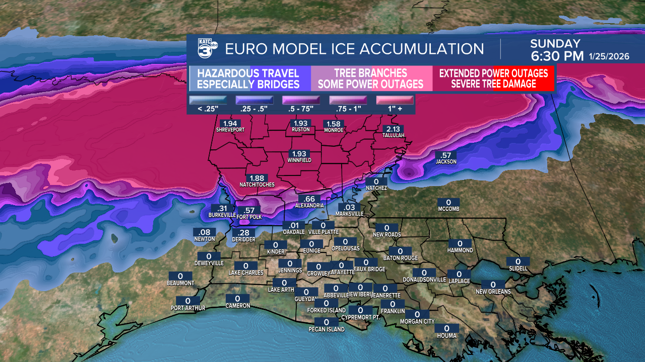
Both the EURO and GFS models suggest we could see a mix of rain, freezing rain, and sleet as a strong cold front moves in early Saturday, continuing through Monday. Prepare for a fluctuation of temperatures from Friday through Monday.
Ice accumulation estimates vary quite a bit. The EURO model predicts nearly 2" of ice for northern Louisiana, especially around Alexandria and north, while the GFS model shows lighter accumulations along the coast up to half an inch. Regardless of the specific numbers, it's definitely something to keep an eye on as the week progresses!

Stay tuned for updates on timing and amounts, as winter weather forecasting in the south can be tricky!
Follow Meteorologist Breyanna Lewis for further updates.
See the KATC 10 Day Forecast for the latest.
