


What a bittersweet day! Tomorrow marks our last full day with 12 hours of daylight, and then it’s down to just 10 hours by December. *sigh*

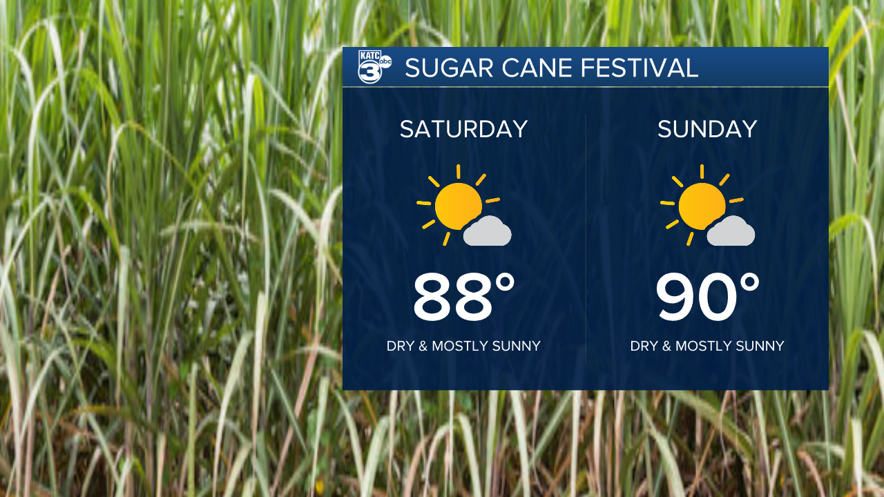
But let’s focus on the positives! The Sugar Cane Festival is in full swing this Saturday and Sunday, and the weather couldn’t be better—sunny ☀️ skies with temperatures in the upper 80s to low 90s. It’s a perfect opportunity to get out and enjoy all the festival has to offer! Just remember to stay hydrated. We’re expecting dry conditions to continue through next week.
As for tonight, it’s going to be cool, dipping into the 60s, which will lead to a lovely warm-up into the mid-80s.
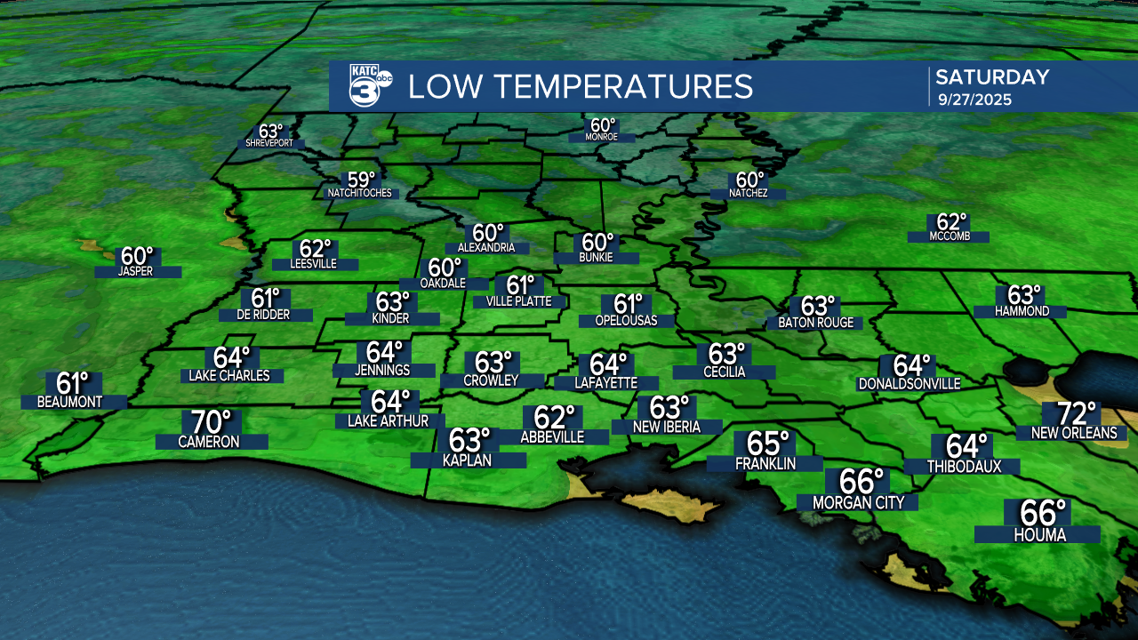

Looking ahead to Sunday morning, we’ll start off cool in the upper 50s and low 60s. Enjoy the weekend, everyone!

The Atlantic is getting very spicy...HOT!
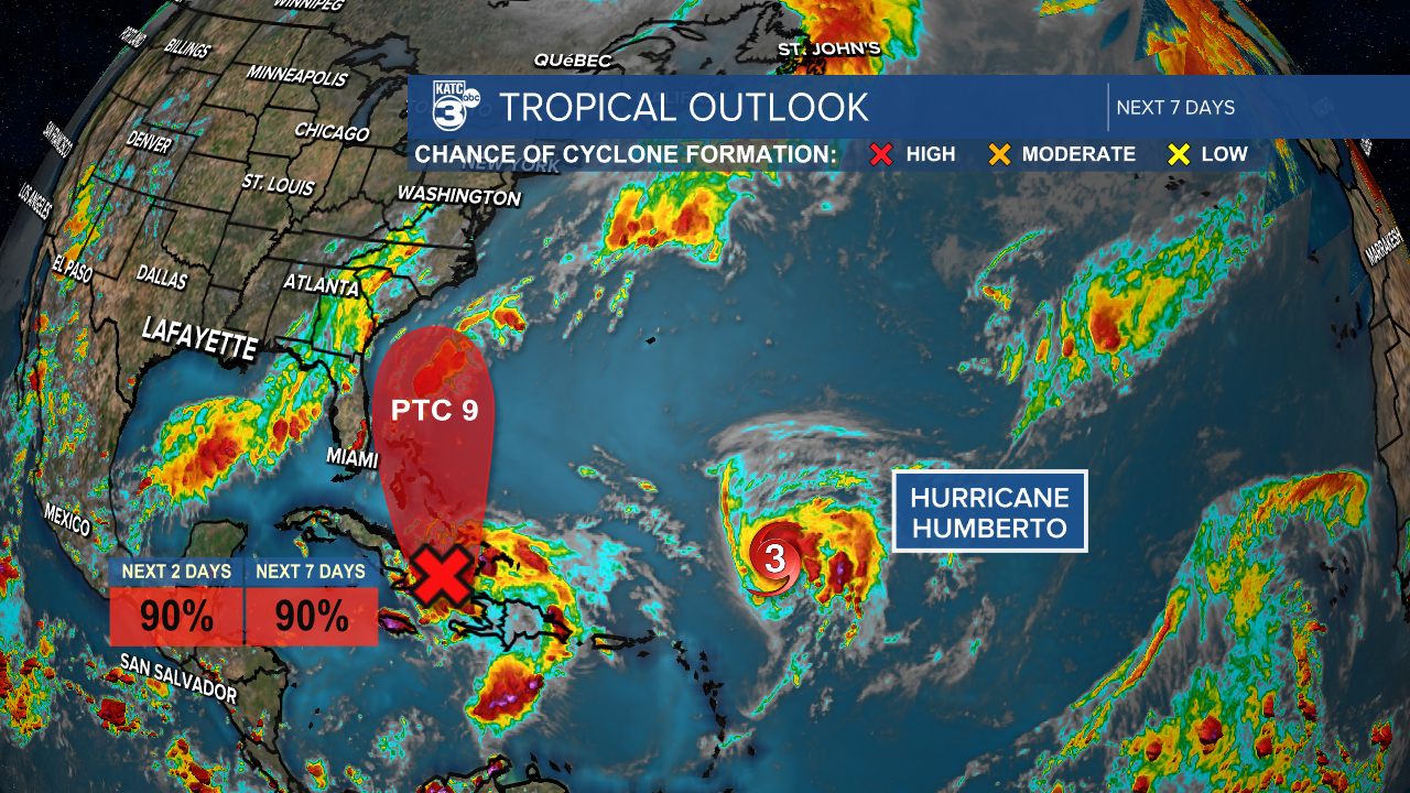
Invest 94L has transformed into Potential Cyclone 9, located about 55 miles north-northwest of Cuba.
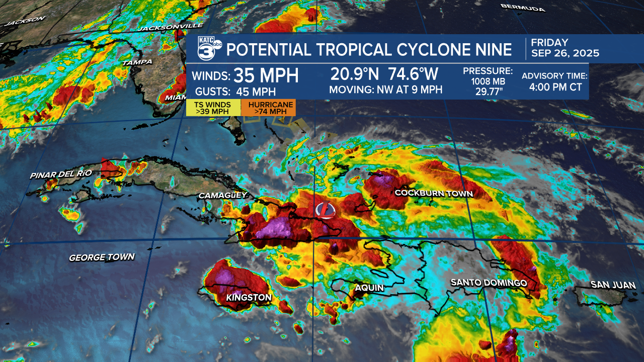
The government of the Bahamas has issued tropical storm watches and warnings as PTC 9 approaches.

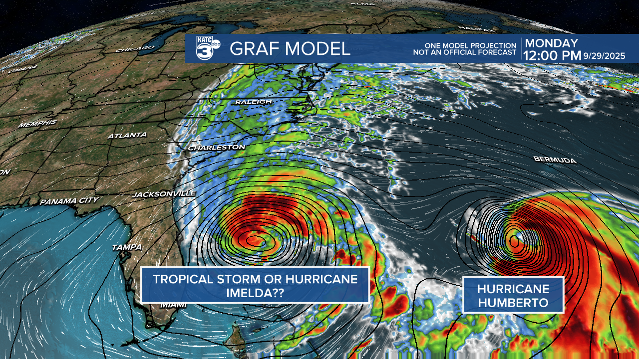
It's likely to strengthen into a tropical storm within the next day, and models suggest it could reach Category 1 status as it heads toward the East Coast.

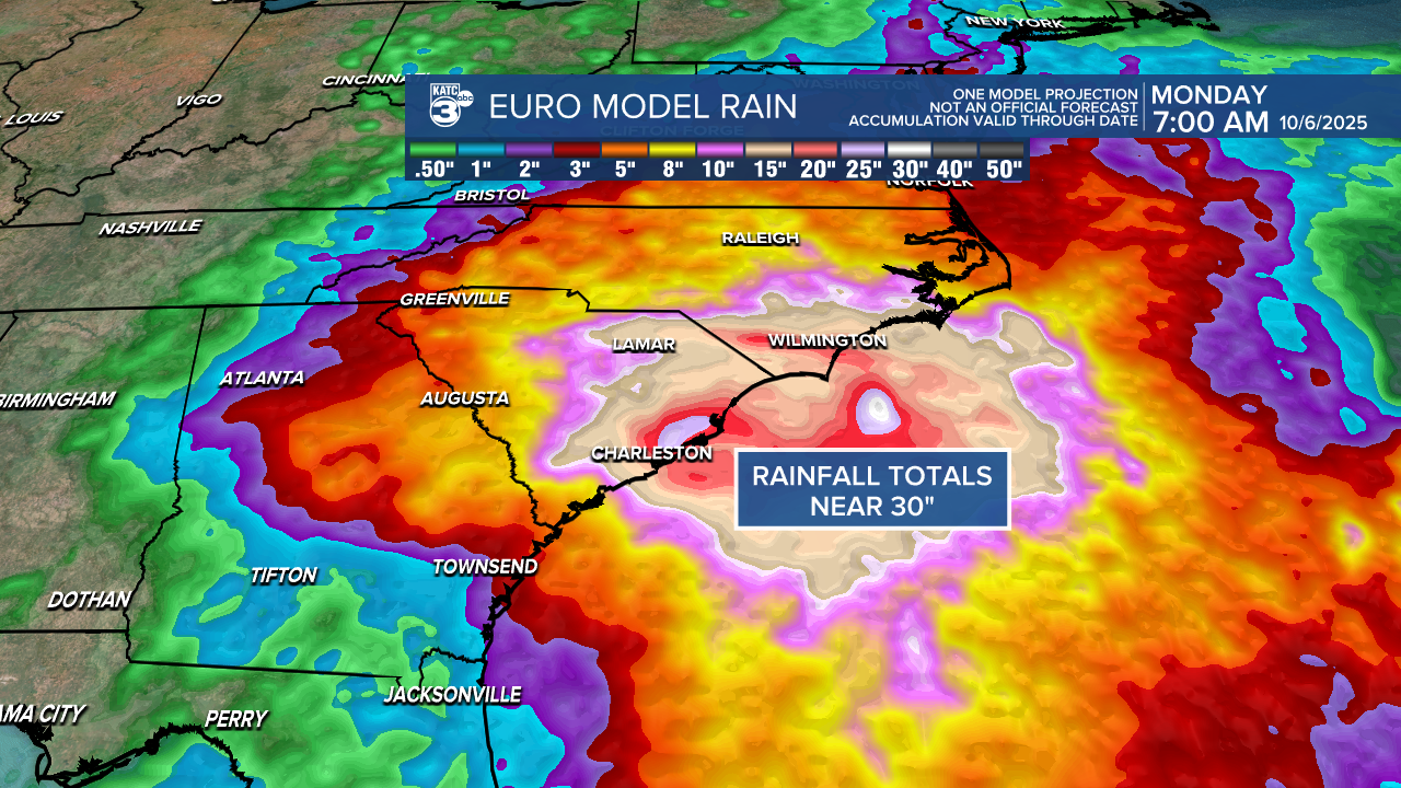
Georgia and the Carolinas should brace for potential heavy rainfall. The EURO model predicts rain totals between 15-30 inches along the Carolina coast, raising major concerns about flooding, storm surge, beach erosion, rough surf, and rip currents. Let’s remember that North Carolina is still recovering from the outer bands of Hurricane Erin last month, which caused coastal flooding.
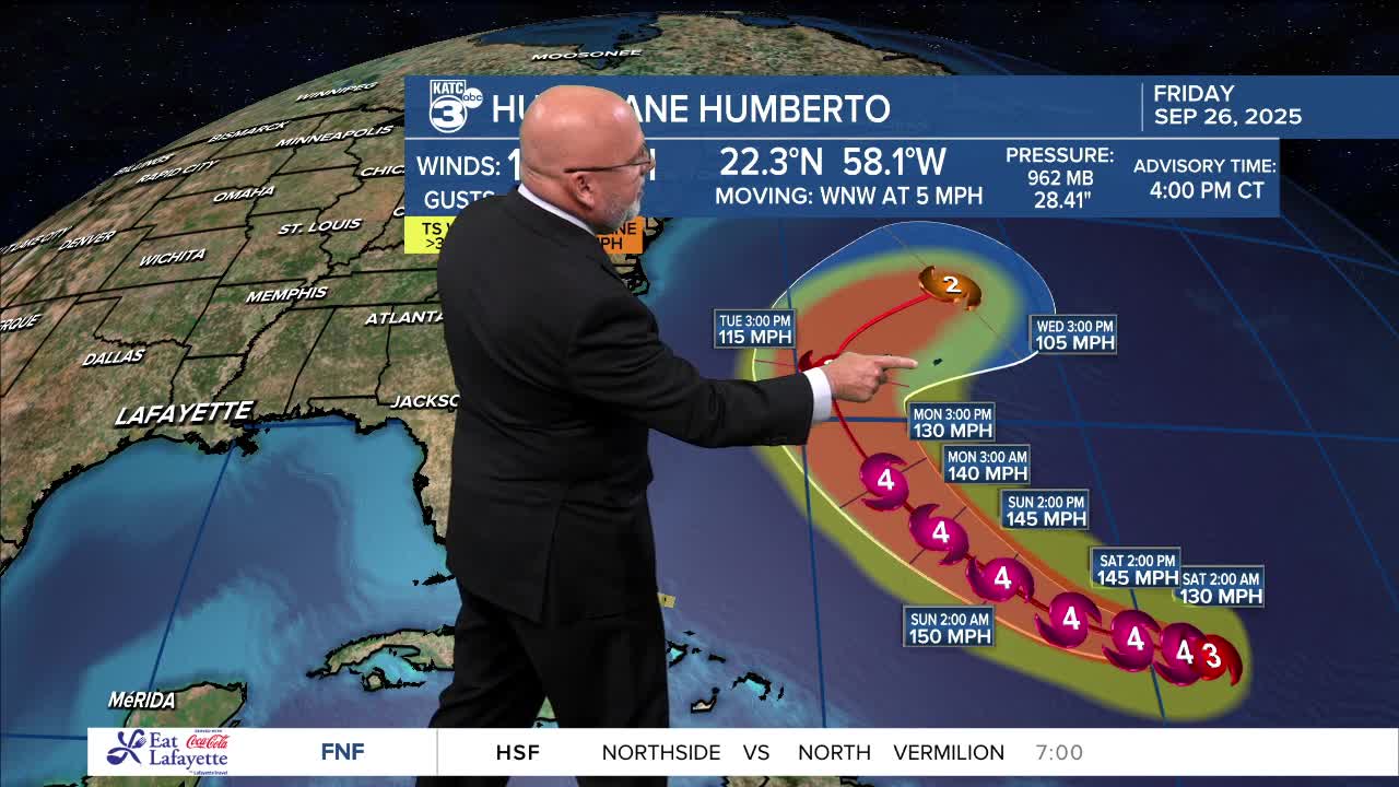
Meanwhile, Hurricane Humberto is making waves as a powerful Category 3 hurricane located about 430 miles northeast of the northern Leeward Islands.

Just last night, Humberto escalated from a tropical storm to a Category 3 and could potentially reach Category 4—don't be surprised if it pushes to Category 5 in this favorable environment! This makes Humberto the third major hurricane of the season. By the middle of next week, Humberto is set to curve towards the northeast, putting Bermuda in its path. Thankfully, Bermuda has managed to dodge Hurricanes Erin and Gabrielle so far.

Good news for Louisiana: neither of these systems poses a threat to the state.
