
What a beautiful Saturday ! With temperatures soaring into the upper 70s, it felt more like April than just eight days away from winter and twelve days until Christmas.

A potent cold front is on the way, and temperatures are set to take a nosedive tonight!
Overnight temperatures drop about 10° into the upper 30s to mid-40s.

Highs tomorrow don't warm too much, only into the 40s and 50s.

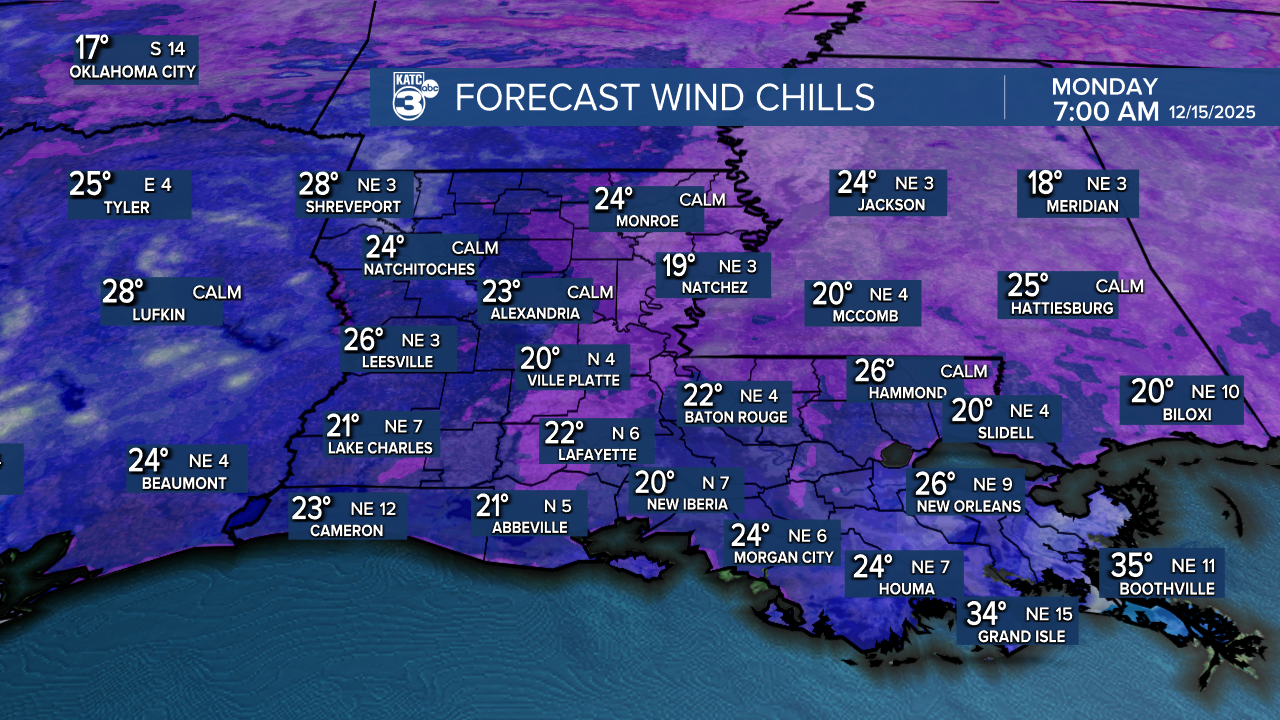
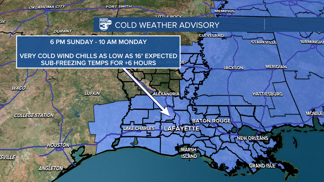
With this cold front, we’ll have windy conditions, causing wind chills to plummet as low as 16° by early Monday.
Expect north winds blowing at 15 to 25 mph, with gusts between 25 and 35 mph. Tie down your Christmas decorations and secure any loose items outside.
Protect your plants, pets, people, and any exposed pipes, as we'll be facing sub-freezing temperatures for over 6 hours! To highlight this, a COLD WEATHER ADVISORY starts tomorrow at 6 PM and runs until 10 AM Monday, with a hard freeze likely too.
Wake-up temps on Monday are expected to be in the low to upper 20s, so bundle up and ensure the kids stay warm while heading to school!


Luckily, the cold temperatures don't last long. We can look forward to milder temperatures by the middle of next week.
Aside from the temperatures, we are in for some rain after midnight. While we don't anticipate any severe weather, there is a possibility of a few stronger storms developing.


In Acadiana, rainfall amounts are expected to remain light, generally under one inch. However, some isolated areas in Central Louisiana may see higher totals, surpassing an inch.

The cold front will be offshore before the colder air settles in, meaning we aren't expecting any winter precipitation.
Follow Meteorologist Breyanna Lewis for further updates.
See the KATC 10 Day Forecast for the latest.
