

Low pressure developing over the western Gulf of Mexico is expected to slide eastward over the next couple of days. Upper level support will help get more rain going into the first part of the week. Some areas could pick up significant amounts of rainfall, hoping to ease drought conditions that have plagued the area all year. Power Doppler 3 has been needing a workout anyway!
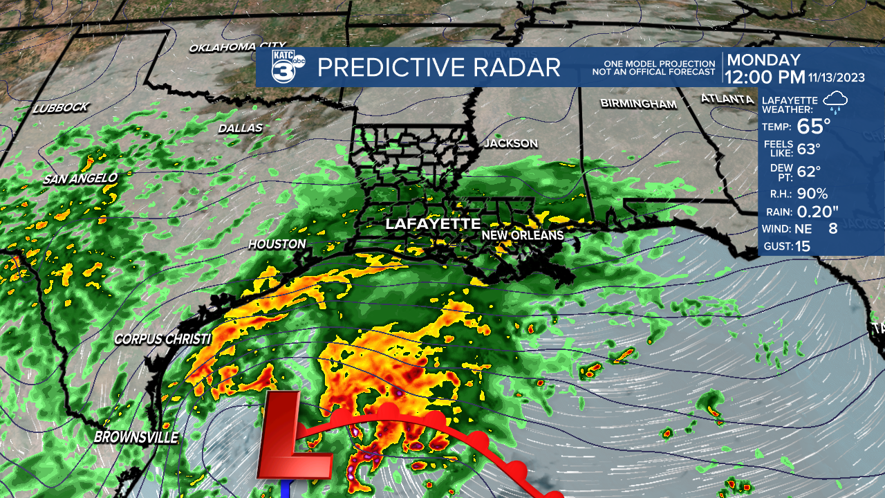
Mostly cloudy skies are expected with temperatures in the mid 60s to start your Monday. Temperatures are expected to hold nearly steady into the afternoon. Rainfall will continue to expand and cover more areas through the day, with some heavy downpours possible into the afternoon. Higher rainfall totals of up to four inches will be over the southern sections and into the Gulf of Mexico. Lighter amounts are expected farther inland, but still up to an inch will be possible between now and the end of Tuesday.

Rainfall will continue through Monday night and Tuesday. Gusty winds are expected in the offshore waters near the center of low pressure. Expect winds to gust up to 35 knots with low visibility. Seas are going to be rough, especially far offshore. Tuesday's rainfall will start tapering off during the evening. No severe weather is expected, and as long as the rainfall comes over several days, only localized flooding will be possible.

As we head toward the mid week, skies will remain cloudy Wednesday. Thursday should bring a bit more sunshine, with mostly sunny skies by Friday. Temperatures will warm back into the low 70s. Saturday looks dry and mild. A weak front will pass north of the area late Sunday bringing a slight chance for a shower.
