


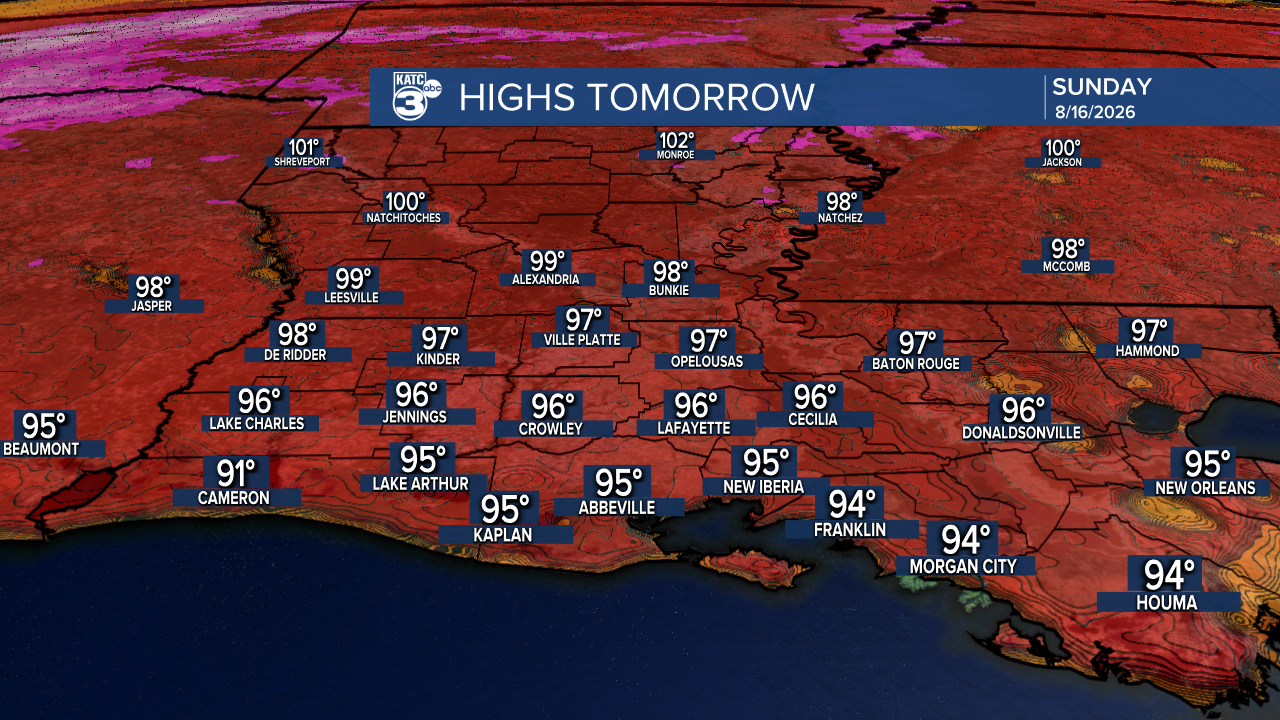
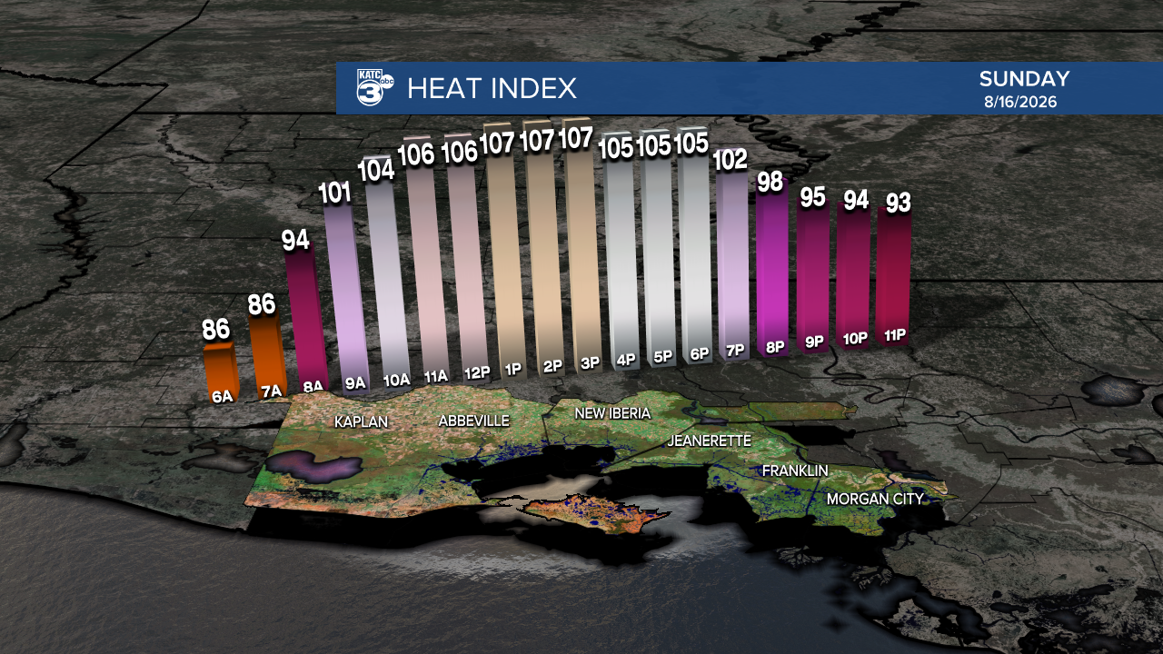
It was a very hot Saturday. Tomorrow's highs will be similar to today's, reaching the upper 90s across the state. To beat the heat, consider having a pool day, visiting a splash pad, or finding other ways to stay cool.
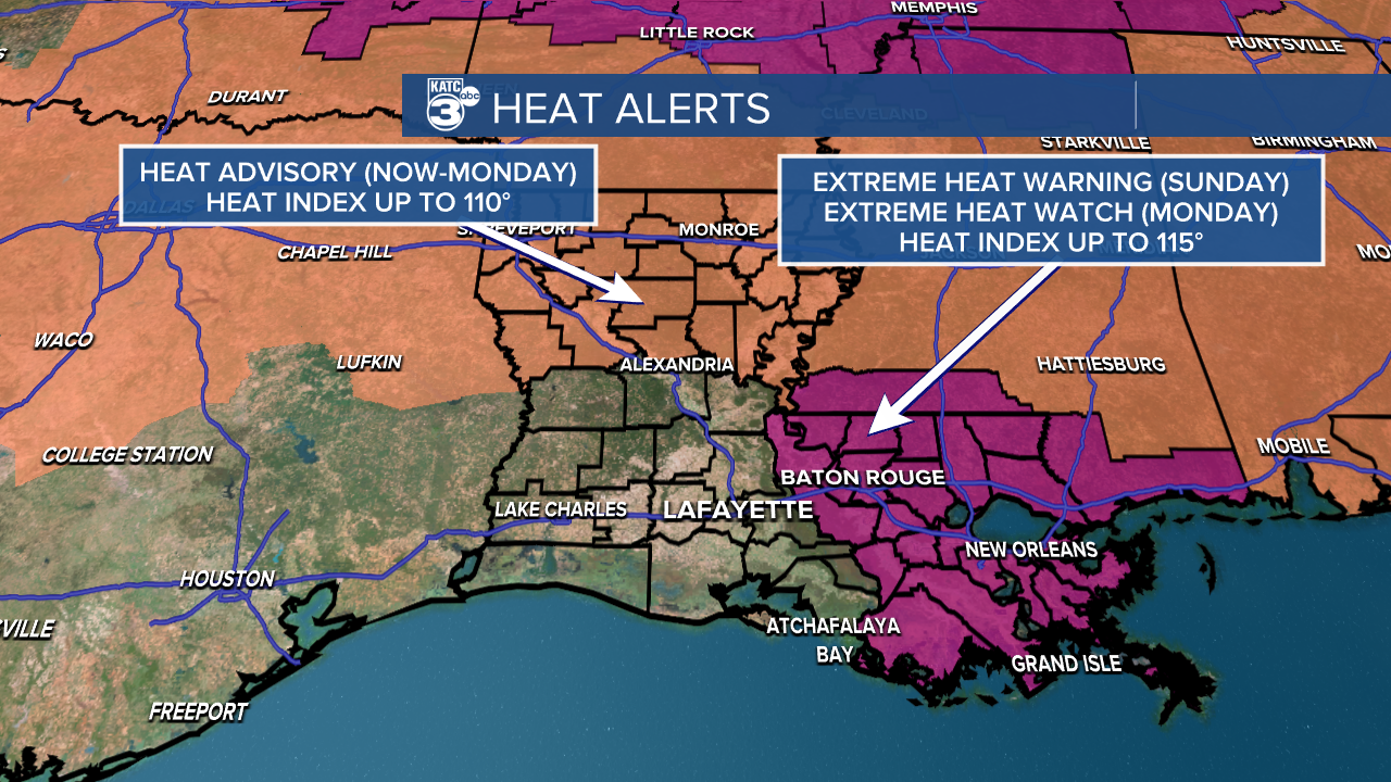
While no advisory has been issued for tomorrow yet, I wouldn't be surprised if one is announced later today or early tomorrow. Northern and Eastern Louisiana will have heat alerts in place through Monday.
Unfortunately, we can’t count on any rain to help cool things down. Rain is essentially nonexistent at this point, with no measurable rainfall expected over the next seven days. Several northern parishes have enacted burn bans due to the dry conditions affecting the state.
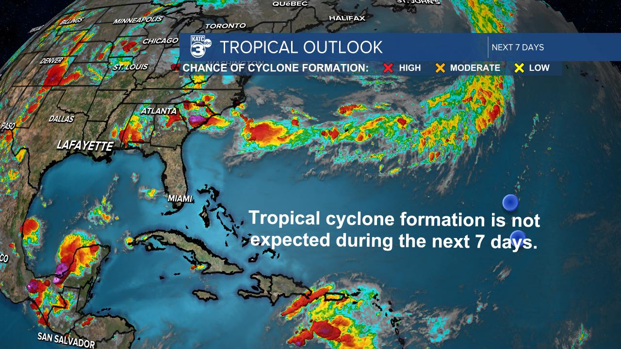
No tropical systems in the Atlantic! Thank you, upper level winds and dry air.
Lala is currently a low-end Category 1 hurricane with sustained winds of 75 mph and is positioned just 65 miles southeast of South Point, Hawaii.
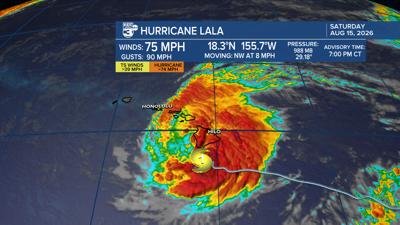
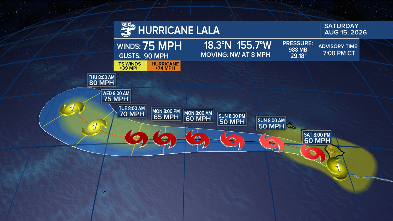
The latest forecast tracks show Lala’s center may track just south of the Big Island; a landfall there is unlikely.
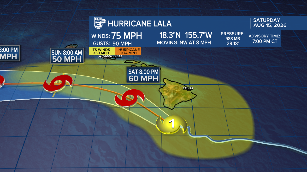
However, we can expect Lala to weaken to a tropical storm for a few days before possibly re-strengthening back to a Category 1 hurricane.
Strong rainbands are already sweeping across the Big Island and will soon spread to the rest of the island chain. The heavy rain will likely produce flooding and mudslides, with projected rainfall between 8-12 inches in many areas, and isolated spots possibly seeing up to 25 inches!
Power outages are already being reported on the Big Island.
Follow Meteorologist Breyanna Lewis for further updates.
See the KATC 10 Day Forecast for the latest.

