

It's over 2000 miles of Winter Weather Alerts across the country this weekend!

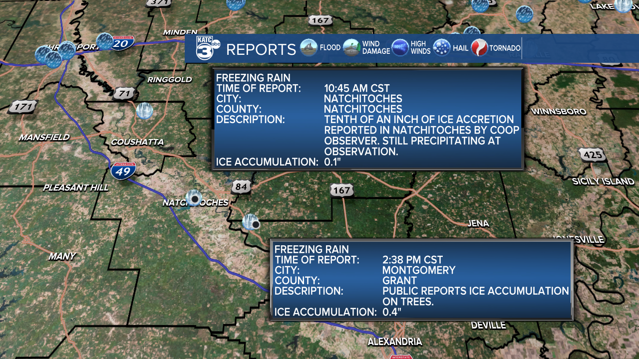
Central and Northern Louisiana is continuing to deal with mixed precipitation tonight into Sunday morning. So far, we’ve had reports of freezing rain in Natchitoches and Montgomery.
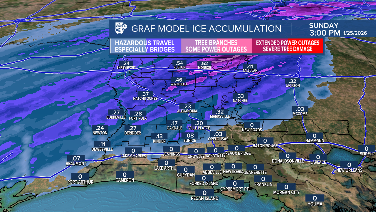
The latest GRAF model shows icy conditions spreading into Allen, Evangeline, and St. Landry parishes by daybreak tomorrow, with anticipated ice accumulation of between a tenth of an inch and a quarter of an inch. Traveling will be hazardous in these areas, try to stay home.
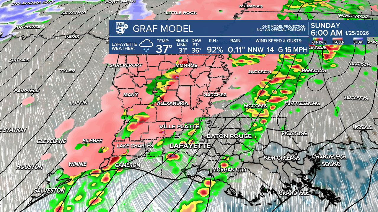
For those south of I-10, you're in luck; no accumulation is expected. The wintry weather and rain will clear out by Sunday afternoon. However, highs will struggle to reach above freezing, making melting minimal. As temperatures fall below freezing after sunset, the risk for black ice increases from any standing water and ice that develops.


ICE STORM WARNING (6 PM SAT-6 PM SUN): Potential ice accumulations up to half an inch. Freezing rain and ice accumulation are expected to begin this evening and continue through tomorrow as temperatures drop below freezing.
Roads, especially bridges and overpasses, will likely become slick and hazardous. Power outages and tree damage are likely.

COLD WEATHER ADVISORY (6 PM SAT-12 PM SUN): Wind chills will plummet as low as 16°. Keep in mind that frostbite and hypothermia can occur with unprotected skin in these temperatures, and prolonged freezing could lead to ruptured water pipes.

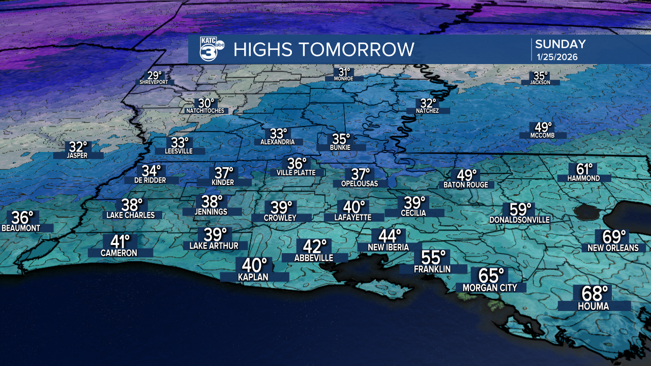
Tonight, most of Acadiana will stay above freezing, with temperatures in the upper 30s to low 40s . However, Central Louisiana is set to have below-freezing temperatures in the low to upper 20s, which means any wet spots or ice will likely freeze, causing travel concerns.

WINTER WEATHER ADVISORY (6 PM SAT-6 PM SUN): Mixed wintry precipitation will be possible with ice accumulations up to a tenth of an inch possible. Slick spots on bridges and overpasses.

Highs tomorrow barely climb above freezing, especially around Alexandria and northward. This will lead to below-freezing temperatures persisting for over 24 hours. Acadiana will be quite cold in the 30s and 40s.
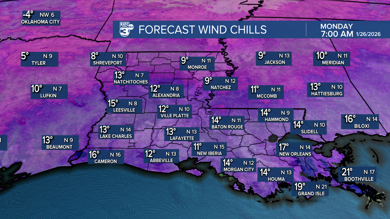
As night falls, temperatures will drop into the teens and twenties, with the wind chill making it feel like the single digits and preteens.

EXTREME COLD WARNING (6 PM SUN-11 AM MON): Dangerous cold wind chills ranging from 4° to 10°.

Protect the 4 P's: People, pets, plants, and pipes! Stay warm, and stay up to date on the latest alerts.
Good news for Monday! We’ll finally see highs breaking above freezing, reaching the upper 30s to low 40s, along with plenty of sunshine to help dry things out.

Follow Meteorologist Breyanna Lewis for further updates.
See the KATC 10 Day Forecast for the latest.
