
A sharp Canadian cold front is set to arrive early Sunday, bringing scattered showers followed by an influx of frigid Arctic air! This will likely be our first hard freeze of the season.
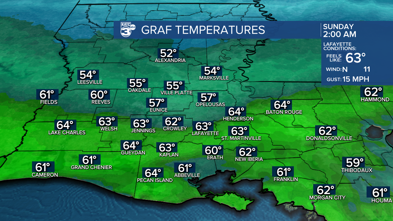
Expect the warmest temperatures in the 50s and 60s early Sunday.
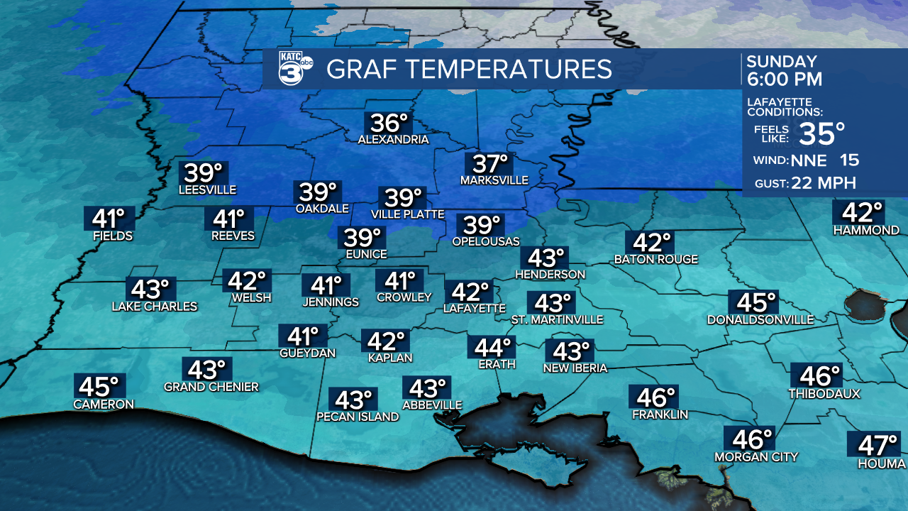
As the cold front moves through, temperatures will plummet into the mid-30s and low 40s.
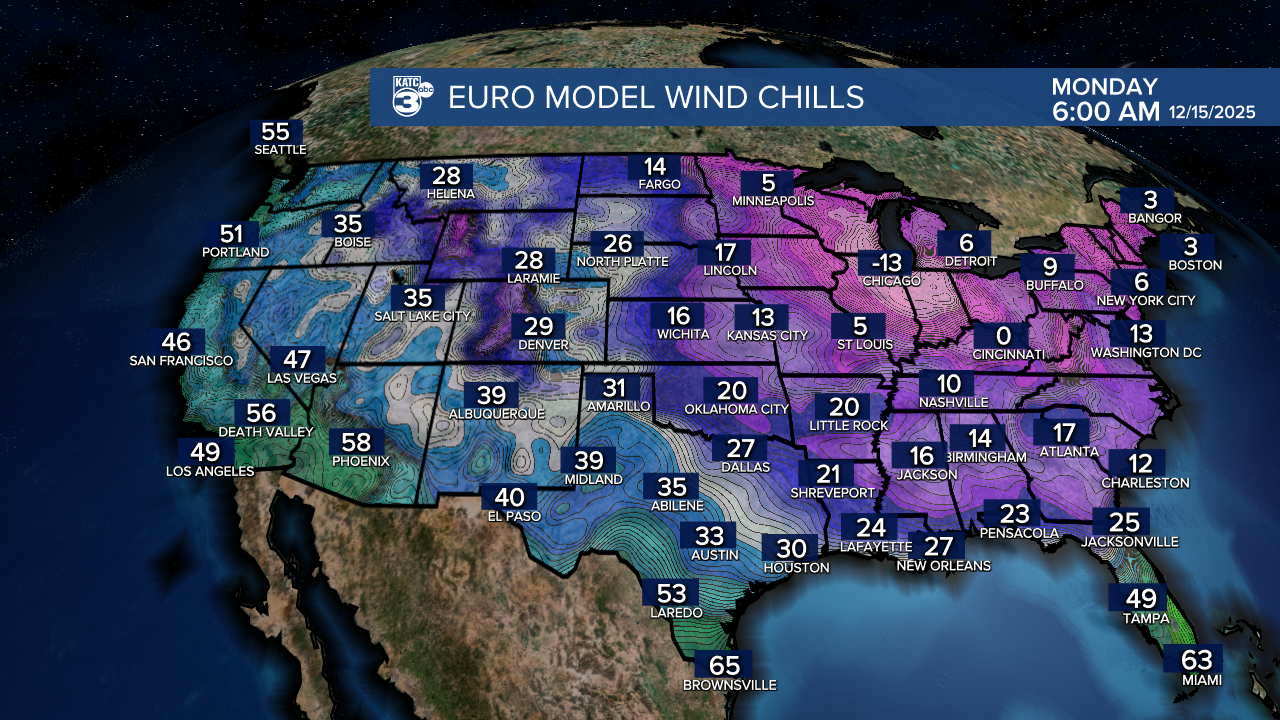
As the cold settles in overnight, prepare for wake-up temperatures in the upper 20s and low 30s on Monday.

With windy conditions, wind chills are likely to dip into the teens and low 20s.
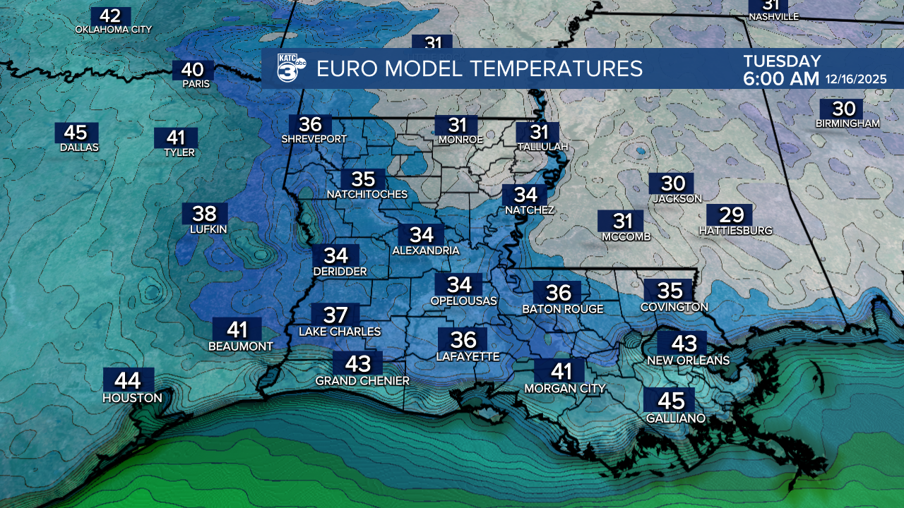
A friendly reminder to protect your pets, people, and plants during this chilly stretch! We anticipate temperatures to stay below freezing for about six hours. However, expect a slight increase in overnight temperatures as we transition into Tuesday morning, with another light freeze possible as temperatures hover near or below freezing.
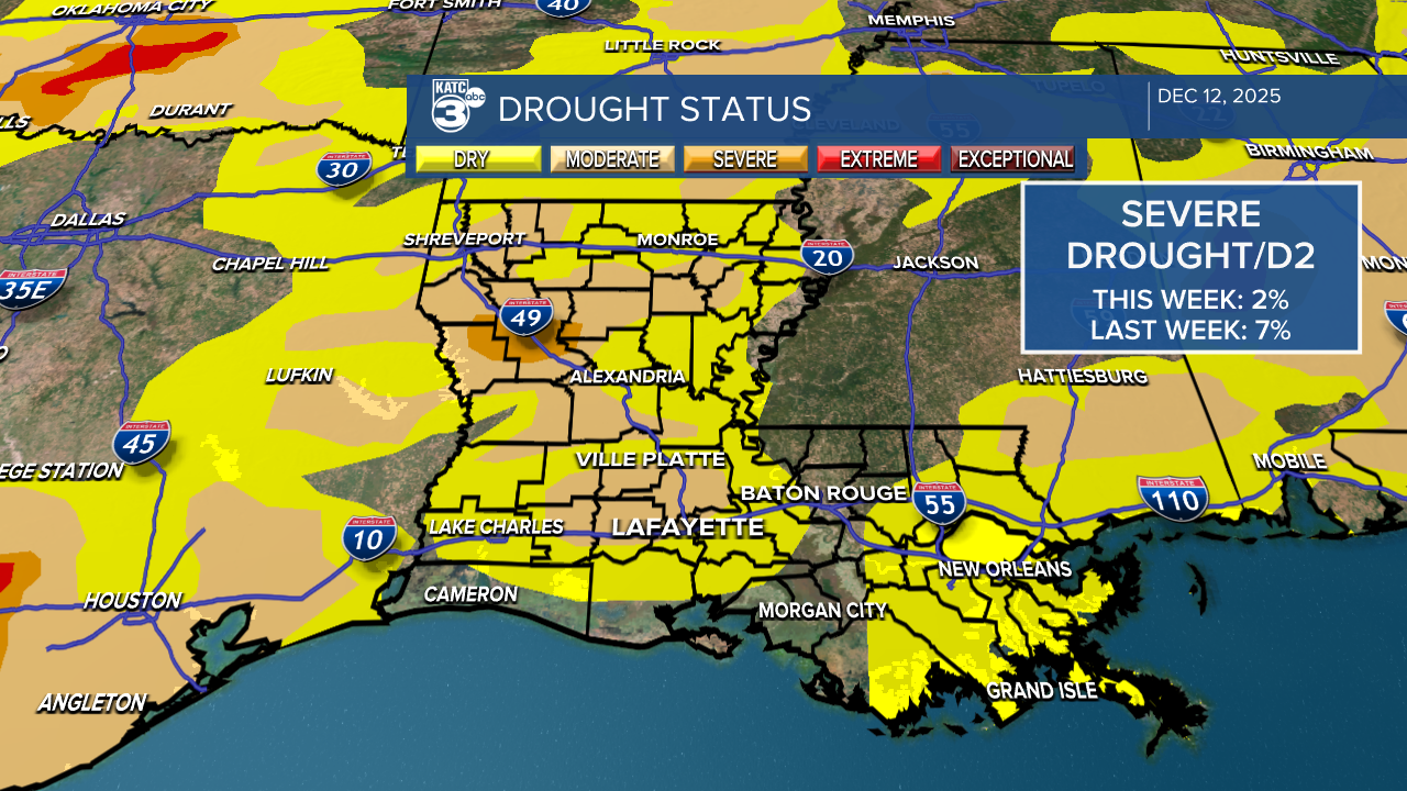
The latest drought monitor shows improvements in southern Louisiana thanks to the rain we received last week! Some areas are now completely drought-free, and the severe drought conditions are behind us. We only have a small patch of moderate drought north of I-10.
Expect a few isolated showers today and tomorrow afternoon, but no widespread rain in the forecast.
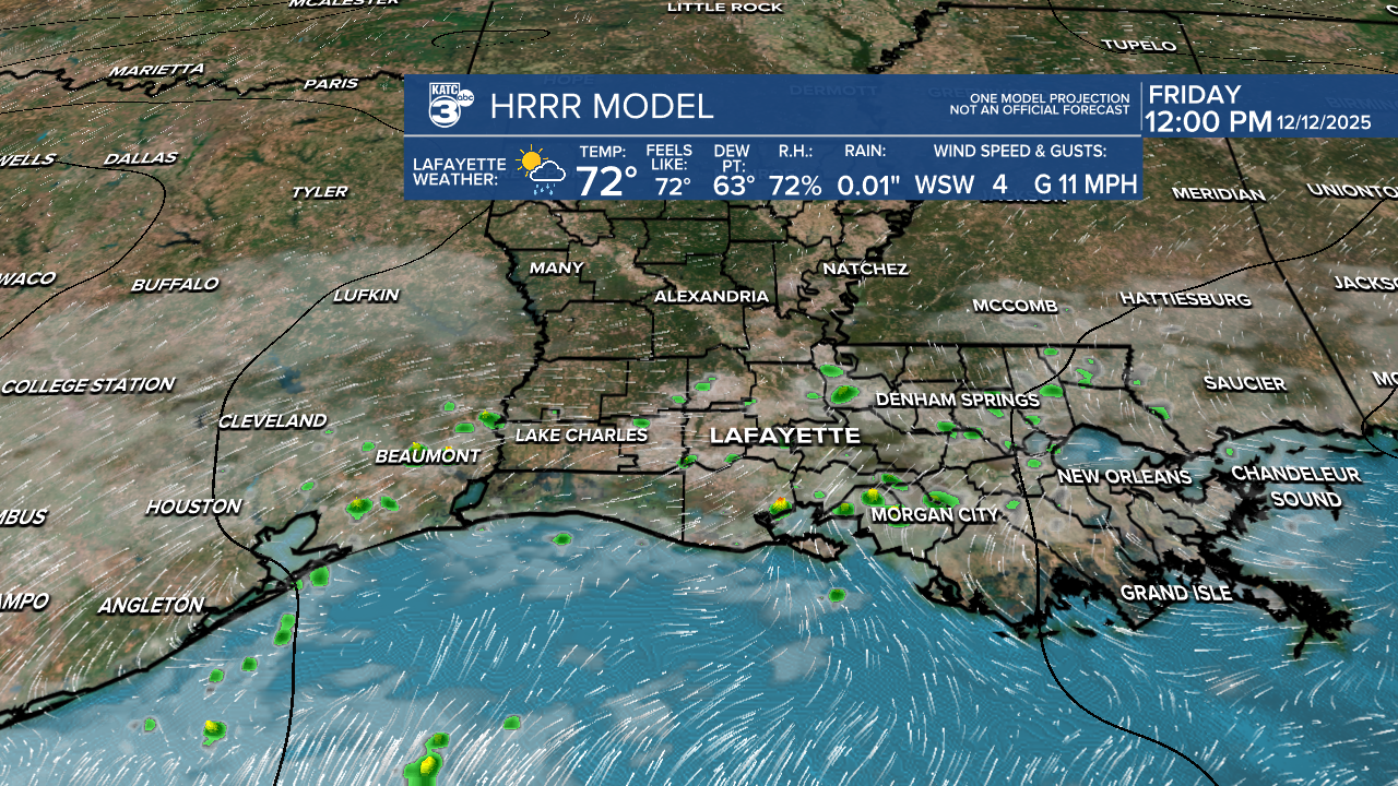

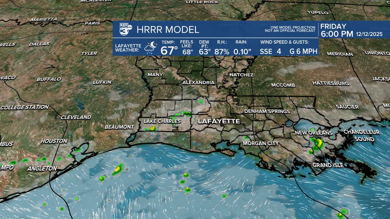
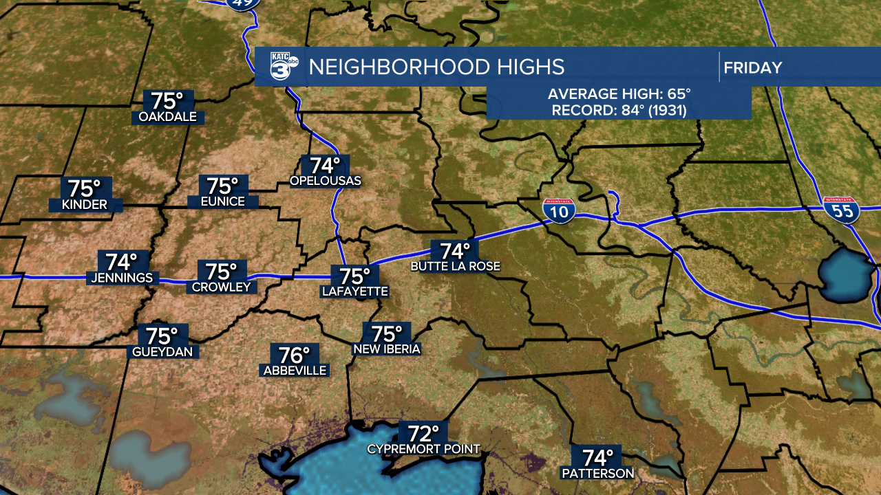
Today’s temperatures will be a warm treat, reaching into the 70s—about 10 degrees warmer than yesterday!
And speaking of warmth, the countdown to winter is on! Just 9 days until we officially welcome the season, and in 13 days, it’s Christmas Day!

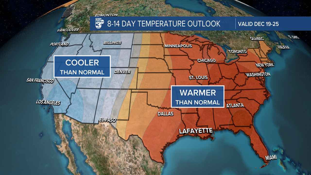
The CPC is forecasting warm weather for the holidays, so it's giving shorts and short sleeves.
Follow Meteorologist Breyanna Lewis for further updates.
See the KATC 10 Day Forecast for the latest.
