


Good afternoon, you guys! We're in for another batch of patchy to dense fog tonight.

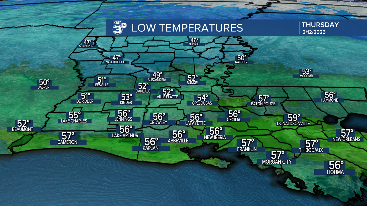
Expect temperatures to dip into the 40s and 50s.
Tomorrow, we’ll warm back up into the 70s with some partly cloudy skies.

As we look ahead, there’s a chance for a few isolated showers during the afternoon tomorrow and Friday. This weekend, a cold front will begin to organize, bringing scattered to widespread showers and storms Saturday evening.


We could see heavy rain at times, with expected amounts between half an inch and possibly up to 2" in some areas.

A low-end severe weather threat is possible, but if you're planning to enjoy the holiday festivities during the day, it should be fine—just be prepared for a few light passing showers. It'll be breezy with wind gusts reaching up to 25 mph!
Stay tuned for more updates as we head into the holiday weekend!
Follow Meteorologist Breyanna Lewis for further updates.
See the KATC 10 Day Forecast for the latest.
