


As we head into the first weekend of December, overcast skies and some lingering showers continue due to a stalled frontal boundary.


But don’t worry, there’s a silver lining ahead! A cold front will sweep through on Sunday, putting an end to the rain and paving the way for clear skies!

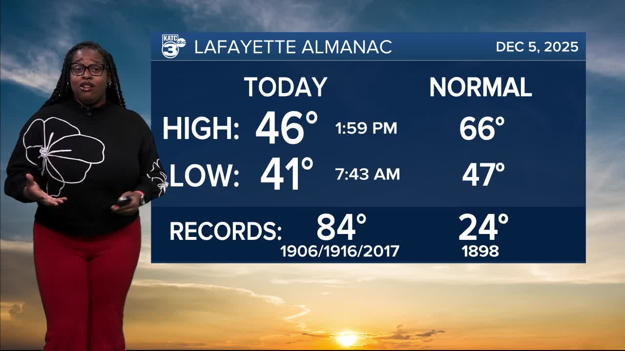
Tonight will be another chilly one, with temperatures dipping into the 40s.

However, tomorrow we’ll finally break out of those 40s—expect highs in the 50s and 60s!

Tomorrow night won’t cool down too much either, staying cool in the 50s for most.

And get excited for Sunday, which promises the warmest temperatures we’ve seen lately, reaching into the 60s and 70s!

Of course, it wouldn't be Louisiana if the mild temperatures stick. Following the cold front on Sunday, we can expect temperatures to drop at or near freezing next week.
Follow Meteorologist Breyanna Lewis for further updates.
See the KATC 10 Day Forecast for the latest.
