

It's been raining cats and dogs since last night, and we’re seeing significant impacts across our area. Here's a summary:
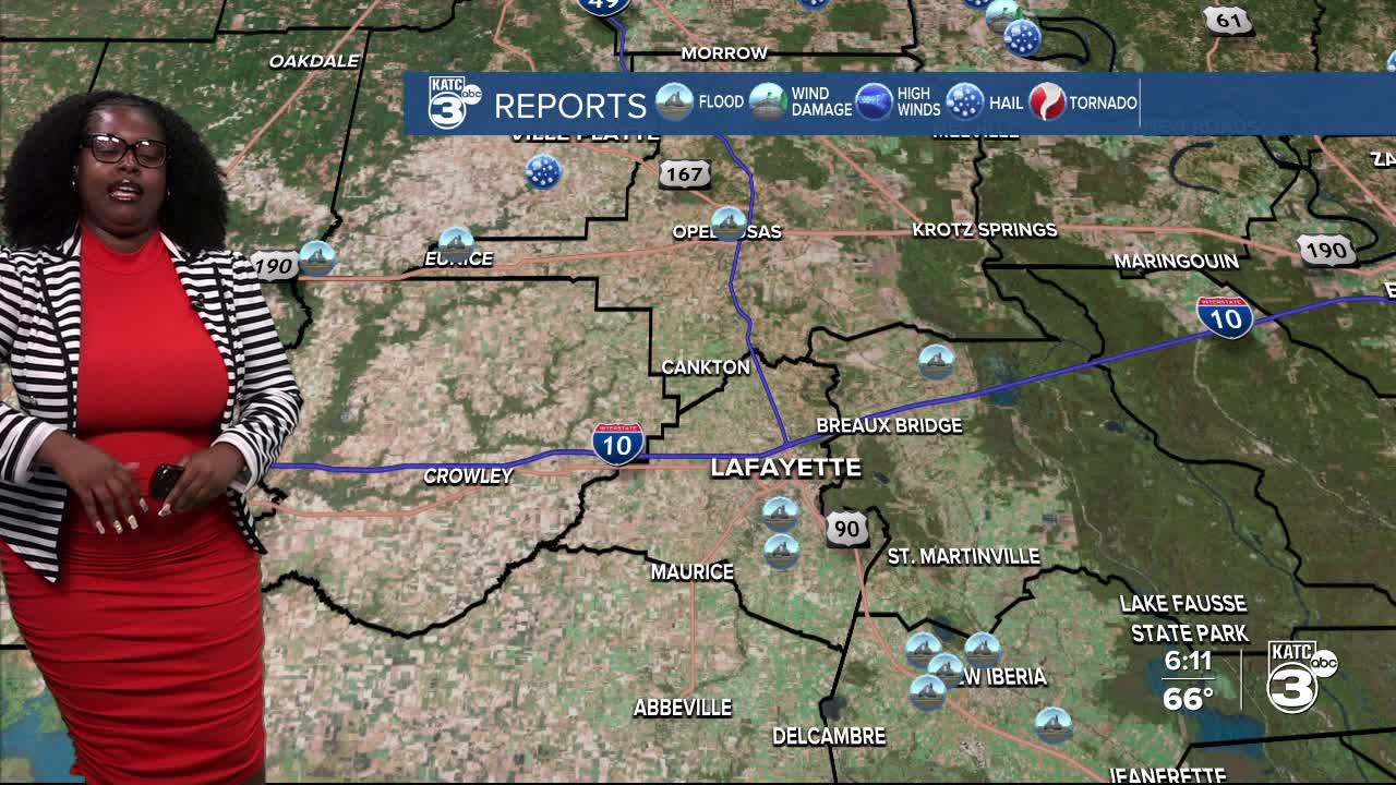
FLASH FLOODING:
- Broussard (Lafayette), Water is covering parts of Camellia Blvd.
- Milton (Lafayette), Reports of water over Verot School Rd; the nearby coulee has overflowed.
- New Iberia (Iberia), Multiple roads, including Broken Arrow Rd, Grand Prairie Rd, Jasper Rd, and Hazard Rd, are impassable due to high water. Watch out for water over the roadway on St. Peter near the library.
- Lydia (Iberia), Darnall Rd near Hwy 90 is blocked by high water.
- Cecilia (St. Martin), Alcide Bonin Rd is closed because of rising water.
HAIL:
- Ville Platte (Evangeline), Witnessed hail at least the size of a nickel in Point Blue.

Rain and storms are expected to linger into the evening. We've already received an average of 3 inches over the past 48 hours, with some areas getting close to 13 inches! The heaviest rainfall has occurred east of the Atchafalaya Basin.

A few key points: Turn around, don’t drown. If you can’t see the pavement, take another route. With more rain expected, flood risks will only increase, especially with the ground already saturated.
The rain is finally letting up tonight and will clear out into tomorrow morning, but we're expecting the infamous fog to roll back in!

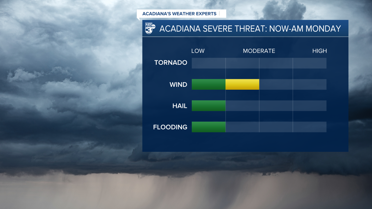
Tomorrow, there's a low-end severe weather threat across the state, with a slight (2/5) risk mainly for CENLA and northern Louisiana, while Acadiana faces a marginal (1/5) risk.

Our primary threats are strong winds and large hail if storms become severe.
Since the ground is already saturated, we could see rainfall amounts of up to 3" through 12 PM on Monday, with some storms possibly bringing heavy rain.

Most of the rain is expected to arrive during the afternoon and evening, but we might still see a few showers in the morning.

A cold front is set to arrive on Monday, which will finally put an end to the rain for good! With southerly winds and warming temperatures, humid conditions return, with highs in the upper 80s and possibly low 90s !
Follow Meteorologist Breyanna Lewis for further updates.
See the KATC 10 Day Forecast for the latest.
