


Let’s dive right into the latest on Tropical Storm Bertha! Currently, she has sustained winds of 50 mph and a central pressure of 997 millibars. Bertha is moving west at 5 mph, positioned just 45 miles northeast of the Mouth of the Mississippi River.
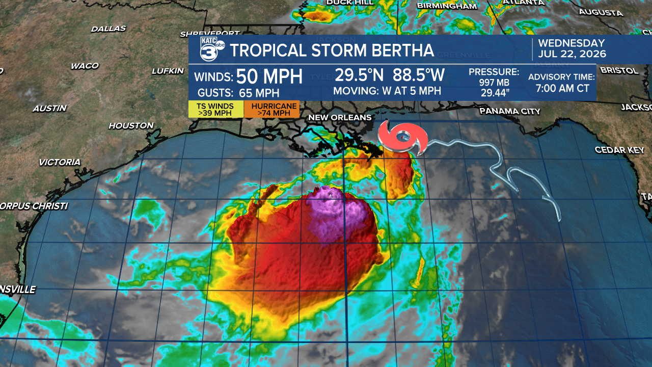
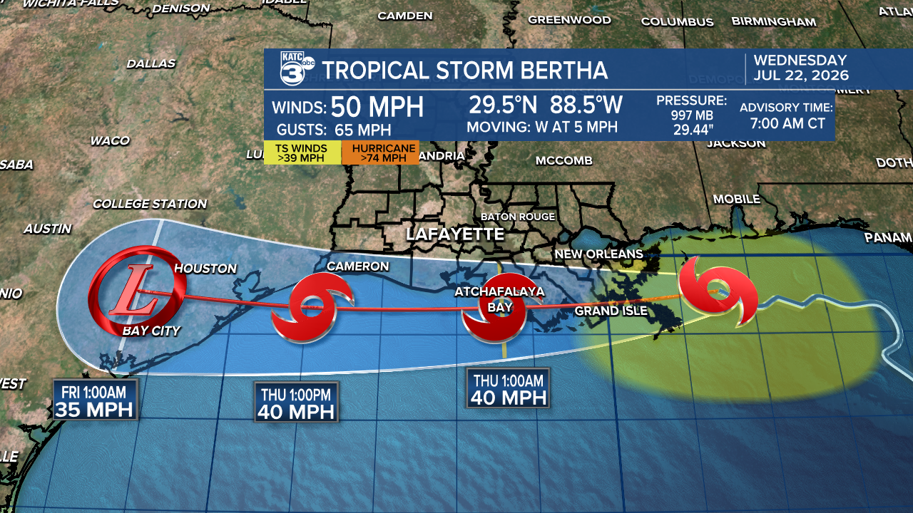
In the latest NHC discussion mentioned, "One thing worth keeping an eye on is the possibility a new center may try to reform under these convective bursts in the 24-36h time-frame like what is depicted in some of the hurricane-regional models, though this is not reflected in the NHC track forecast at this time." This could explain the buzz about a potential Corpus Christi landfall.
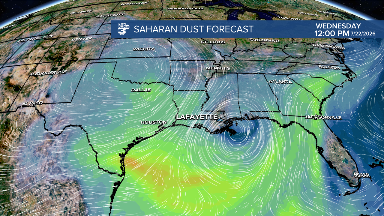
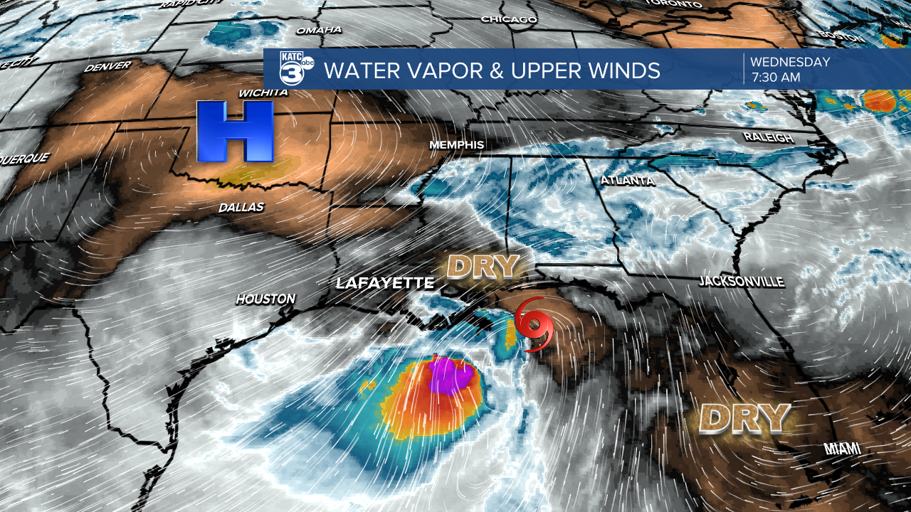
Bertha’s path will largely depend on whether her circulation stays along the Gulf Coast or if it attempts to reform further south under those convective bursts. Most models suggest she will slowly weaken over the next 24 hours due to vertical wind shear, Saharan dust, land interaction, and dry air. Ultimately, Bertha is expected to drift further west and move inland over Texas by the end of the week.
A Tropical Storm Warning (tropical storm force winds are likely) is still in effect for southeast Louisiana, including Metro New Orleans, through tonight. There's also a Tropical Storm Watch (tropical storm force winds are possible) for Vermilion, Iberia, and St. Mary Parishes tonight into Thursday. With the latest advisory, Tropical Storm Watches have extended through the Texas Coast.
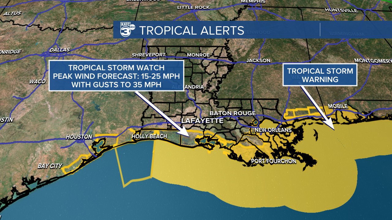
While the strongest winds are likely to remain offshore, we can expect breezy to windy conditions inland, with gusts up to 30 mph.
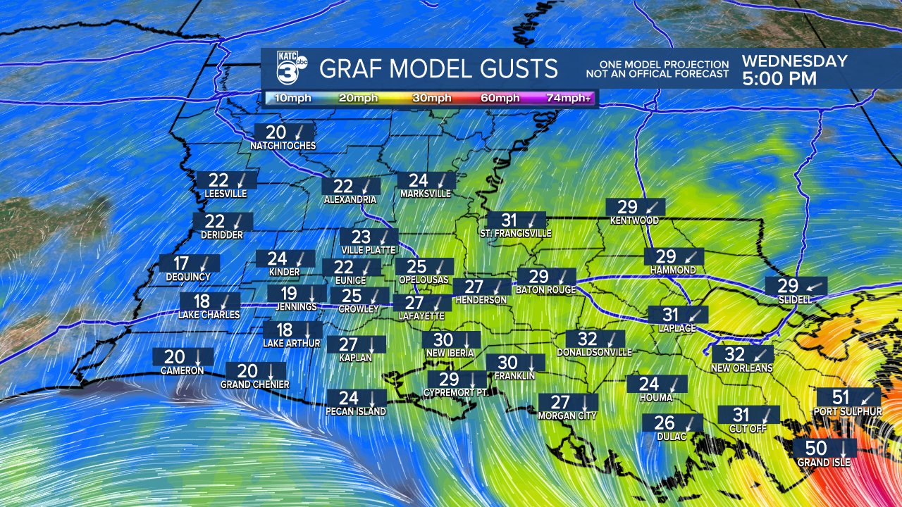
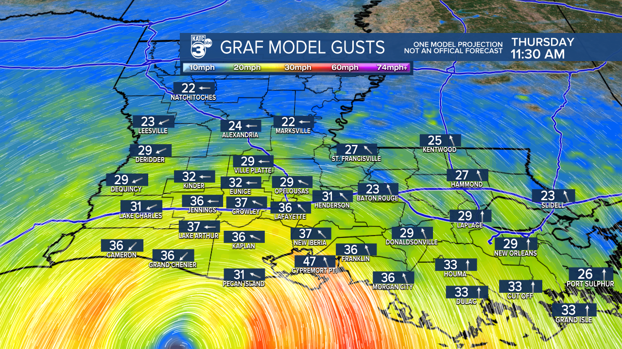
The GRAF model suggests wind gusts near 50 mph near Cypremort Point on Thursday morning. Make preparations to tie down loose outside objects.
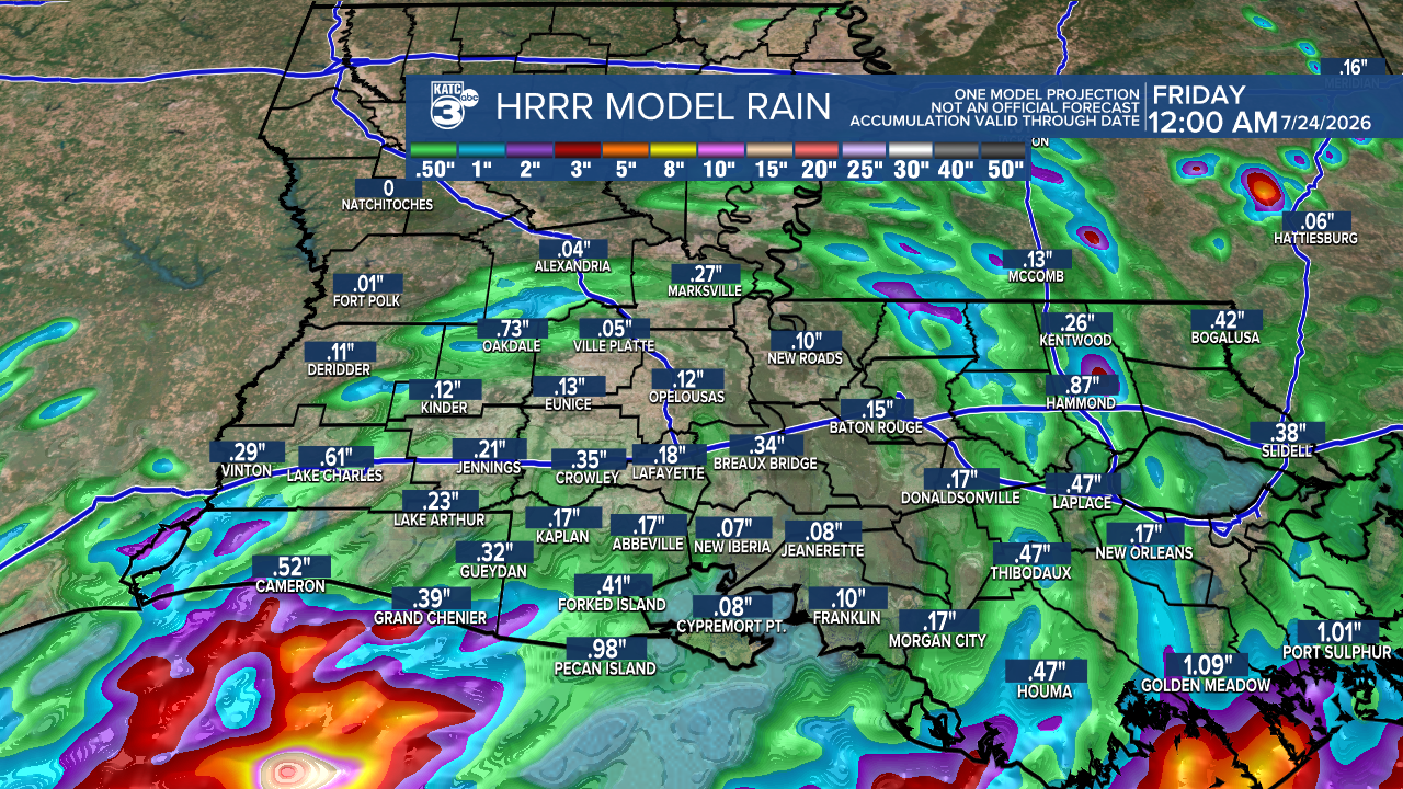
Rain chances are on the rise, especially for Thursday as Bertha continues her westward track. Most areas will see less than an inch of rain, with the heaviest downpours expected offshore.
Plus, minor coastal flooding is possible where Coastal Flood Alerts are active in southeast Louisiana, along with localized flooding from storms in Acadiana.
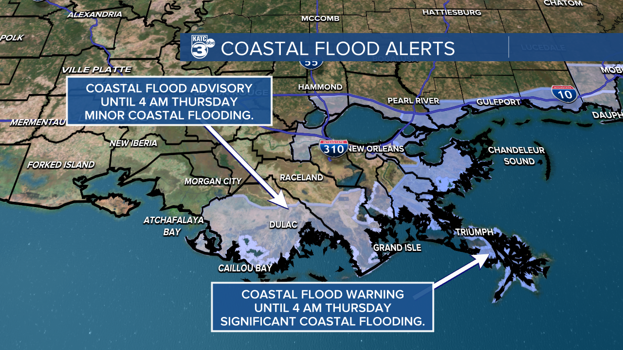
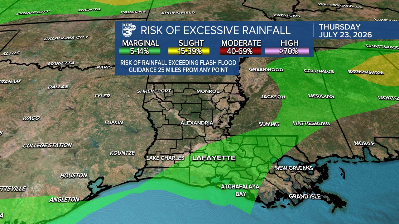
No significant impacts are expected for inland Acadiana. However, if you’re near the coast, be prepared for breezier winds and a few showers and storms associated with Bertha. No severe weather is expected. We must thank the dry air and wind shear because without those major factors, the situation would look completely different.
As we dive into this sweltering summer day , temperatures soar to dangerously high levels across Texas, Louisiana, Mississippi, and Alabama.
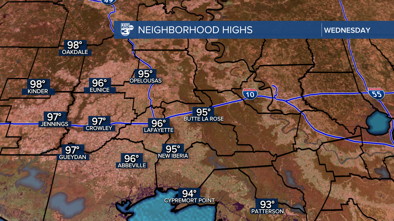
Almost the entire state is under an EXTREME HEAT WARNING, with heat indices up to 117°. The sinking air aloft and outflow from Tropical Storm Bertha are contributing to this stifling heat!
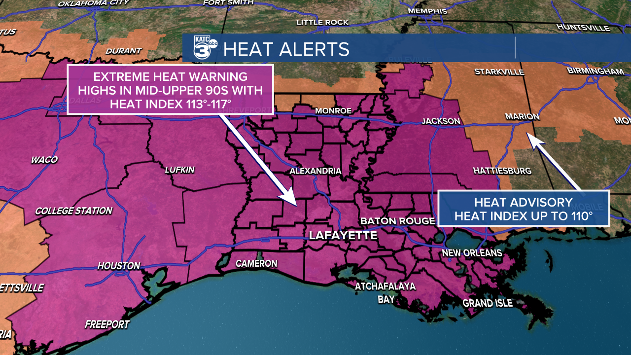
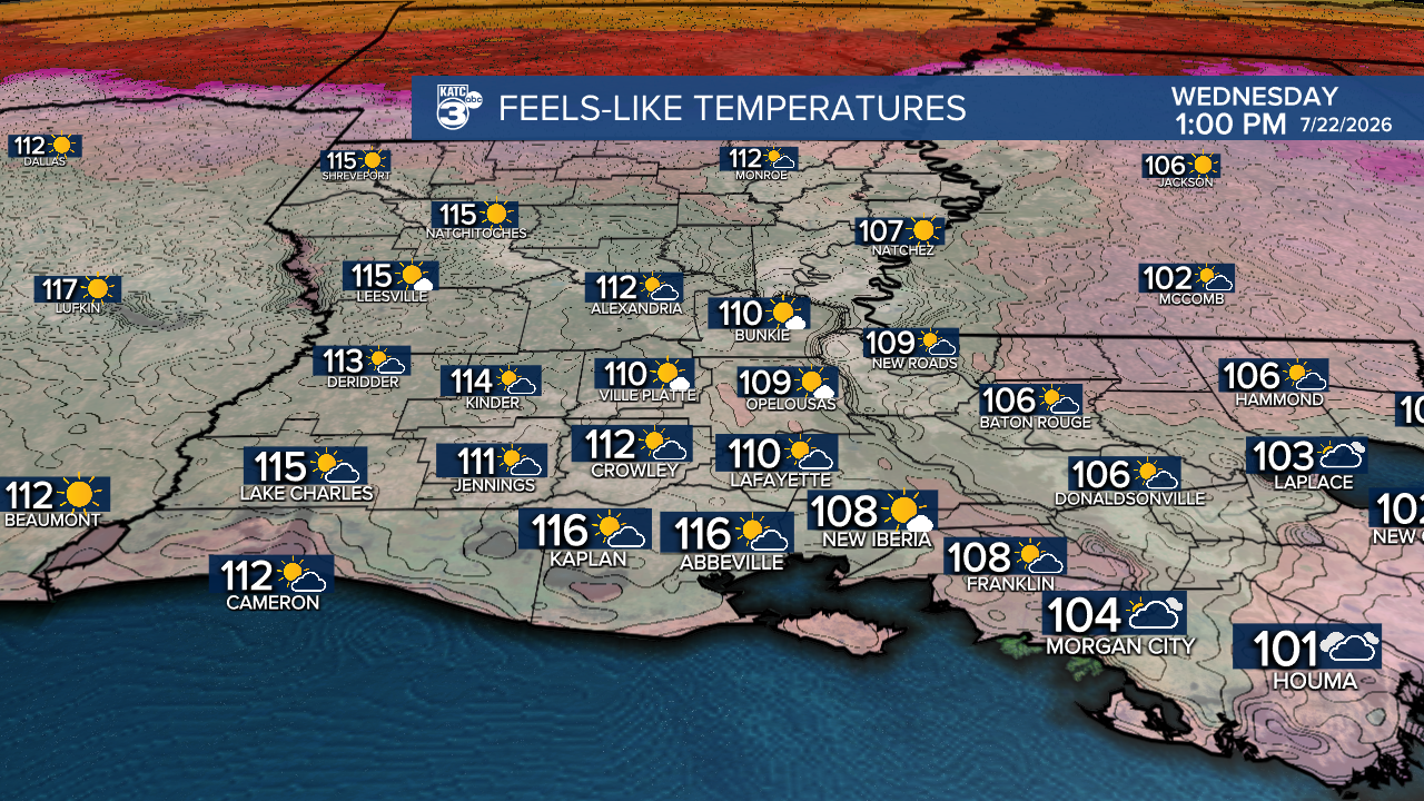
Here are some essential heat safety tips to keep you and your loved ones protected:
- Dress smart: Opt for lightweight, loose-fitting clothing.
- Timing is Everything: Try to limit outdoor activities to the early morning or evening when it’s somewhat cooler.
- Know the Signs: Familiarize yourself with symptoms of heat exhaustion and heat stroke. If you or someone around you feels unwell, don’t hesitate to act!
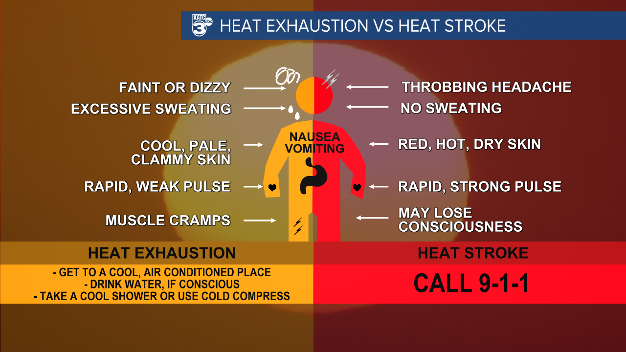
Follow Meteorologist Breyanna Lewis for further updates.
See the KATC 10 Day Forecast for the latest.

