
This evening, showers and thunderstorms will clear up just in time for your holiday fireworks celebrations!
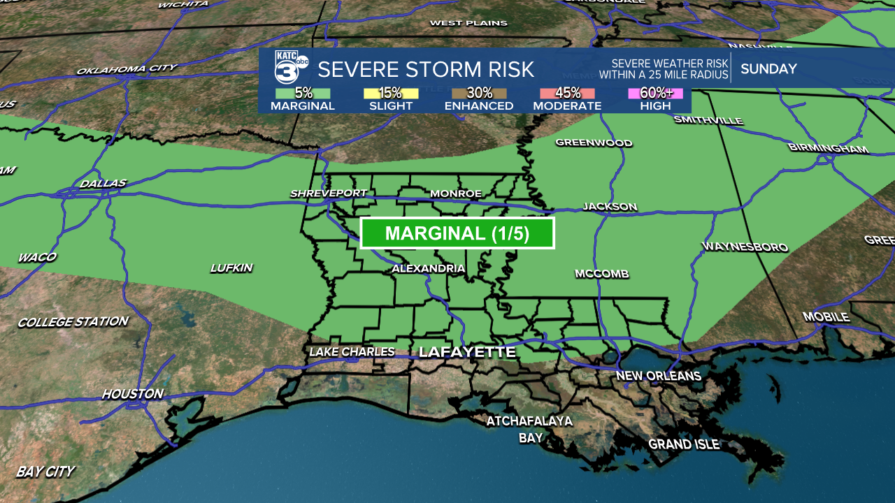
Looking ahead to tomorrow, the SPC has issued a marginal (1/5) risk for severe wind gusts for areas north of I-10.
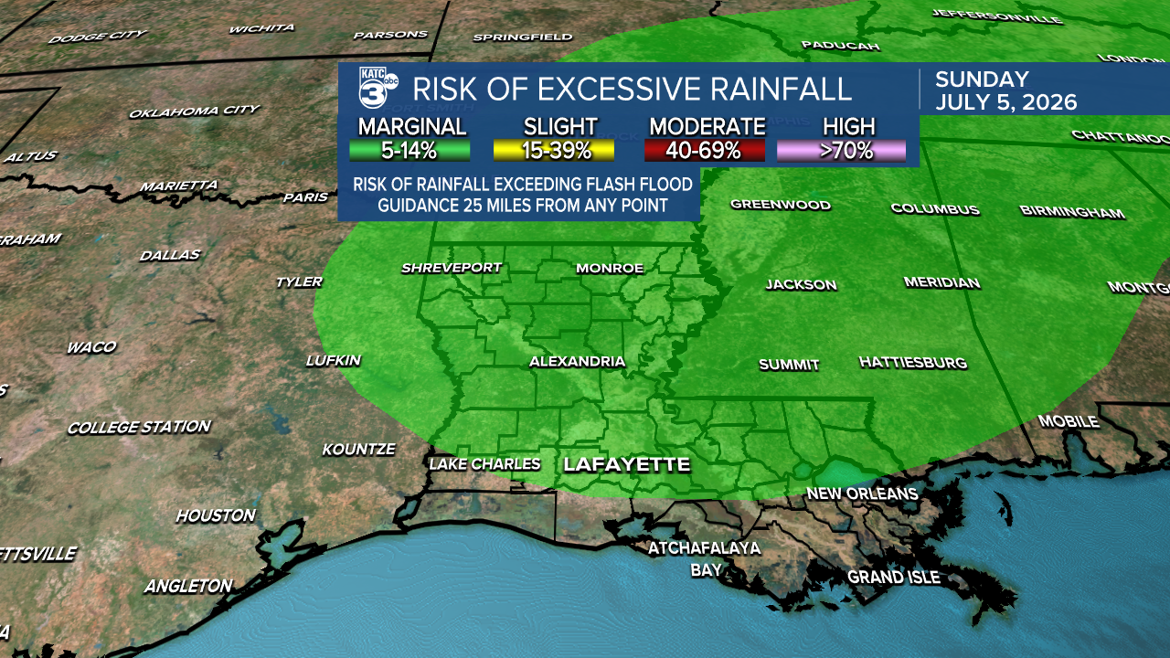
We’re also keeping an eye on a low-end flood threat. A larger portion of Acadiana is under a marginal (1/4) risk for heavy rain, given the likelihood of showers and storms that could bring some hefty downpours.
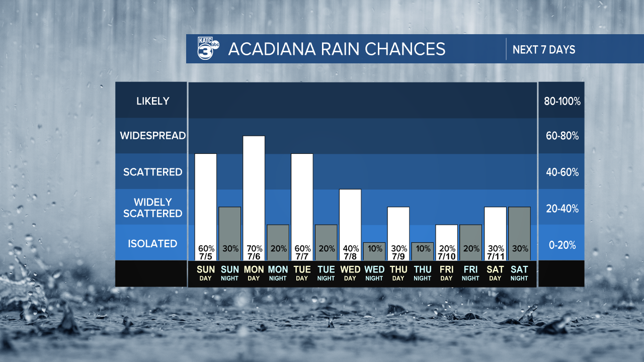
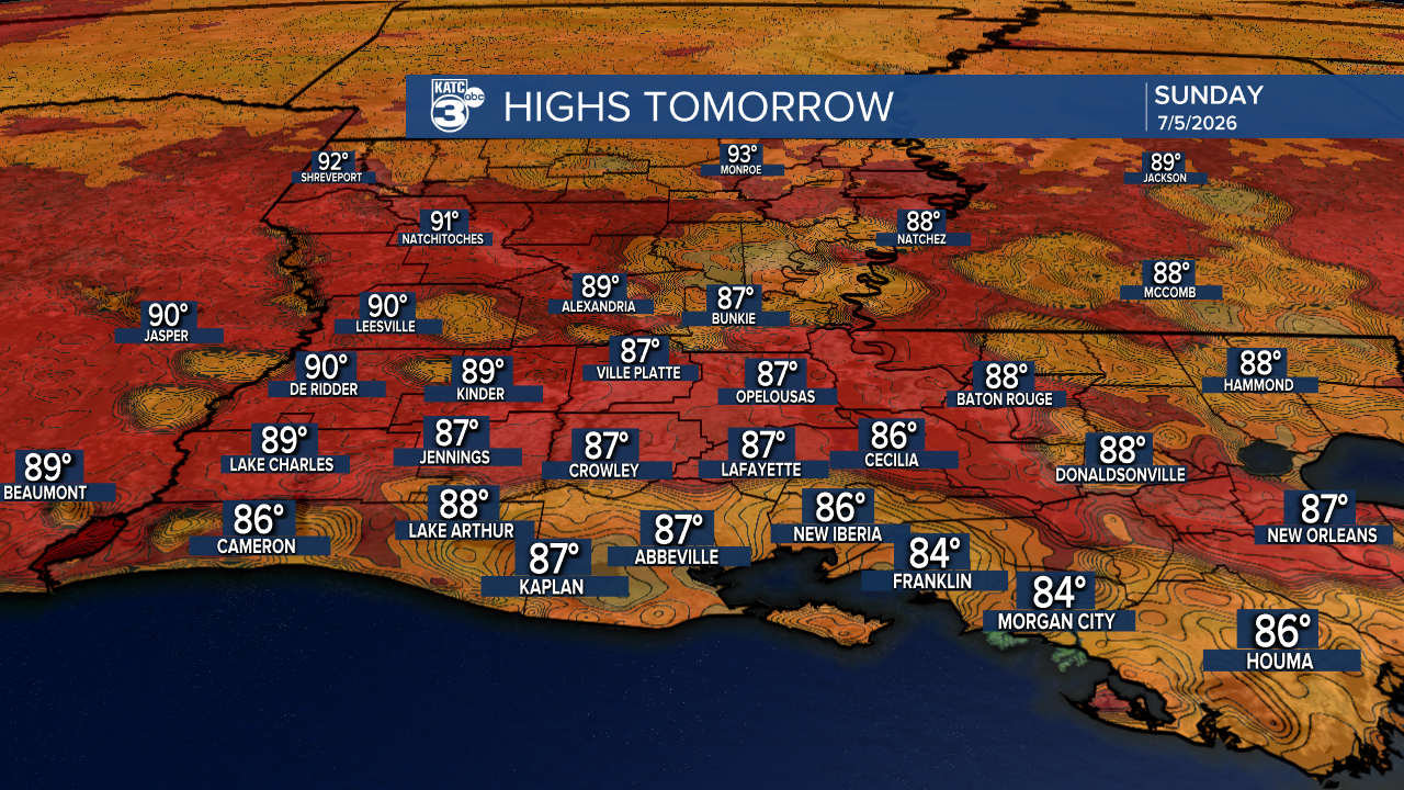
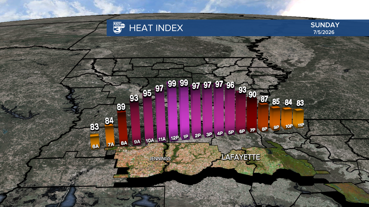
Expect more showers through Tuesday, but it's going to be a warm one with highs in the 80s! Feels-like temperatures are expected to rise into the upper 90s. With more clouds and shower activity, this will keep temperatures in check.
Follow Meteorologist Breyanna Lewis for further updates.
See the KATC 10 Day Forecast for the latest.
