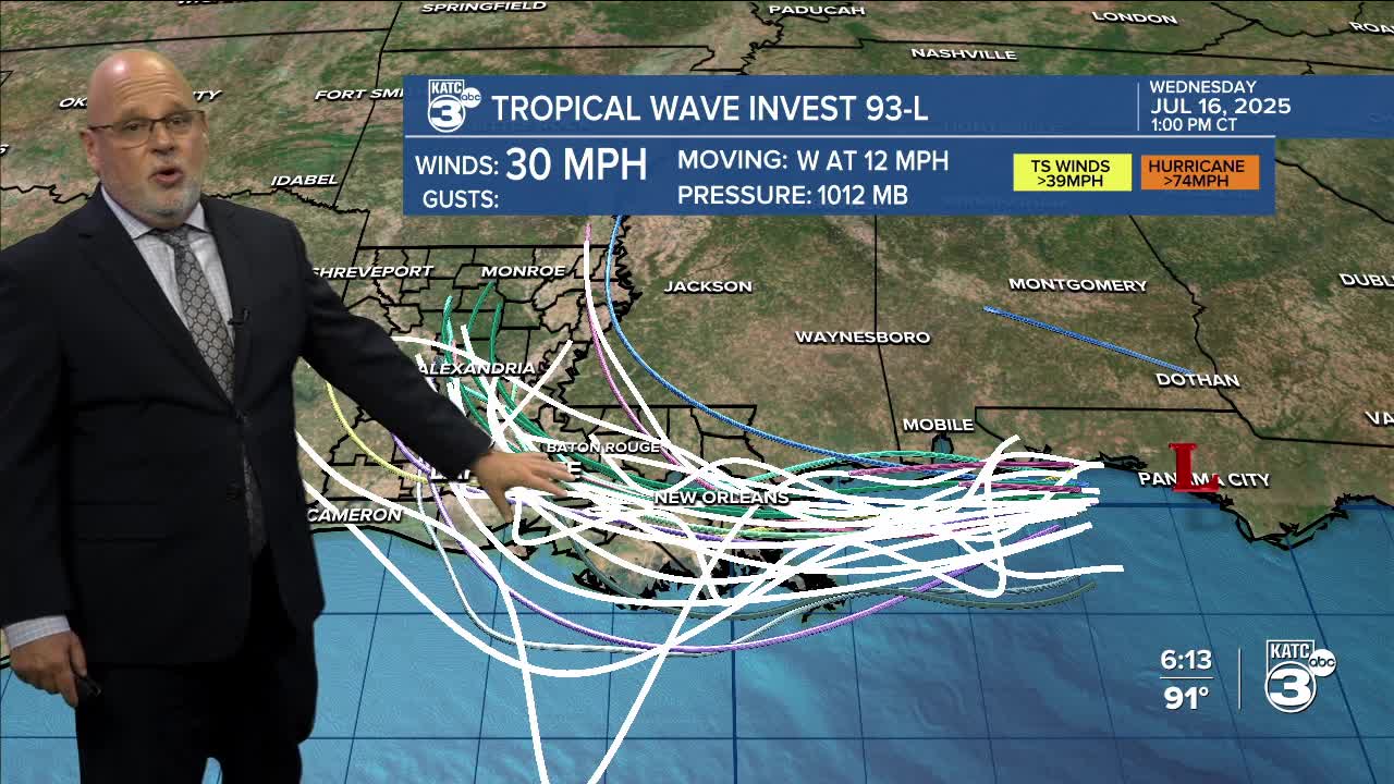


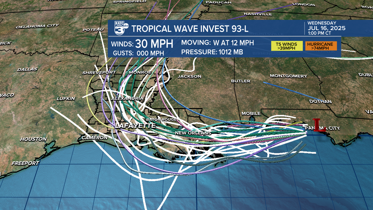
Invest 93L is still trotting along the northern Gulf. It's basically a "blob" of showers and storms near Panama City, Florida, and is moving westward. Showers begin to push into eastern Louisiana tonight, and rain eventually moves into Acadiana Thursday morning.

Gradual development is possible, and a tropical depression could form within the next two days. Keep in mind this system is very disorganized and the bulk of the rainfall won't be along the center.
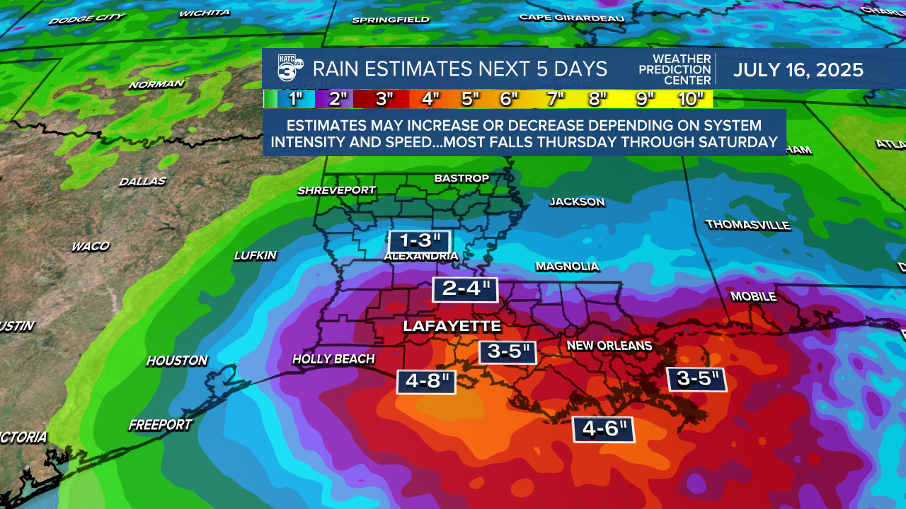
We're expecting several days of heavy rain across Acadiana from Thursday through Saturday. The WPC issued a slight to moderate threat for flooding during this period, and a FLOOD WATCH goes into effect tomorrow morning.
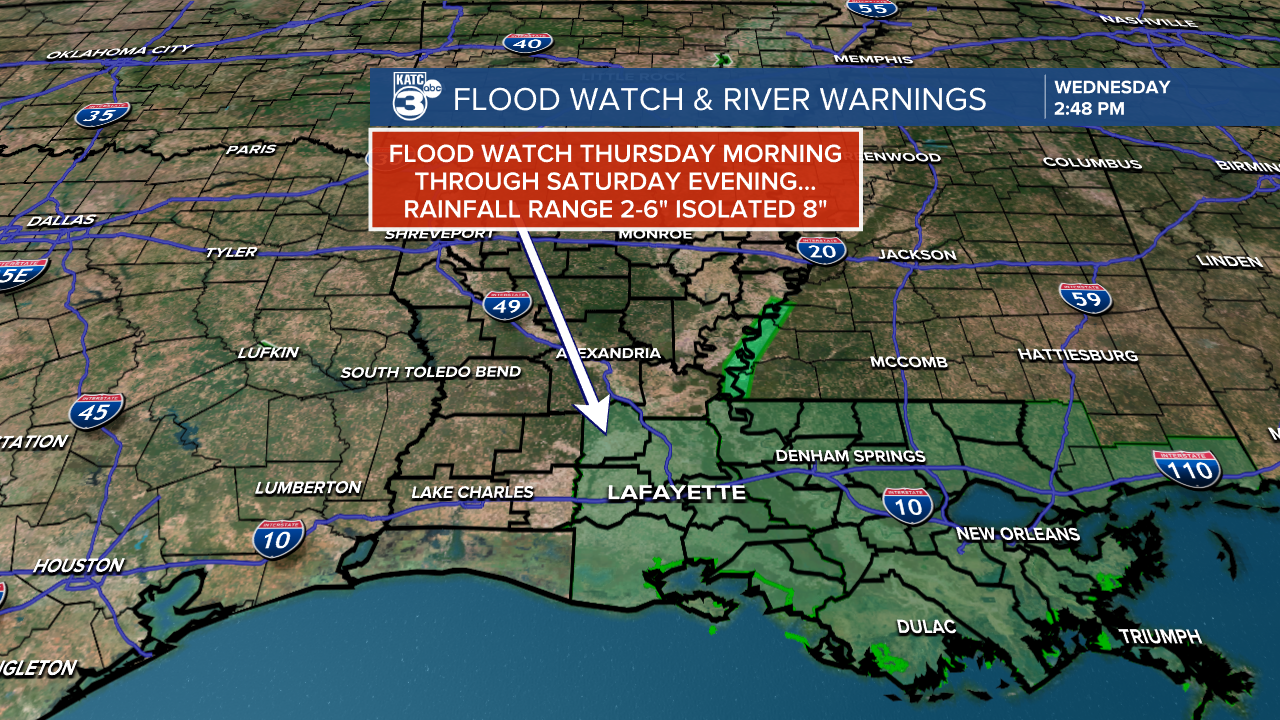

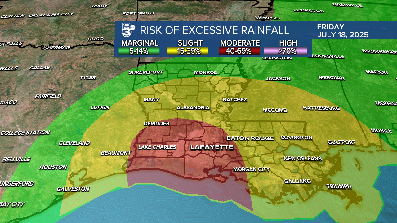

Rainfall amounts are expected to vary, with most areas receiving anywhere from 1 to 6 inches. However, localized spots could see significantly higher totals of up to 8 or even 12 inches. While recent models have slightly downgraded the extreme rainfall predictions, it’s essential to stay vigilant and prepared.
By Sunday, a weak upper-level ridge builds in, lowering rain chances into next week. We'll be back to our regularly scheduled program.
See the KATC 10 Day Forecast for the latest.
