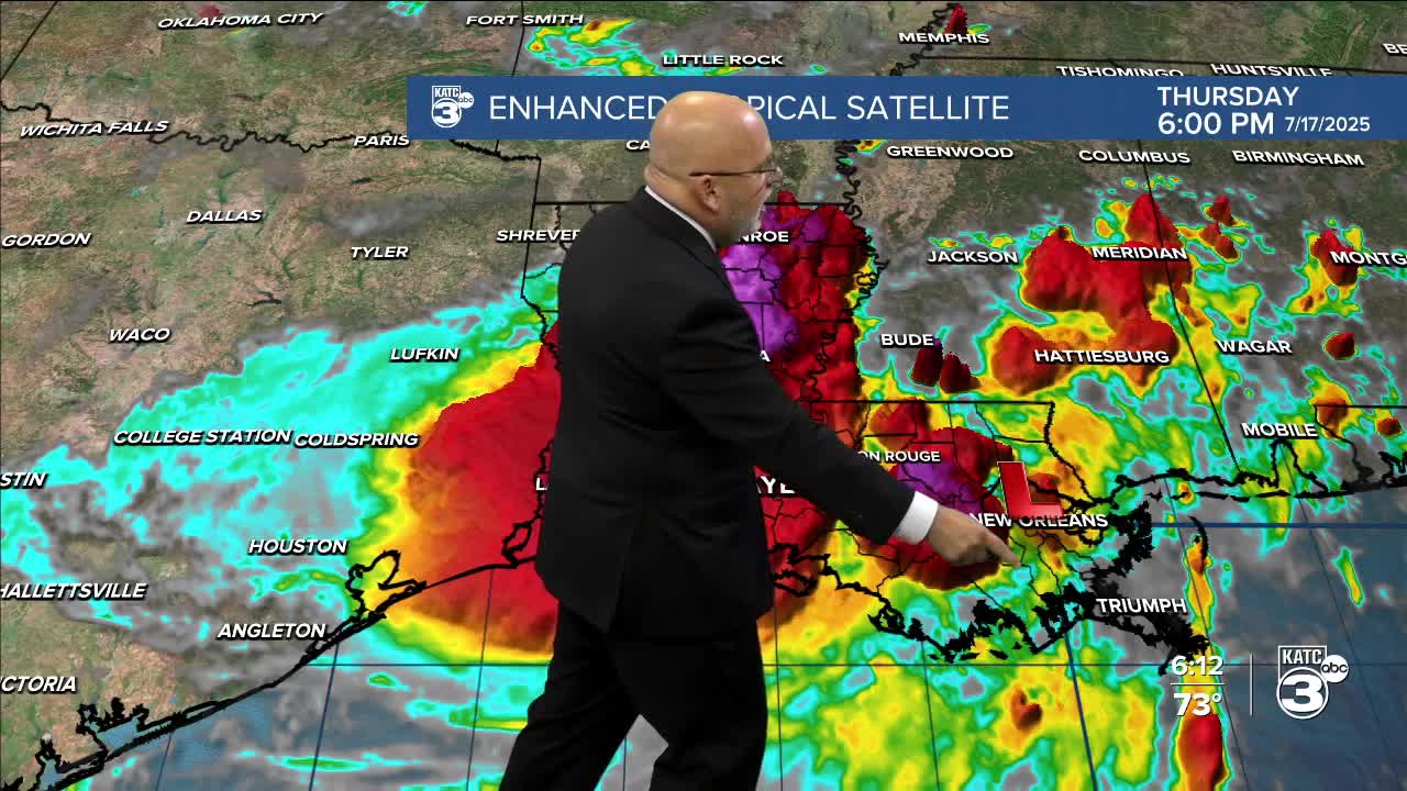


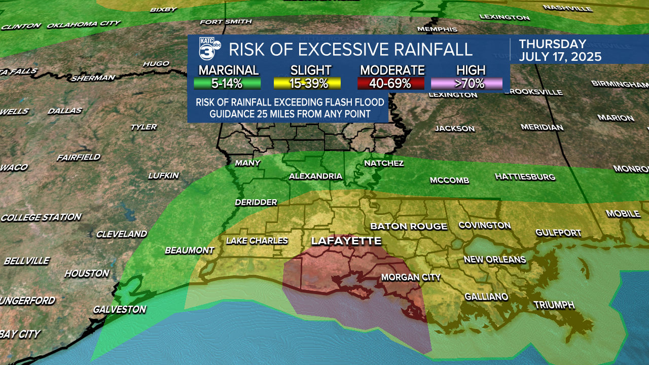
Today has been quite gloomy across southern Louisiana as Invest 93L continues to bring heavy rain to the area. As a result, the Flood Watch has been extended into southwest Louisiana until Saturday evening. So far, between 2 to 9 inches of rain have fallen in Iberia and St. Mary parishes, which are currently under a Flash Flood Warning until 5:15 PM. Please exercise caution when traveling this afternoon and evening.

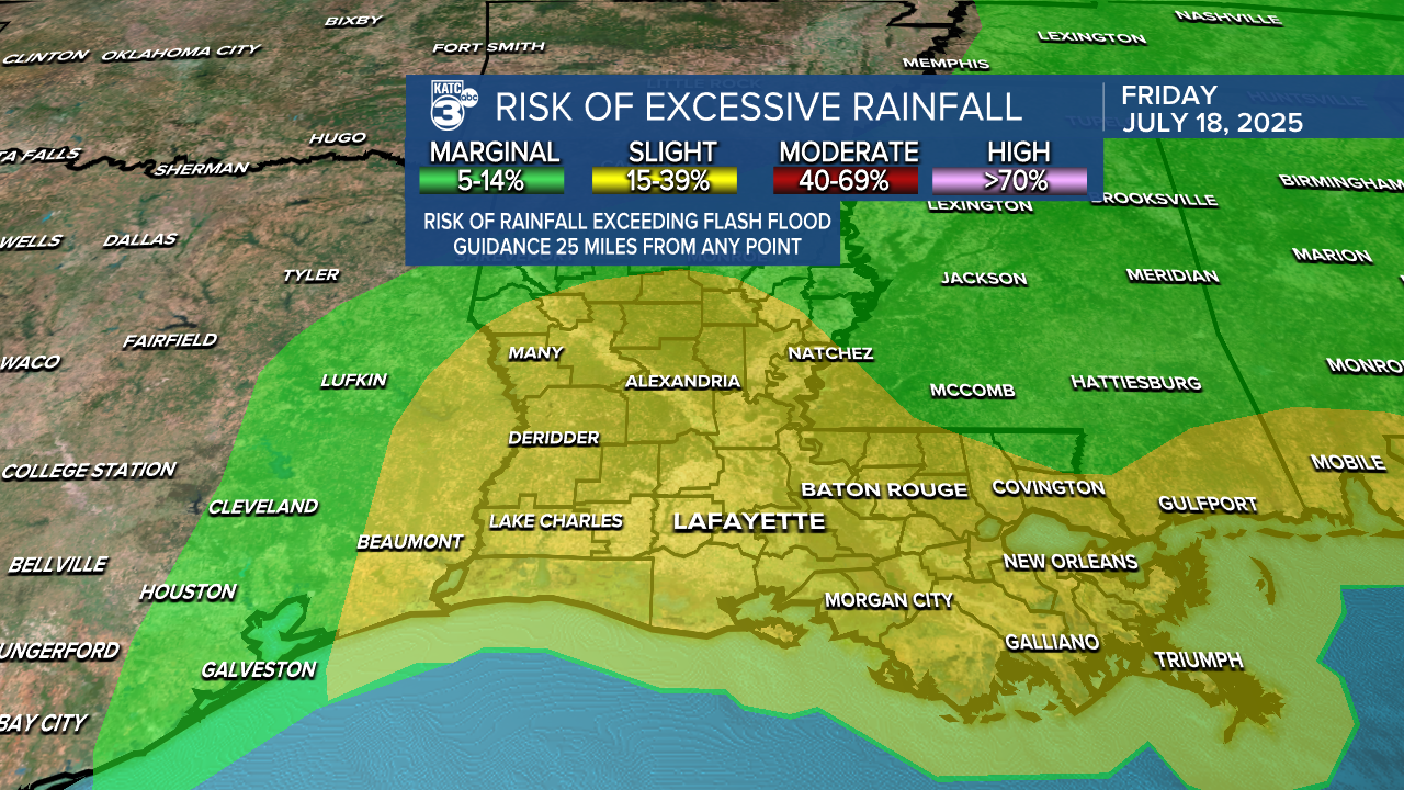
There is a moderate threat of flooding today; however, this risk is expected to decrease to a slight risk tomorrow and a marginal risk on Saturday.

After this disturbance passes, we will return to our typical summer weather pattern, which will feature heat and mostly dry afternoons, with occasional isolated showers and storms. High temperatures are expected to reach the mid-90s, with some areas potentially hitting the upper 90s, leading to heat indices well into the triple digits.
See the KATC 10 Day Forecast for the latest.
