



The NHC has raised the odds of formation to 50% over the next seven days. Invest 91L remains a broad area of low pressure in the eastern Gulf.
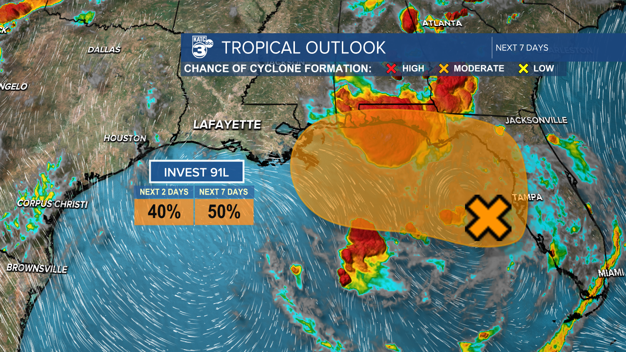
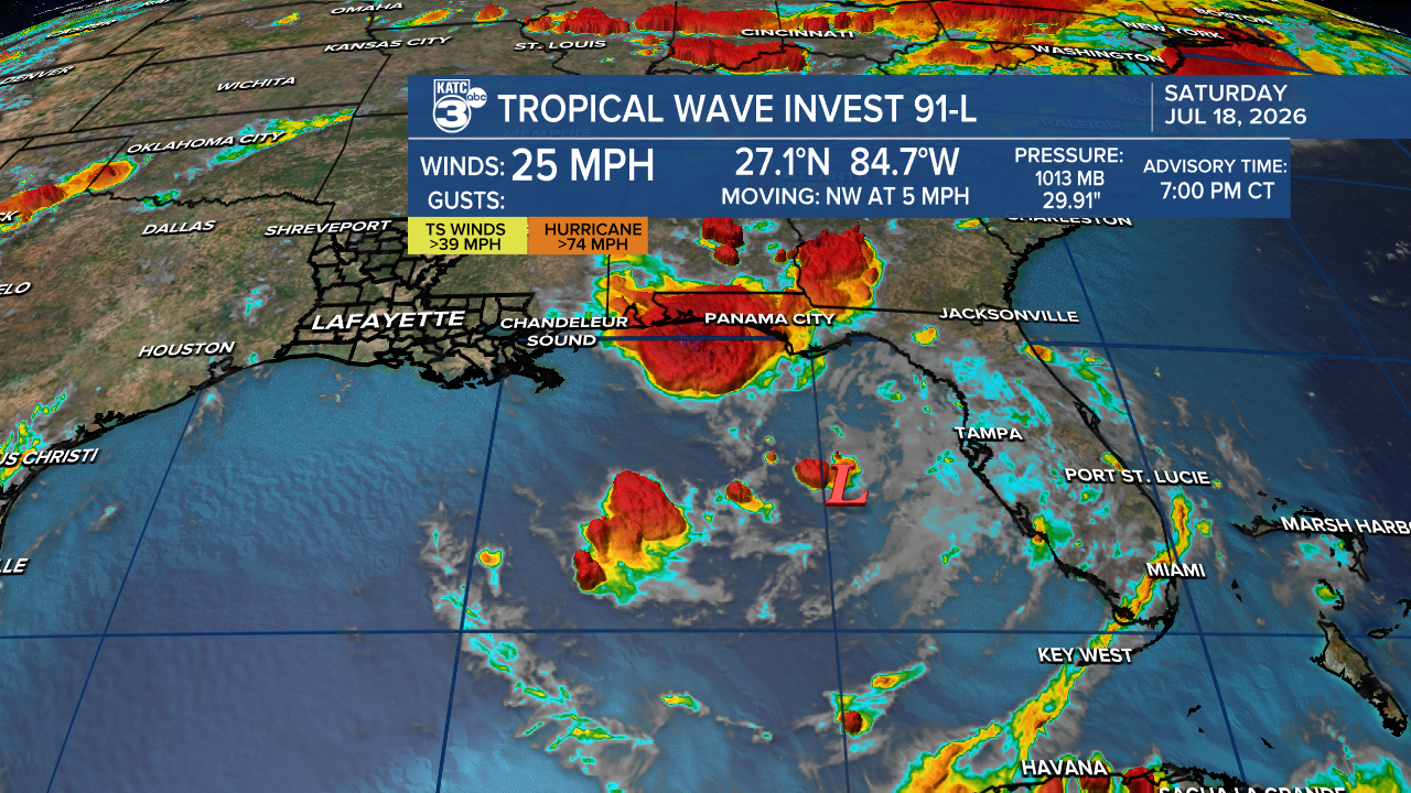
Per the NHC, "The associated winds are currently light, and the shower and thunderstorm activity remains disorganized. However, gradual development of this system is possible, and it could become a tropical depression while it moves slowly northward or north-northwestward during the next few days."

As wind shear increases, there’s a narrow window for this system to strengthen. If it becomes a tropical storm, the next name on the list will be Bertha.

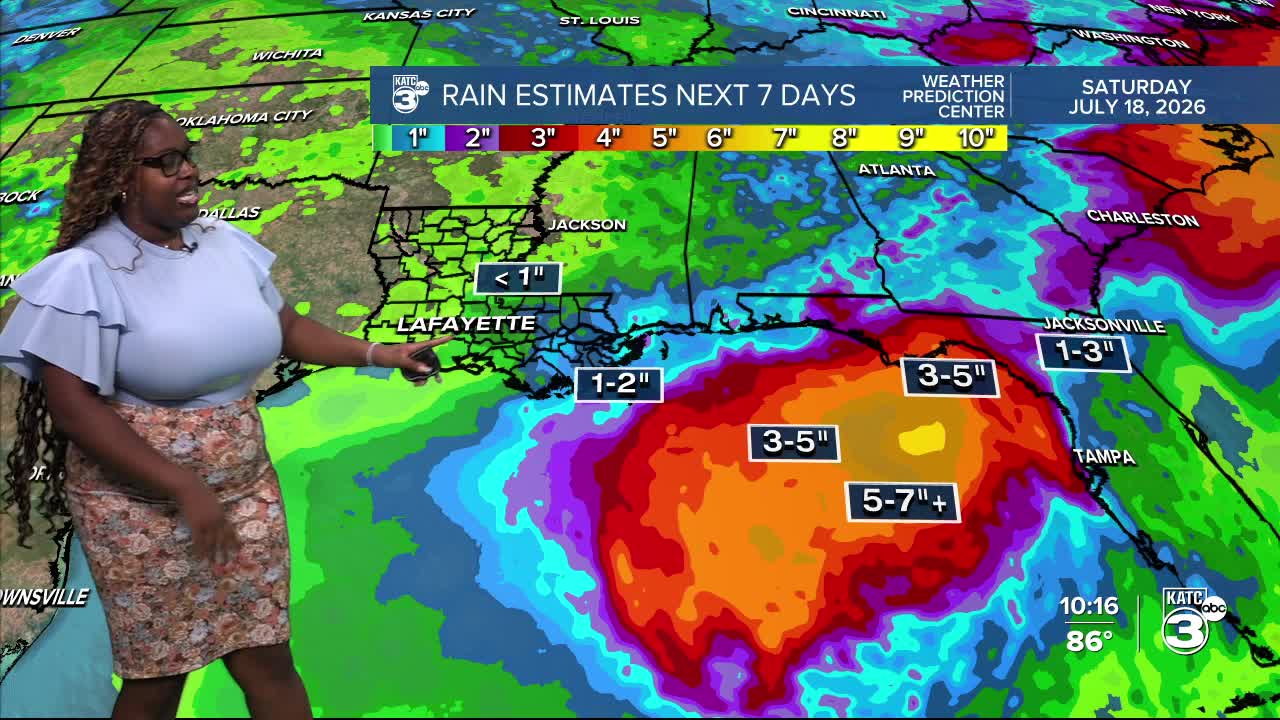
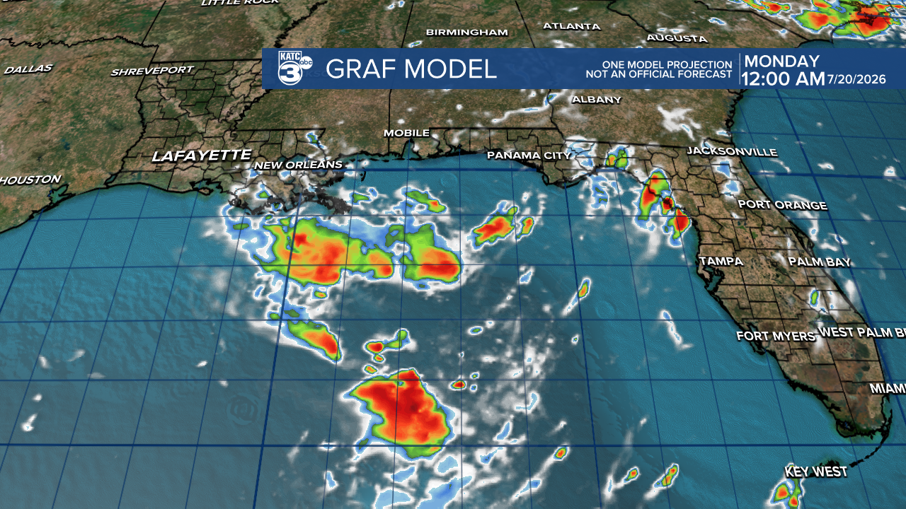
Regardless of development, the areas of concern include the Florida Gulf Coast, southern Alabama, and southwestern Georgia, where heavy rain is anticipated. This will likely put a damper on beach plans for the week ahead. The bulk of the rain remains offshore, with nearly 7" over the next seven days.
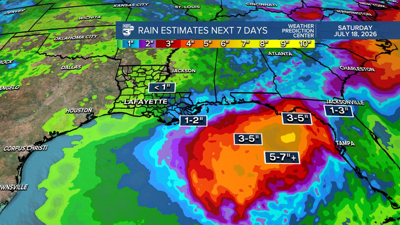
What does this mean for Acadiana? We're not in the threat zone. Much of the activity appears to stay east. Instead, we’ll continue to face hot temperatures and dry air throughout the week. However, we can expect a slight uptick in tropical moisture and minimal rain chances. Our rainfall amounts remain below one inch.
We'll keep you posted on any developments!
Hope you're all staying cool because it’s a scorcher out there! Lafayette reached 94° today with a morning low of 78°, and we’re expecting highs in the upper 90s through Tuesday—this is shaping up to be the hottest days of the season so far.

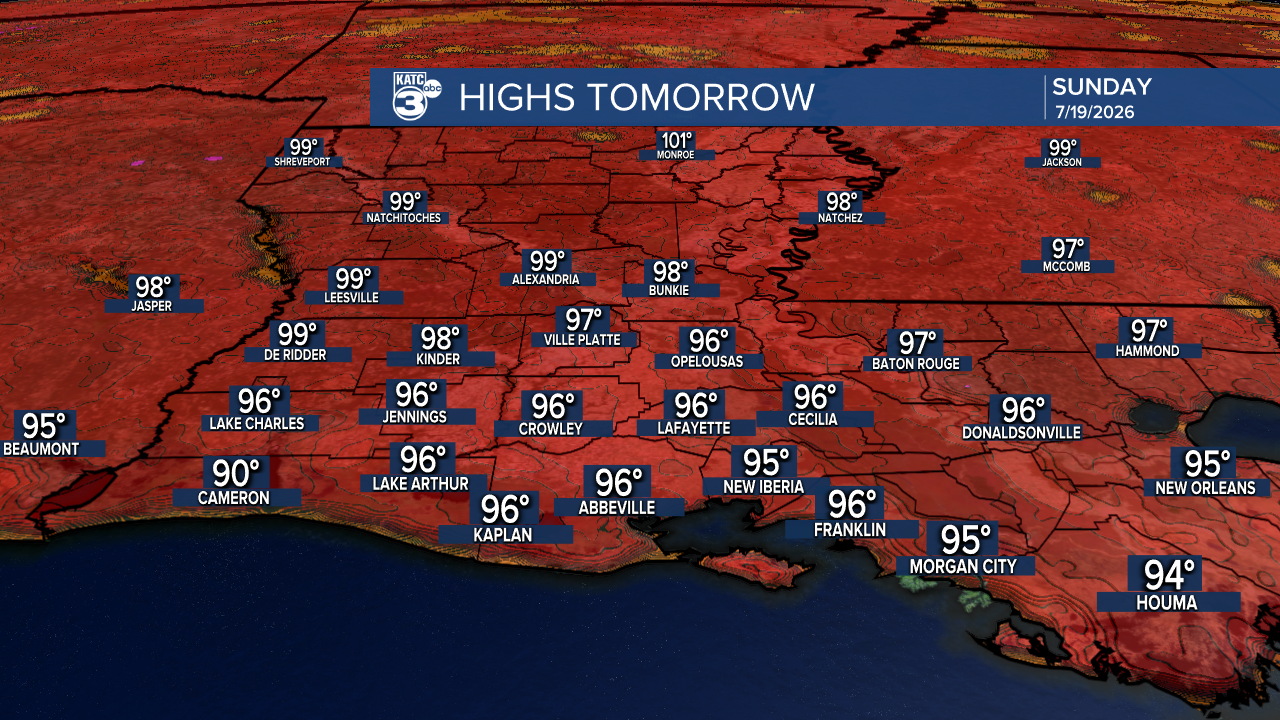
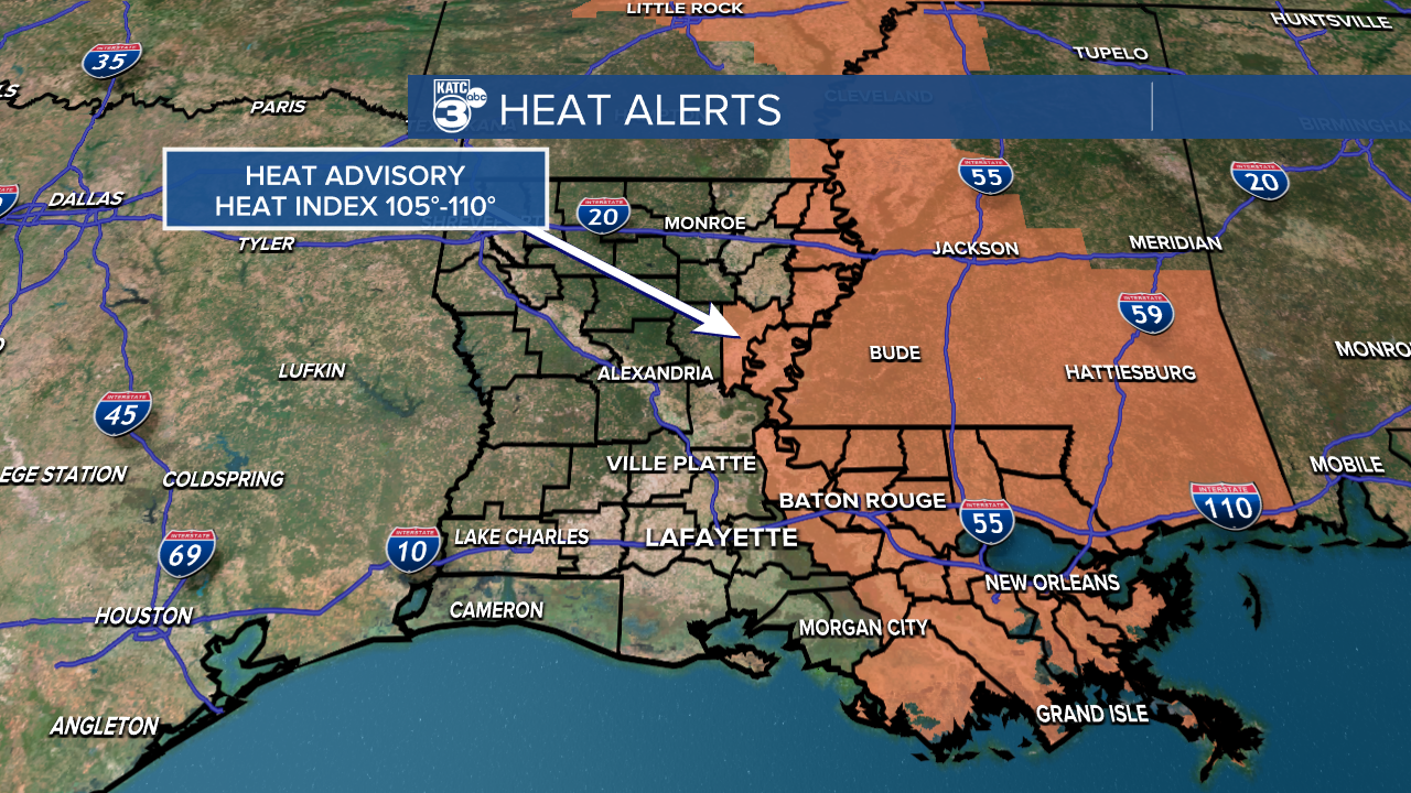
While Acadiana isn't under a heat advisory, much of eastern Louisiana is, and temperatures are expected to approach 100° next week. With higher temperatures and heat indices on the rise, heat advisories are likely.

Follow Meteorologist Breyanna Lewis for further updates.
See the KATC 10 Day Forecast for the latest.

