
The Atlantic tropical season isn’t quite over and while there is nothing pressing there is a reminder that the season is still going.

There’s an outside chance we end up with another named system in the Caribbean sometime next week, remember while there’s a 30% chance of development that also means (as of Wednesday morning) there’s a 70% chance that is doesn’t form. This disturbance is slated to move northeast, more as a wave, and there’s no real model support for development. It should also be noted that there’s also no model support for the wave to jet across the Gulf of Mexico.
This does not mean, however, that we won’t see any impacts and it will make next week’s forecast an interesting one to watch. As it does move to the northeast it will inject a deep layer of tropical moisture into the Gulf of Mexico, and figuring out where that axis of moisture goes will be the big forecasting challenge the next few days.
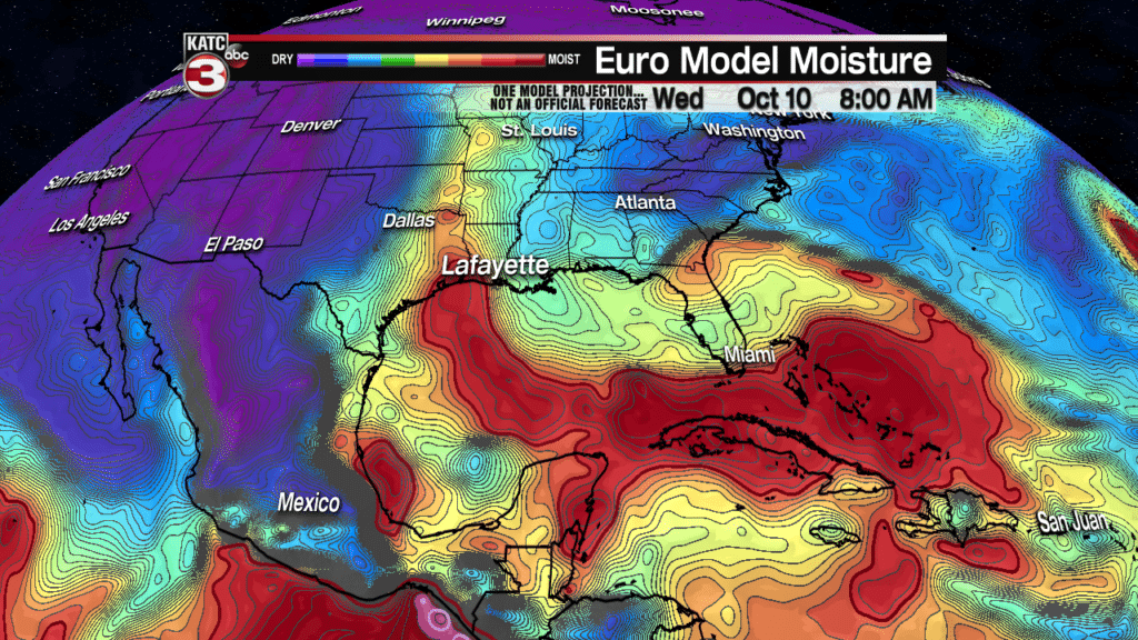
The encouraging news is that already the EURO is less bullish on the axis moving over Acadiana and already moving it further west. Acadiana is still right on the edge which makes the forecast more of a challenge since small changes in the forecast could mean the difference between partly sunny skies and heavy rain. So keep your eye on the middle of next week and don’t be surprised if the rain chances fluctuate a little bit as we try and deal with the uncertainty.
