


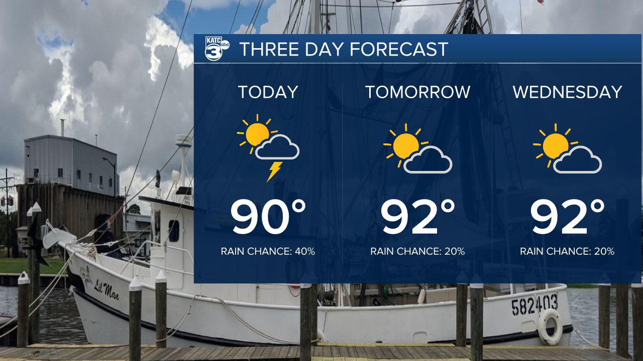
We'll start the new week off pretty much where we left it on Friday with a scattering of showers popping up in the afternoon.
Temperatures will be in the low 90s and heat index values should push to the triple digits by the end of the day.
It's looking a little hotter for the middle of the week as rain chances drop slightly through the middle of the week.
The heat index through the middle of the week will push beyond 100 without the rain to cool us down in the evening.
The back half of the week promises to be a little wetter as moisture will pool up along a stationary front that will sit just off the Florida coastline.
This feature will need to be monitored for potential tropical development, although there's several factors that could limit development.
Models seem to think there's a low end chance of seeing a tropical depression by the end of the week as an upper low will drift west headed into the weekend.

In practical terms for Louisiana this means we're likely going to see a wet stretch of days starting the second half of the week and going into the weekend.
As it currently stands most of the rain will be offshore although parts of Acadiana could see several inches of rain over a few days.
It's still a little too early to dive into specific rain totals and we have time to nail down those numbers.
This is the kind of set up that could lead to some localized street flooding over the weekend depending on where the showers fire up so be sure to keep up with the forecast through the week.
