
High pressure continues to hold strong through Tuesday, keeping rain at bay and allowing for a mix of sun and clouds with warming temperatures.

However, a cold front is on the way! Expect more showers and storms starting mid-week, with nearly the entire state under a slight (2/5) risk for severe weather. The main concerns will be damaging winds and large hail, but we’ll keep you posted as we get closer to Wednesday.

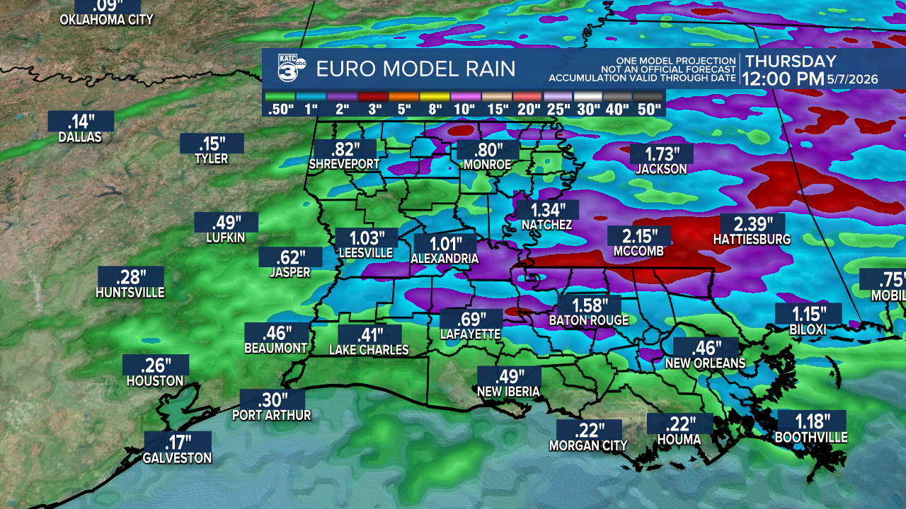
Between Wednesday and Thursday, we could see up to 2 inches of rain, with some localized areas potentially receiving even more. On a positive note, this will help us catch up to the normal for the year.

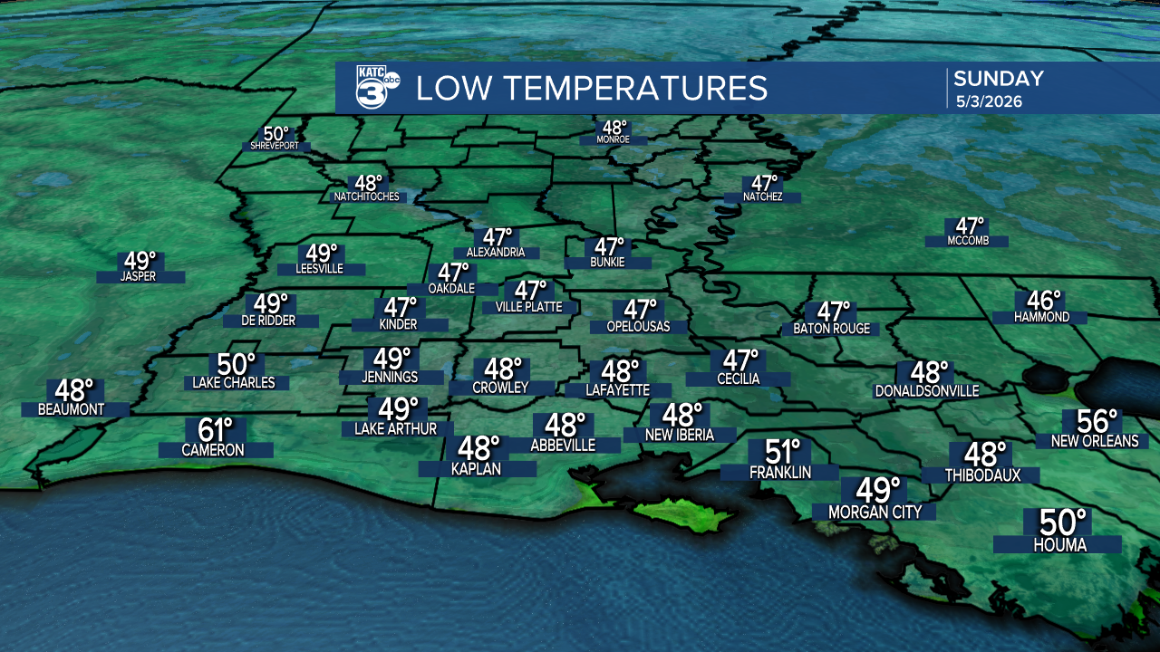
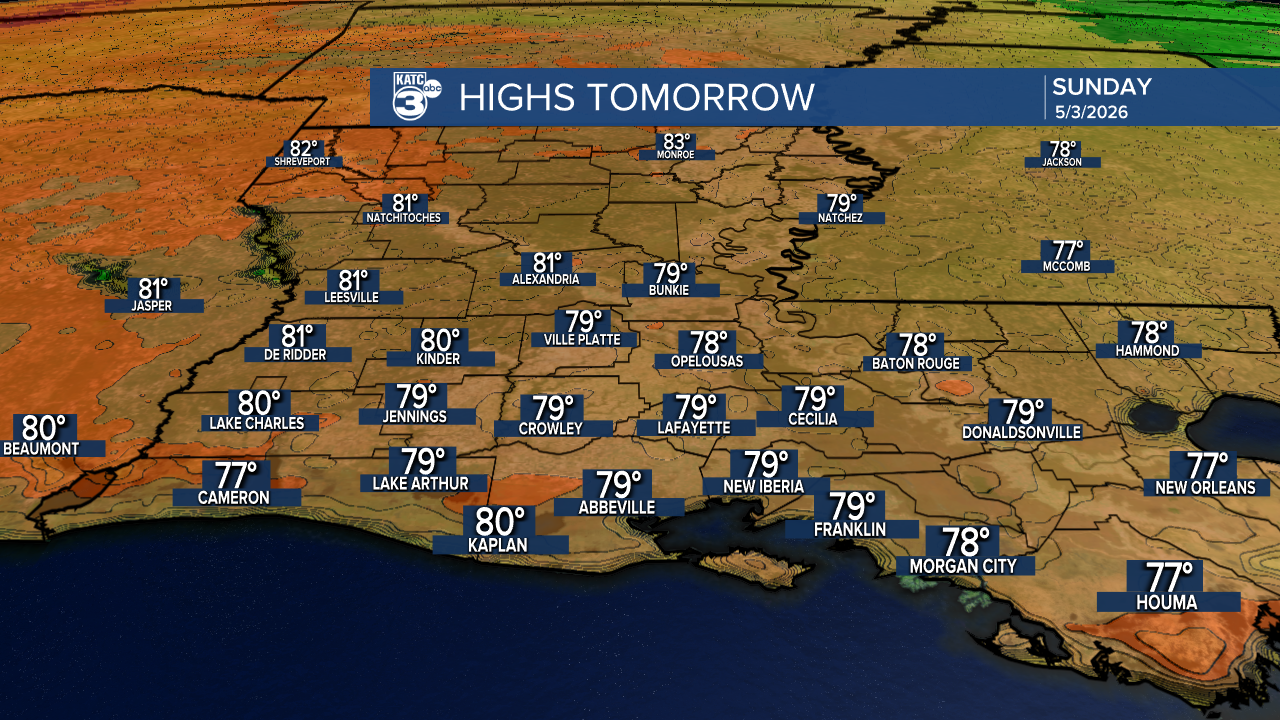
Aside from all that rain jazz, enjoy tonight’s last chilly night in the upper 40s, as Sunday promises to warm up with highs reaching the upper 70s!
Sunday night will be a bit cool, in the low 50s.

Highs return to the low 80s on Monday.
Follow Meteorologist Breyanna Lewis for further updates.
See the KATC 10 Day Forecast for the latest.
