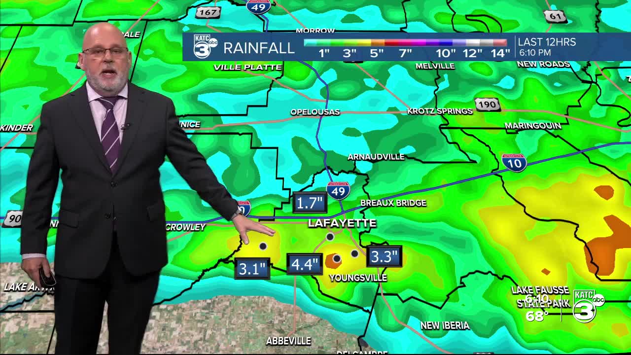


Oh boy, what a rainy afternoon it’s been! Most areas have seen up to 2" of rain, with some locations nearing 4"! Unfortunately, it looks like this wet weather isn't done just yet, as more rain is expected through early Saturday. The biggest threat right now is heavy rainfall.


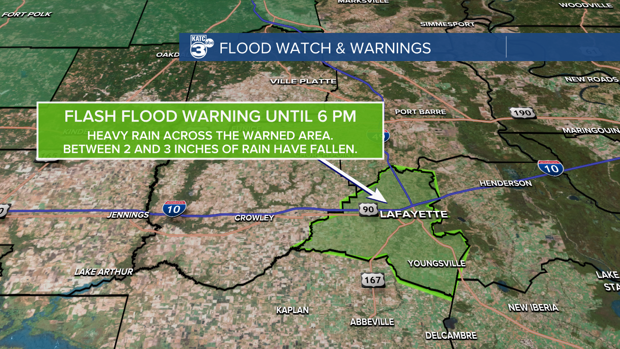
The NWS in Lake Charles has issued a FLOOD WATCH for Vernon, Beauregard, and Rapides Parishes tonight through Saturday morning due to training thunderstorms that are dumping heavy rain in the same areas. This watch will likely be expanded, especially along the I-10 corridor.

A Flash Flood Warning has been issued for Lafayette Parish until 6 PM. We've already seen between 2-3" of rain , and it looks like more is on the way this afternoon into the evening. It has been multiple reports of flooding on Ambassador, which is typical during heavy rain events like this. Avoid flooded areas until the water recedes, and keep an eye on the weather updates.
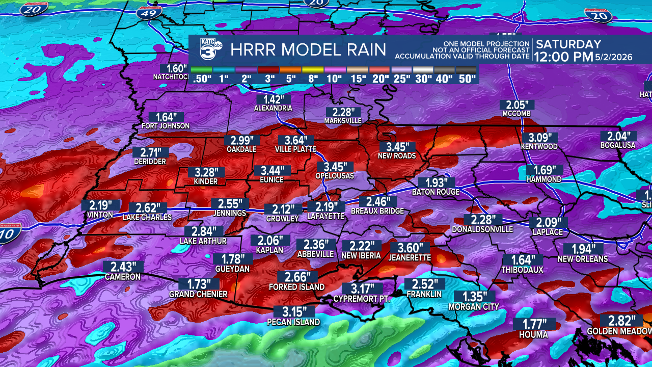
The WPC has also placed us under a slight risk (2/4) for flash flooding tomorrow, as more rounds of rain move in.

We could see an additional 1-3", with some areas possibly reaching up to 5". Please be cautious on the roadways and in low-lying areas.
While we aren’t expecting severe weather, Morgan City is under a marginal risk (1/5) for gusty winds and large hail tomorrow. Be on the lookout for potentially strong storms throughout the state!

And for those planning to enjoy the Crawfish Festival in Breaux Bridge tomorrow, it’s shaping up to be quite soggy! But hey, at least the plants are loving the rain! The good news is that the weekend looks drier and cooler, perfect for the festivities ahead!
Follow Meteorologist Breyanna Lewis for further updates.
See the KATC 10 Day Forecast for the latest.
