


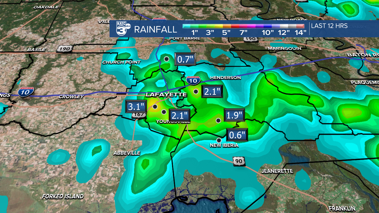
It's finally quieting down across Acadiana this evening. Lafayette, St. Martin, and Iberia parishes received plenty of rainfall in a short amount of time with radar estimates between 1 to 3 inches of rain, with some areas receiving up to 1 inch.
Over the next couple of days, another half-inch to 3 inches is possible.

Along with the rain, a few severe thunderstorm warnings materialized, producing wind gusts up to 60 mph and hail ranging from the size of a quarter to a golf ball, which I witnessed firsthand. There were a few reports of tree limbs down on roads, but most reports focused on street flooding.
Switching to temperatures, the hottest readings reached the 90s before the rain and thunderstorms moved in.

Tomorrow, temperatures are expected to be slightly cooler, with highs in the upper 80s.

However, the "feels like" temperatures will mostly be in the upper 90s.

The morning low was 72° here in Lafayette, and similar temperatures are expected across the area tonight.

Meanwhile on the East Coast, Chantal is now a tropical depression.
See the KATC 10 Day Forecast for the latest.
