

Another day of hot temperatures with high humidity. Some relief coming Tuesday with a few scattered storms, today's coverage will be less, with even less rain toward the end of the week.
Skies will start out mostly sunny this morning. Clouds will mix in later this morning into the early afternoon. Temperatures will reach the mid to upper 90s with heat index values around 105 degrees. There will be a couple of isolated thunderstorms this afternoon, but the rain chances are about half of what we saw Tuesday.
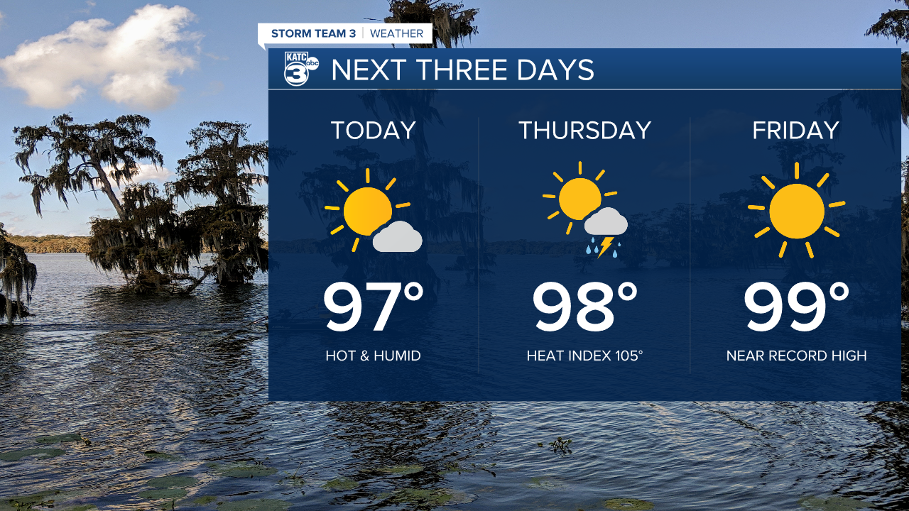
Overnight, skies should become fair. Lows will drop into the upper 70s. Thursday looks sunny during the early part of the day, with a 30% chance for afternoon storms. Highs Thursday will run in the upper 90s.

Toward the end of the week, the ridge of high pressure responsible for this latest heat wave will expand, lowering the chances for rainfall. This should help temperatures Friday to climb to near 100 degrees. This pattern should hold through the weekend. More normal temperatures, along with better chances for rain will return next week.

Tropics remain quiet and should stay that way through the weekend.
