


It's shaping up to be an active day and night. A TORNADO WATCH is in effect until 6 PM, and it may extend further east.

A WIND ADVISORY is in place until 5 PM, with south winds up to 20 mph with gusts near 30 mph.

Even after the advisory lifts, expect elevated winds as the cold front moves through. We might need another Wind Advisory tomorrow.


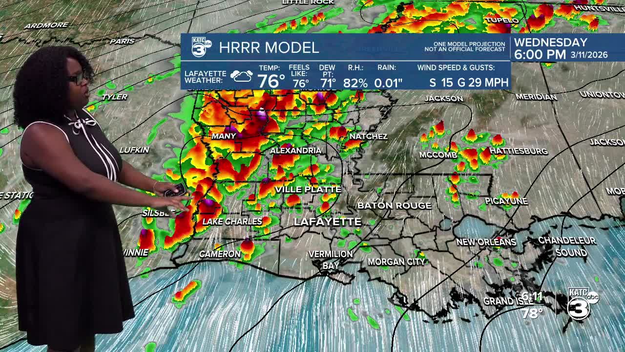
This afternoon and into the night, the entire state is under a slight risk (2/5) for scattered severe thunderstorms. Here’s what you need to know:

THREATS: If storms turn severe, they have the potential to produce damaging winds over 65 mph, isolated tornadoes, quarter-sized hail, and even flooding.

TIMING: A line of storms has developed, producing gusty winds and heavy rain in eastern Texas. Expect the storms to reach Beauregard and Calcasieu in the next hour or two. They’ll make their way to Acadia and Evangeline by 7 PM, move over Lafayette around 8 PM, and exit St. Mary before midnight.

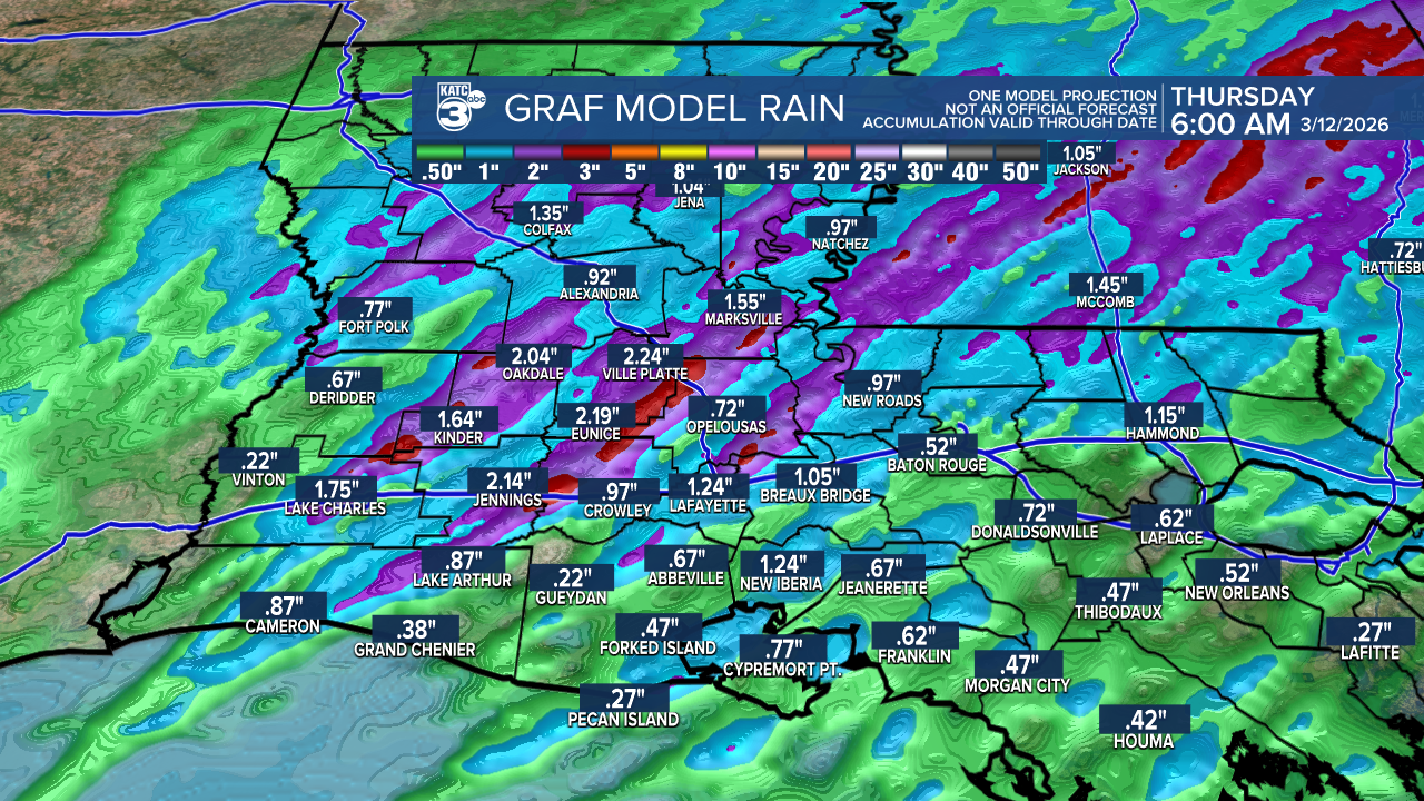
EXPECTED RAINFALL: The latest GRAF model shows rain totals up to 3", with some areas possibly seeing 4", if storms produce heavier downpours.
Flash flooding is a concern, especially in Acadiana, where the risk is split between a marginal (1/4) to slight (2/4). Ponding on the roadways and minor street flooding are likely.

AFTER THE STORM: Once the front passes, get ready for cooler and drier air! Expect noticeably colder temperatures by Thursday night.
Follow Meteorologist Breyanna Lewis for further updates.
See the KATC 10 Day Forecast for the latest.
