

Tropical Depression Fred has remained near the Cuban coastline, and some visible satellite imagery this morning indicates the center may be over land. Therefore, we're not expecting much strengthening during the day today. The center is also exposed, with most of the convection occurring to the south and east of the low pressure area.
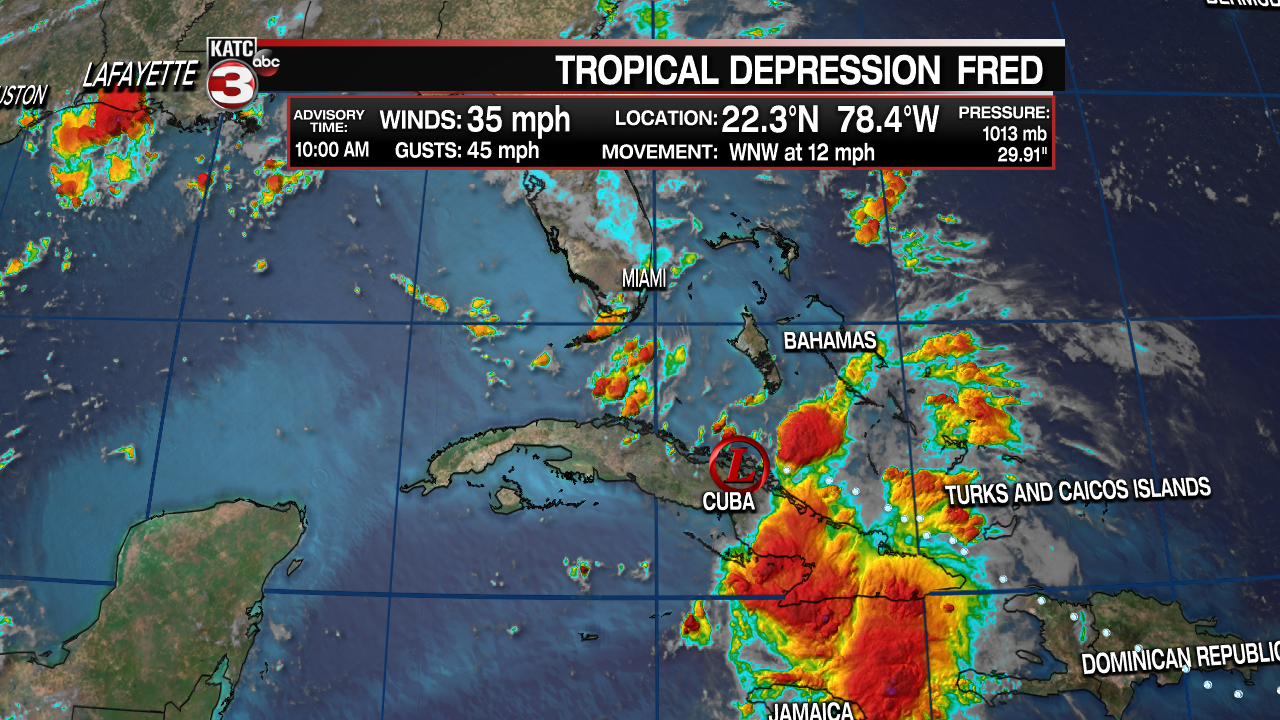
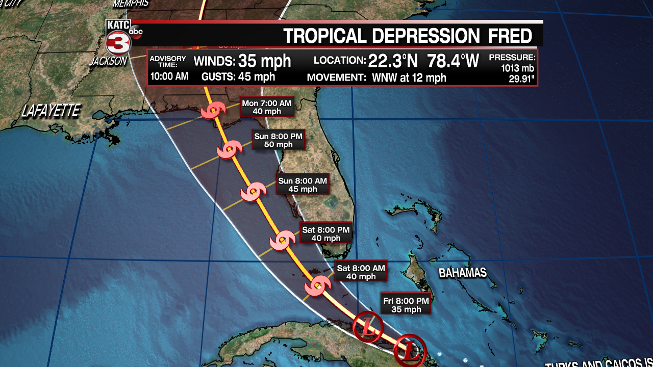
The 10am Advisory from the National Hurricane Center is still forecasting some strengthening as Fred moves away from Cuba, toward the Florida Keys and the eastern Gulf of Mexico. Vertical wind shear values will drop off, especially as Fred moves closer to the Florida Panhandle. The forecast track has generally remained unchanged for the last several days, and the current forecast isn't expected to vary much. Most of the impacts from Fred will be over the Florida peninsula and eastern panhandle. Flooding rains are expected, with rough seas and gusty winds east of the center of circulation. Intensity models range from a 35mph tropical depression to 50mph tropical storm. Most models are going with the lower end of the scale. Landfall is forecast for early Monday morning near Apalachicola.
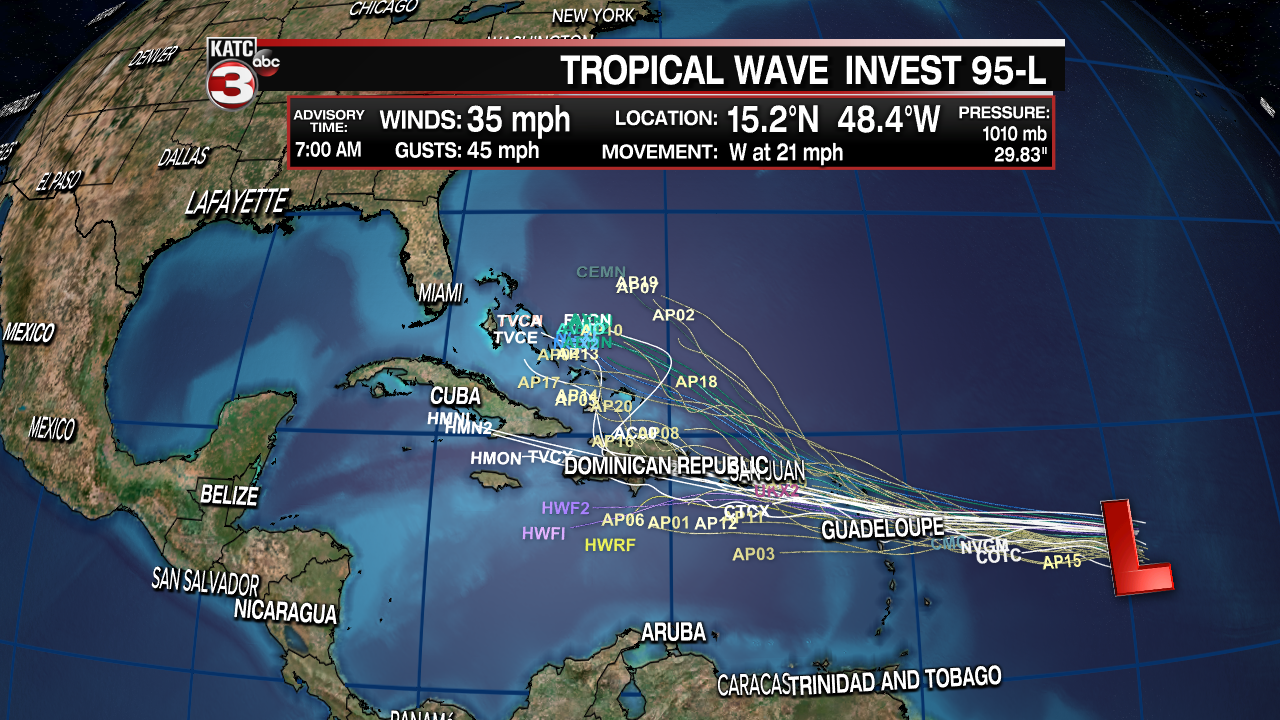
Meanwhile, another tropical wave, now known as Potential Tropical Cyclone 7, is moving westward across the Atlantic Ocean. It's track influenced by a huge ridge of high pressure over the central Atlantic. Models this morning were pretty robust, strengthening the system into a hurricane over the next few days. Current models have backed off a bit, most keeping it as a tropical storm. If it gets a name it will be called "Grace". The track forecasts are generally westward for the first three days, then a curve to the northwest by day 4. This could mean impacts from #7 (Grace) will be more likely over The Bahamas and the east coast of the United States.
Other waves will be moving off the African coast of the next few weeks, it what is a normal pattern looks like as the peak of the hurricane season approaches September 10th.
