
The weather has been very quiet the last several days, on top of that the forecast over the next couple of days looks to be very quiet.
So while we’ll certainly address the forecast and what we can expect this weekend lets first talk about the skies and how hazy they were on Thursday.
Hazy skies is nothing new in south Louisiana, this year alone we’ve seen several summer days when dust from the Sahara made its way to Louisiana, but Thursday’s haze was something new.
Instead of dust particles that had traversed the Atlantic Ocean this round of haze can be attributed to the horrific wildfires that are currently burning from the west.
The wildfires have produced so much smoke that it has gotten caught up in upper level winds and dragged down to the eastern half of the country, creating hazy skies from east Texas to the Atlantic Coast.
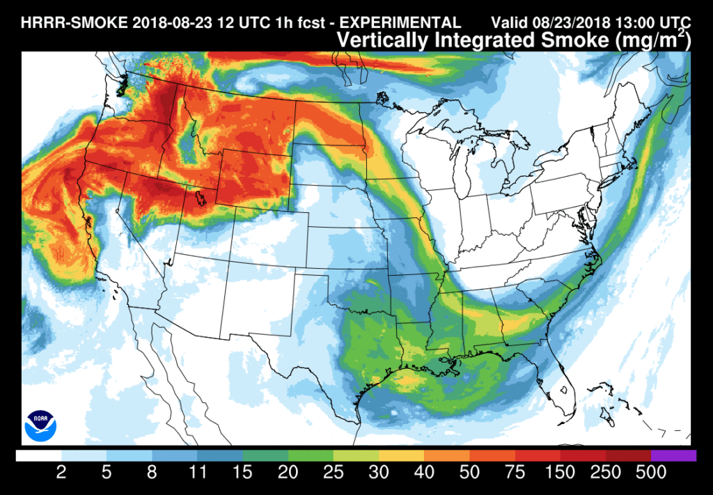
Glancing at Louisiana, particularly the center of the state it does stand out that there is a little thicker layer of smoke then even on eastern parts of the country, or places closer to the jet stream.
Pulling up the GOES 16 satellite imagery it looked as if a few different fires were present in central Louisiana in north Evangeline and Rapides Parish.
Neither seemed overly significant and later in the day the fire signature disappeared but it would explain the ticker smoke layer in the above picture.

So that’s what a slow forecast can get you a diagnosis of haze that doesn’t have any major implications in the day to day weather but a chance to look at cool experimental models and satellite images.
One last note on the haze it should lead to a spectacular sunset Thursday and draw out some great colors which is always a treat.
Anyway I’m sure very few of you came here for haze and are more interested in the weather for the upcoming weekend, which is fair.
There’s not much new to report with the forecast, however, the dry air continues to put a cap on clouds and showers leaving us with plenty of sunshine.
We’ve had a few comfortable mornings and we’ve got another one coming up on Friday, but the standard mugginess returns for the weekend.

As the moisture increases this weekend so will the rain chances so expected scattered showers to return to the forecast by the end of the weekend.
