
After some careful forecasting, the festival weekend looks fantastic besides the humidity! If you’re heading out tonight, you can expect partly cloudy skies with no rain until later in the night. Temperatures will be comfortably in the 70s.

As we move into the weekend, there might be a stray shower or two, but overall, it should stay dry for all the festivities! However, be prepared for the heat, as we’re under a muggy Gulf airmass—feels like temperatures will hover around 91°. Sunglasses and sunscreen are a must!

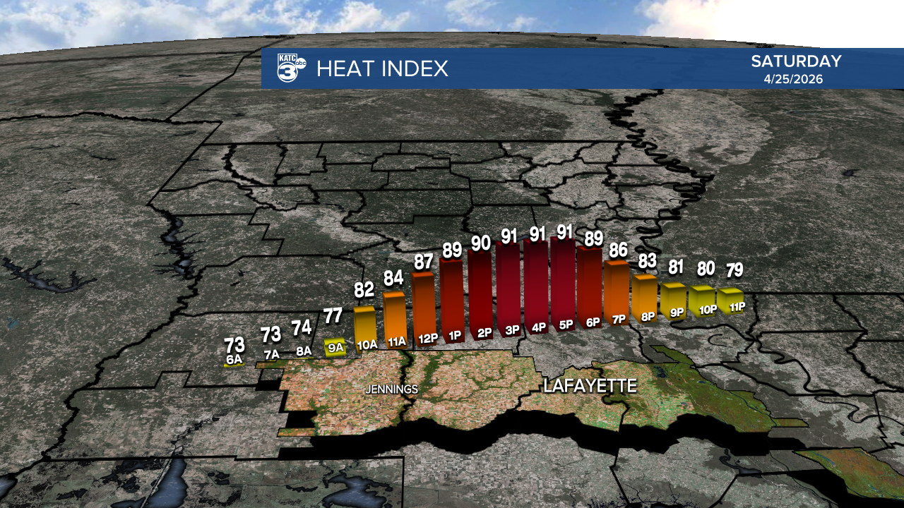
For the rest of the weekend, expect a mix of sunshine and clouds, with highs topping out in the upper 80s.

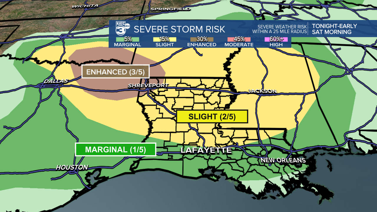
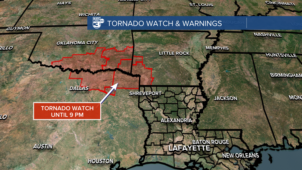
Tonight also is shaping up to be quite active across our state as a squall line moves in. Tornado watches are already in effect for Oklahoma, Texas, and a small portion of Arkansas.
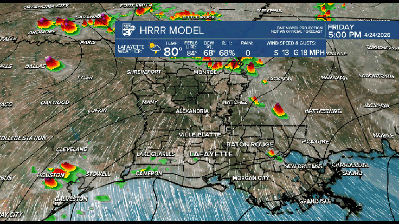
The latest models have been a bit uncertain about how far south the storms will reach, with the heaviest activity expected after midnight as it crosses over Alexandria.
The GRAF model shows the storms will track southward but will start to weaken near I-10. Areas like Allen, Evangeline, and St. Landry could see up to 1 inch of rain, while south of I-10 may remain completely dry.


On the other hand, the HRRR model suggests the main line of storms will move through Alexandria, leading to scattered showers and some storms for the rest of CENLA and Acadiana, especially near the coast. The main line of convection slides further east on the other side of Baton Rouge, hence why the rainfall amounts are scattered.

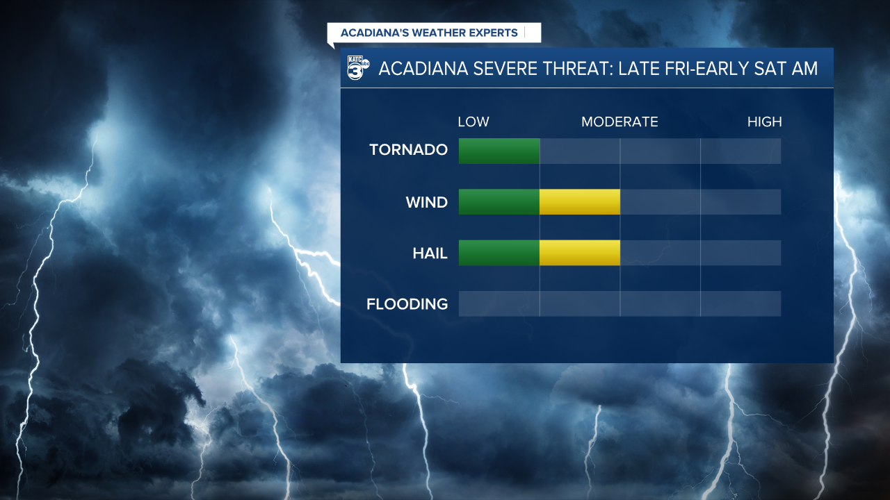
If the squall line holds its strength and intensifies, we could face damaging winds and large hail as the primary threats, with a lower chance of a brief spin-up tornado. This all depends on factors like instability and CAPE.
We’ll keep a close eye on their progress as they enter Louisiana, so please stay tuned for updates.
If watches or warnings are issued, make sure you have multiple ways to receive notifications—especially during the wee hours of the morning.
Follow Meteorologist Breyanna Lewis for further updates.
See the KATC 10 Day Forecast for the latest.
