


We’ve got some Gulf moisture rolling back in, which means warmer temperatures are on the way. Tonight's lows will be much cozier, in the upper 40s to low 50s.

Tomorrow is shaping up to be a lovely Saturday, with highs in the upper 70s and a nice mix of sun and clouds. Perfect day to enjoy the outdoors!

Saturday night will feel even warmer, with lows in the upper 50s to low 60s.

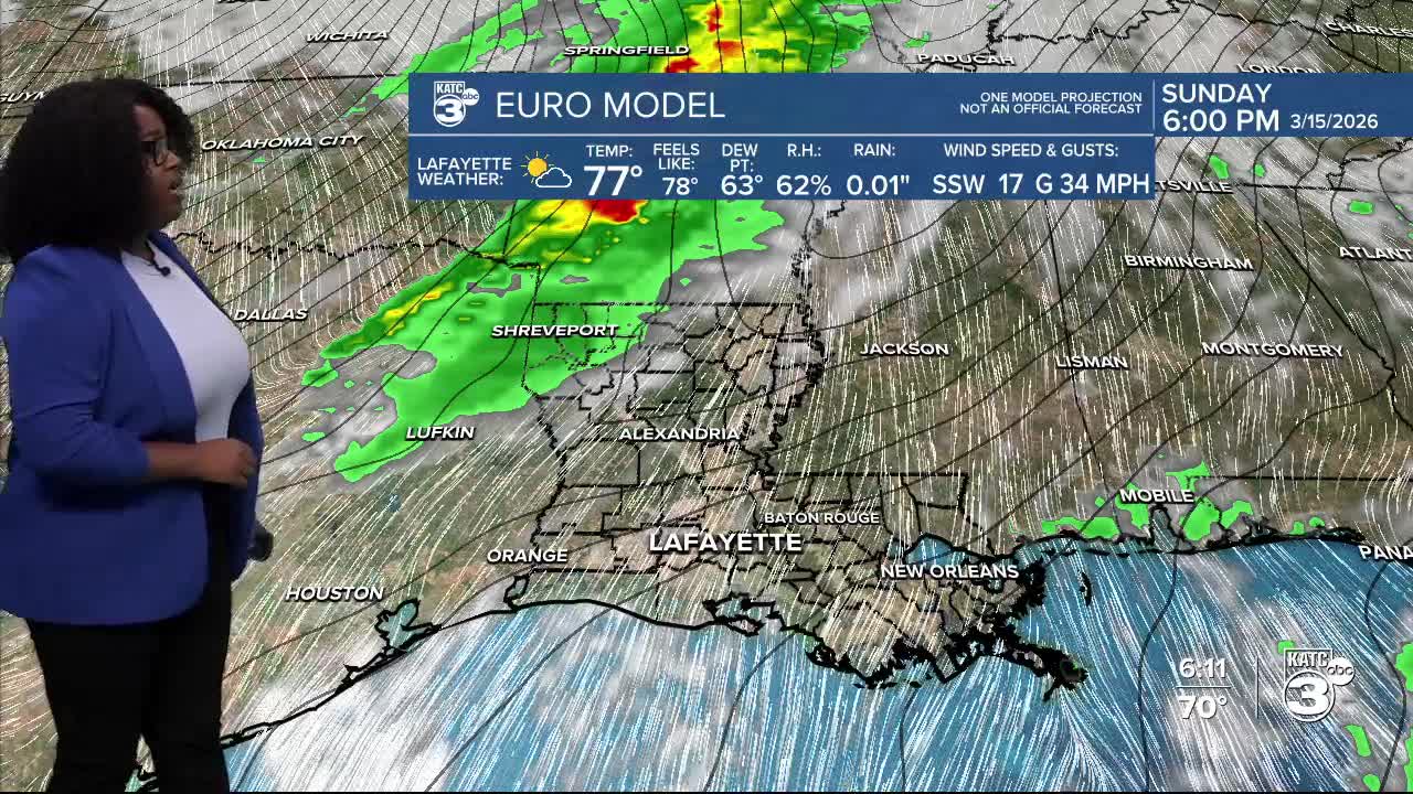
Highs on Sunday are expected to be in the low 80s. But brace yourselves for a major cooldown coming our way!

A massive system forms late this weekend. It'll bring the potential for severe weather across multiple states!

The SPC has upgraded a portion of CENLA and Northern Louisiana to an enhanced (3/5) risk for severe weather this Sunday night. Meanwhile, Acadiana is facing a marginal (1/5) to slight (2/5) risk.

Be prepared for all modes of severe weather, with damaging winds being the primary concern. Keep an eye on updates, as things can still change closer to Sunday.
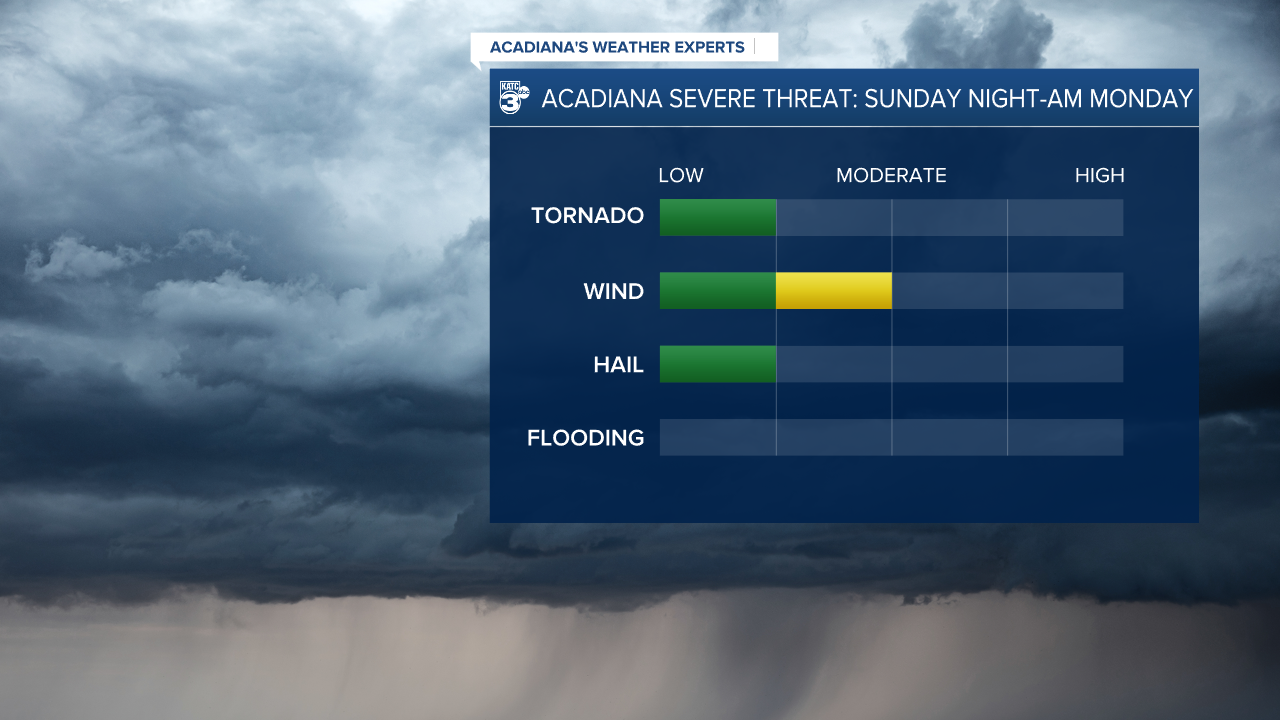
Since this system is expected to move quickly, we’re expecting low rainfall totals—around a quarter of an inch. However, some storms might bring heavier downpours.
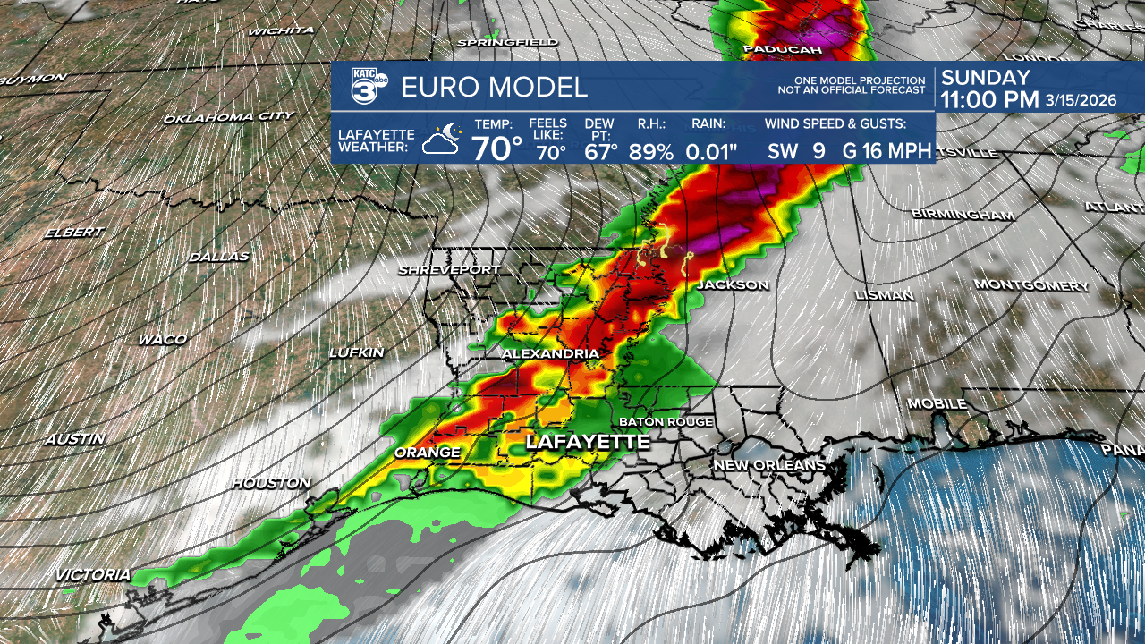
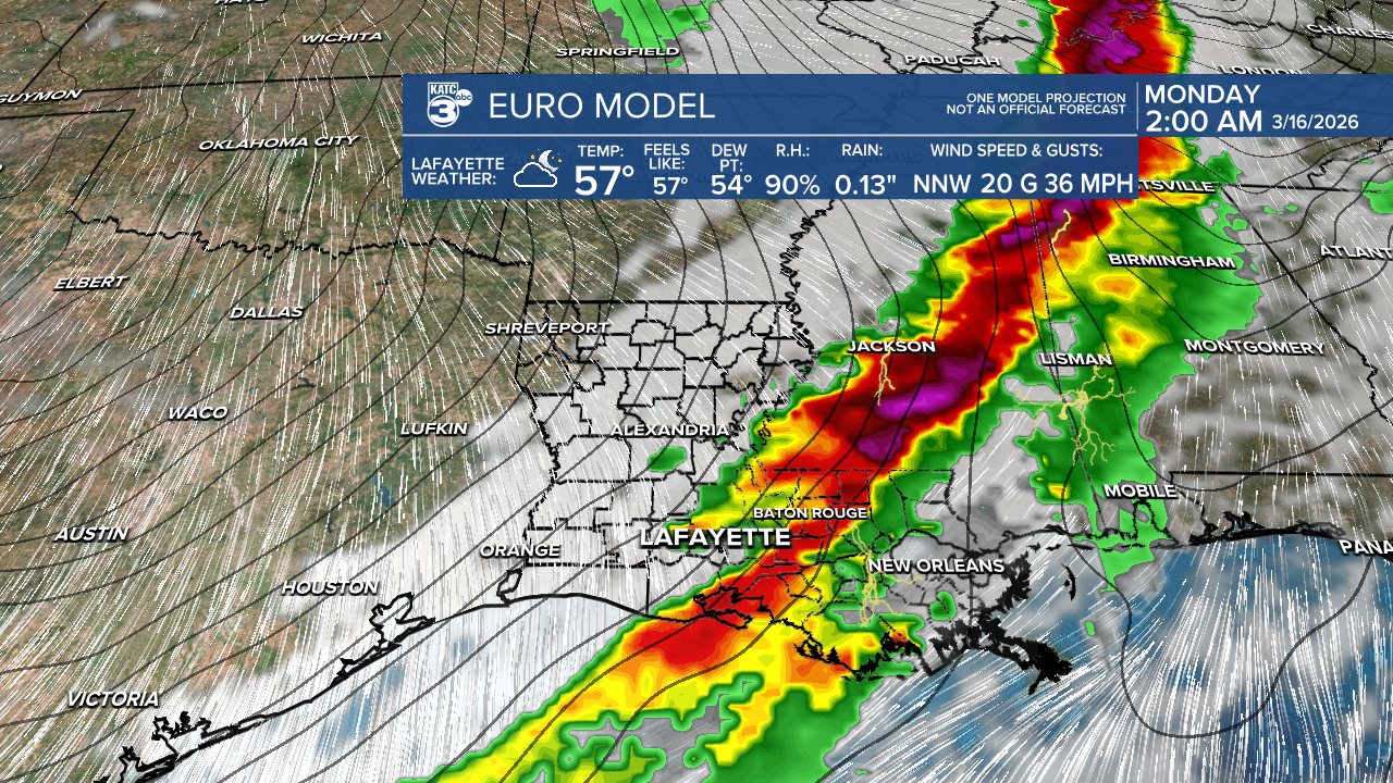
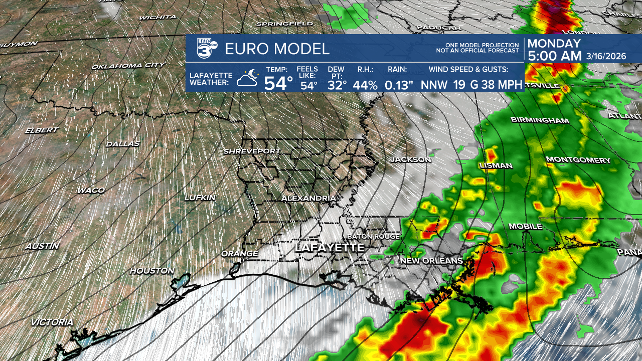
Most of Sunday will stay dry, with just a few afternoon showers possible. The real action kicks in late Sunday as rain, linked to a cold front, rolls in just before midnight (depending on how fast the front moves).

Stay alert as more updates are available!
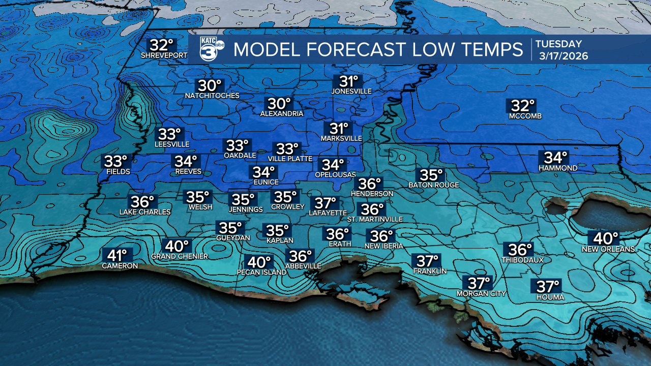
We're looking at cooler highs on Monday and Tuesday in the 50s. A Wind Advisory might be necessary on Monday, with gusts near 40 mph. Dry air combined with gusty winds leads to an elevated fire danger.


Monday night will likely be the coldest of the week, with temperatures dropping close to freezing. Some areas further north may even dip below freezing, which could lead to a light freeze early Tuesday morning.
Follow Meteorologist Breyanna Lewis for further updates.
See the KATC 10 Day Forecast for the latest.
