


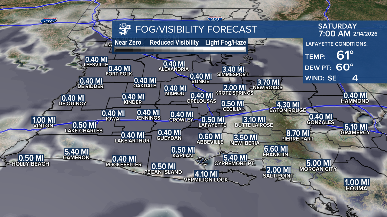
A DENSE FOG ADVISORY goes into effect tonight through Saturday morning.
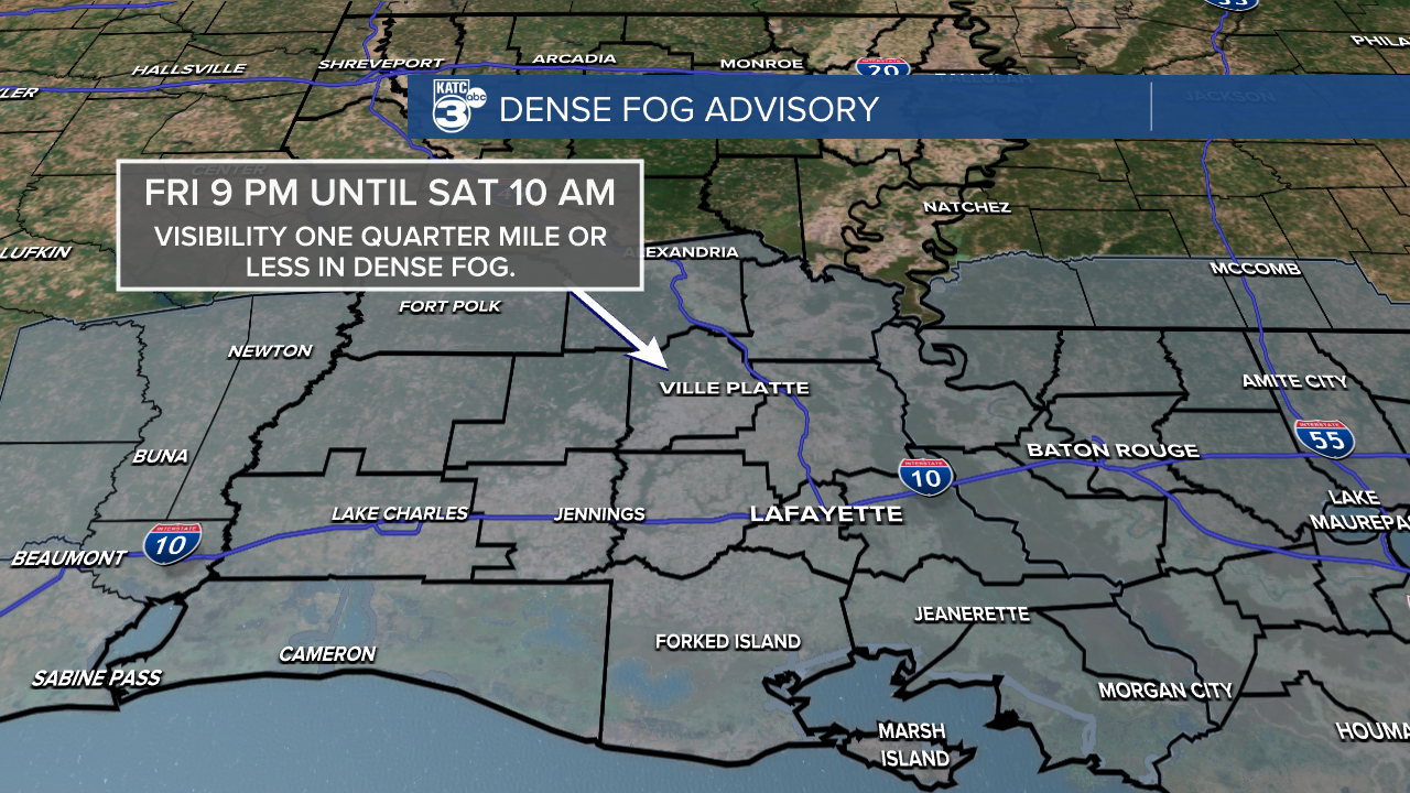
Expect widespread visibility to drop below a quarter mile.
Driving tips:
- Slow down and increase your following distance
- Turn on low-beam headlights
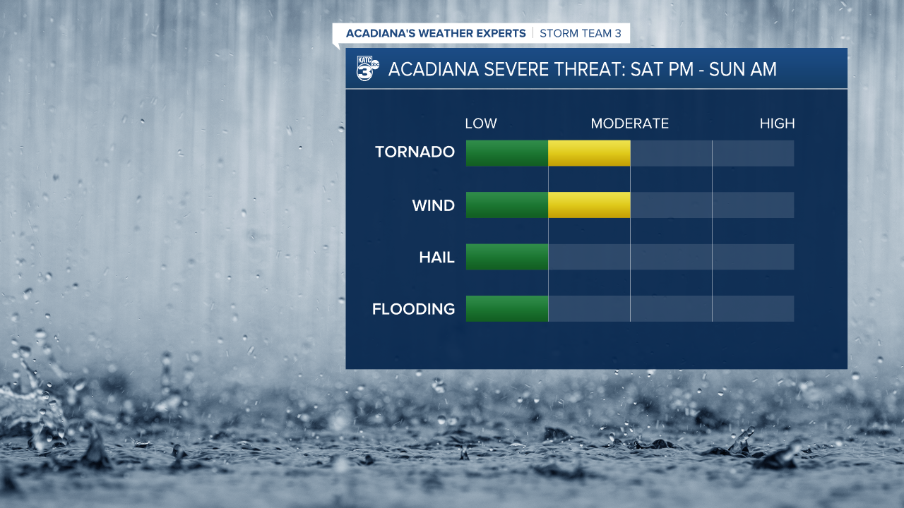
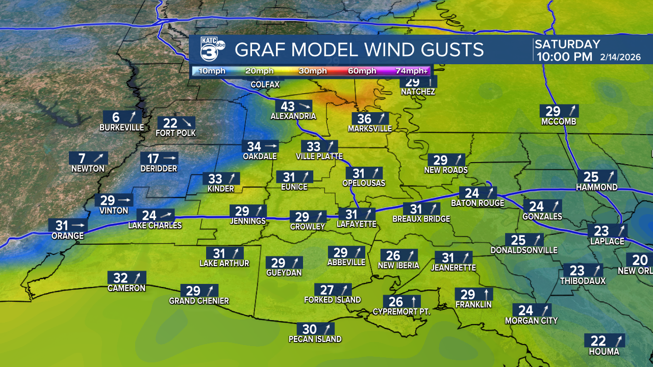
The SPC has increased the severe weather threat for Saturday, and now most of our state is under a slight (2/5) risk.
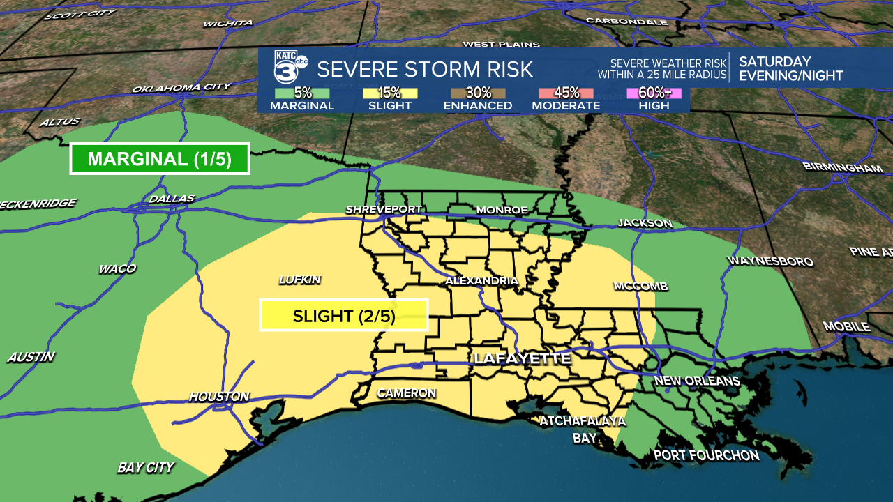
The primary concern will be damaging winds, with secondary threats including a brief spin-up tornado or two and large hail.
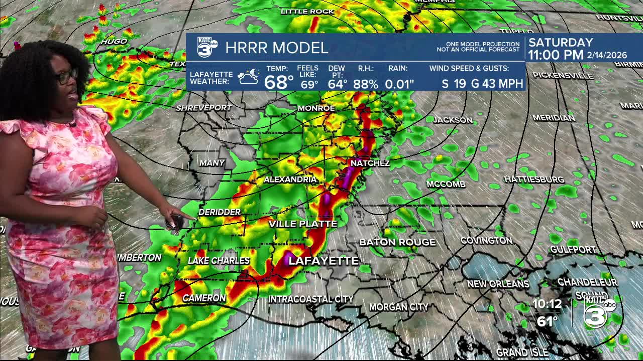
Good news for those celebrating Mardi Gras and Valentine’s Day! The main line of storms won’t move in until late at night, so you can enjoy the festivities. Just keep your rain gear handy, as a few hit-or-miss showers may pop up during the day along with some breezy conditions.
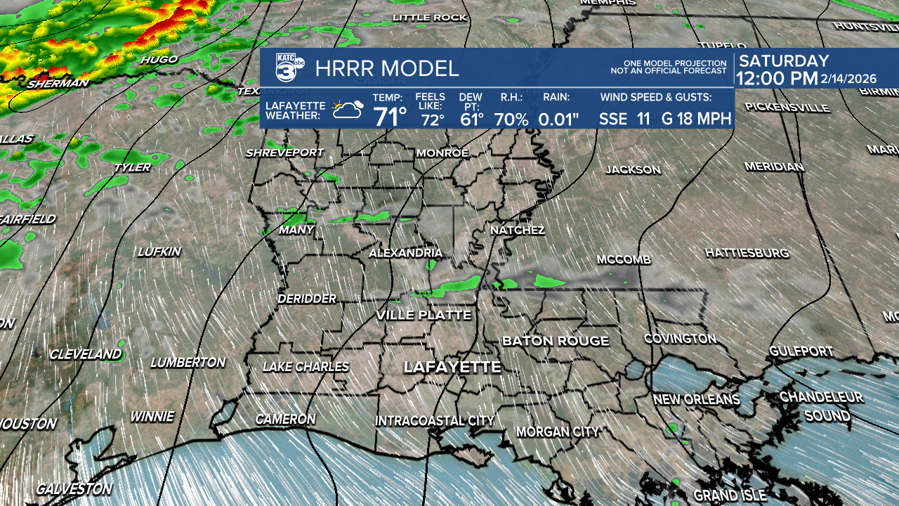
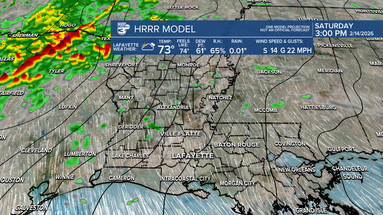
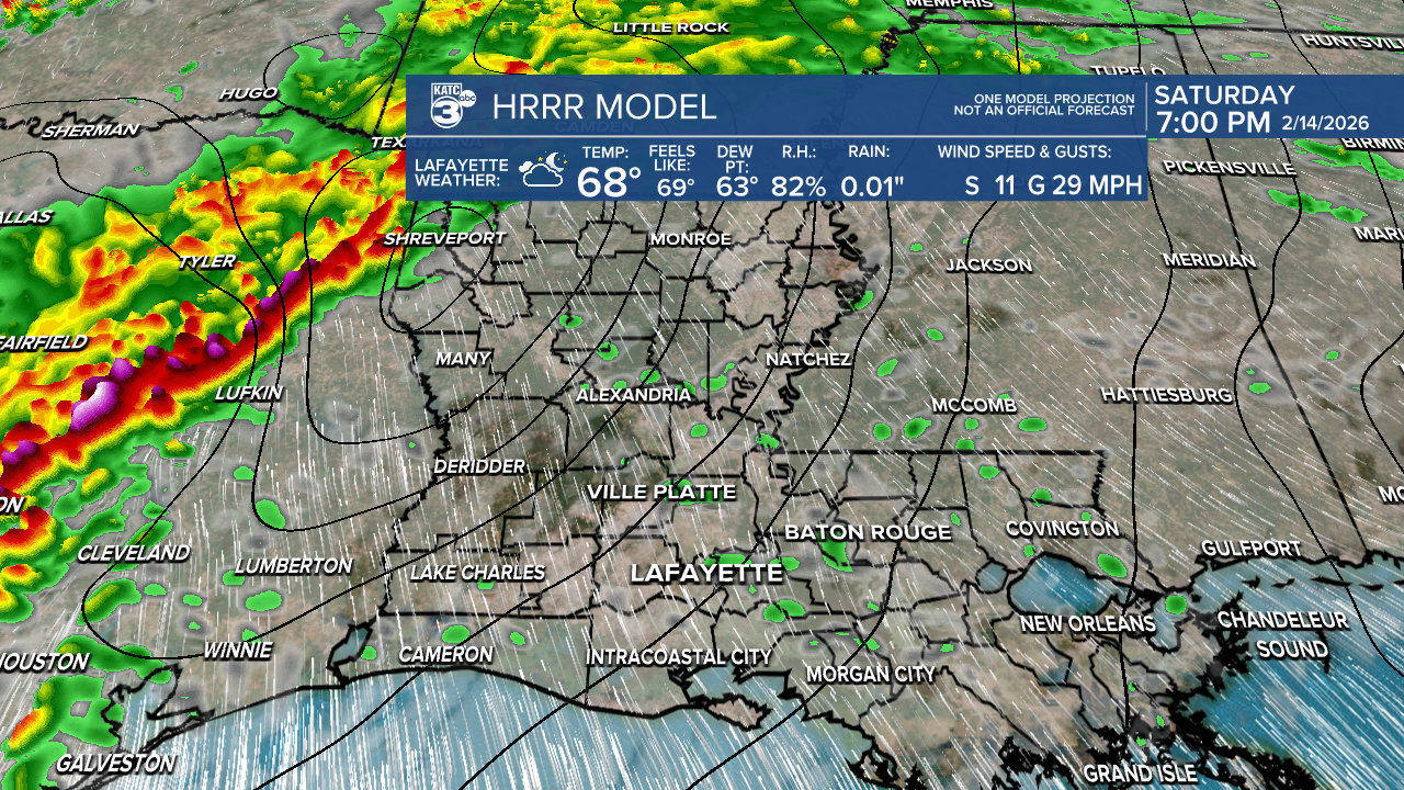
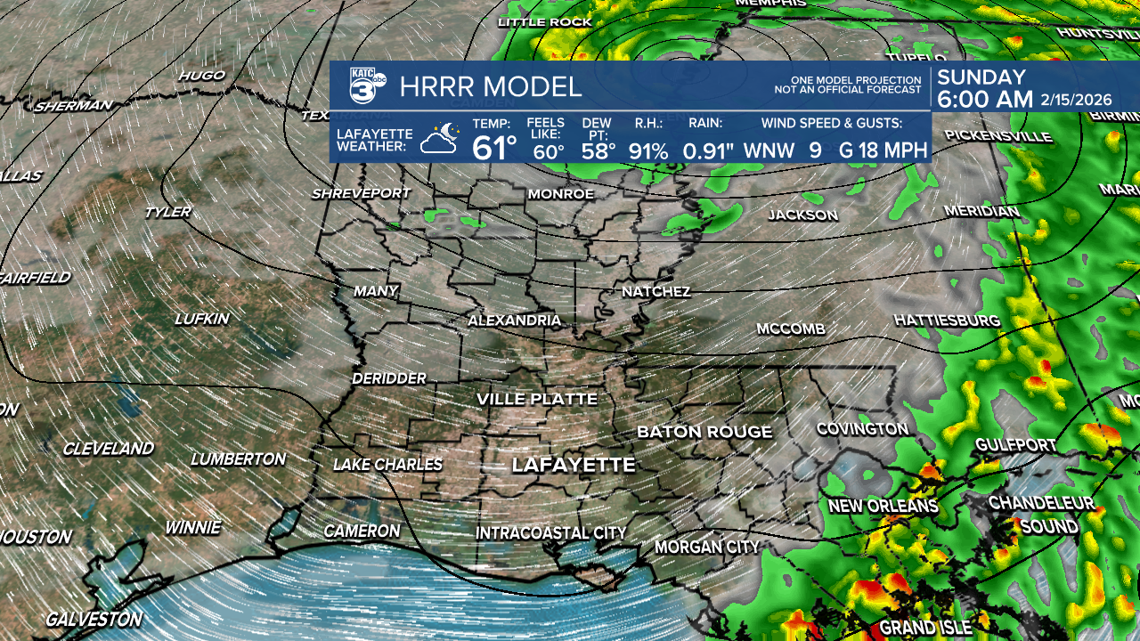
Timing-wise, the storm activity is expected to hit Acadiana in our western parishes an hour or two before midnight, sweeping through Lafayette right around midnight, and exiting St. Mary Parish between 2 and 3 AM.
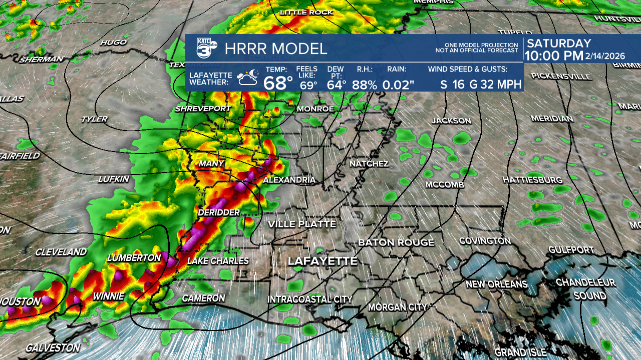
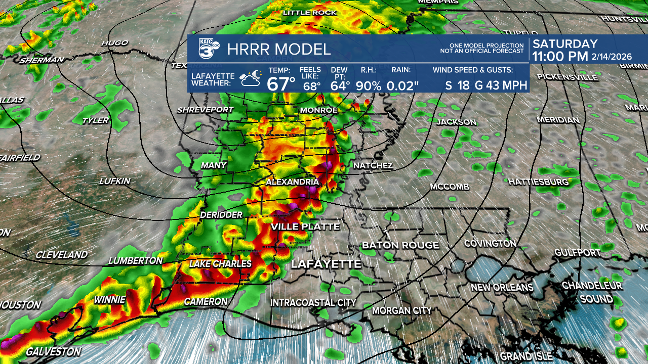
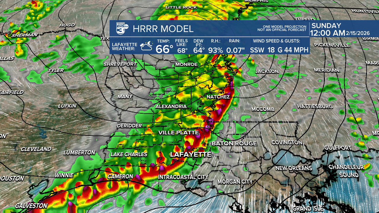
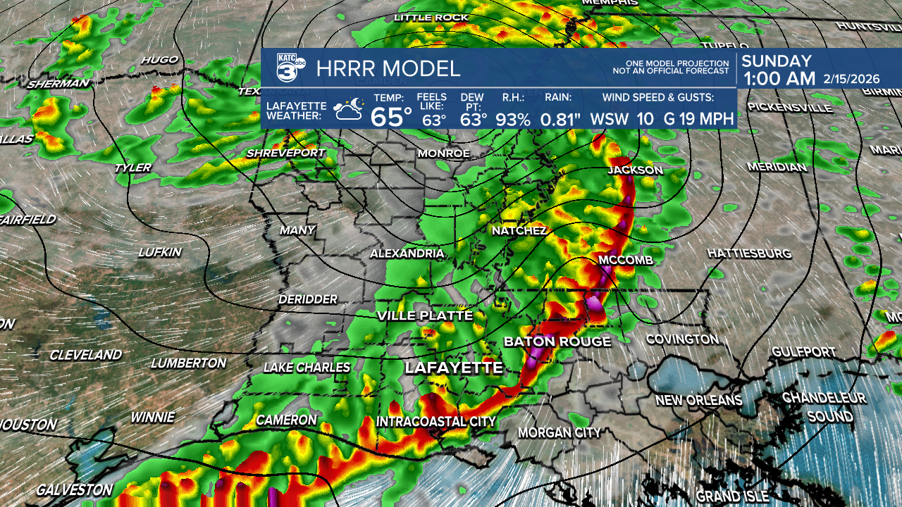
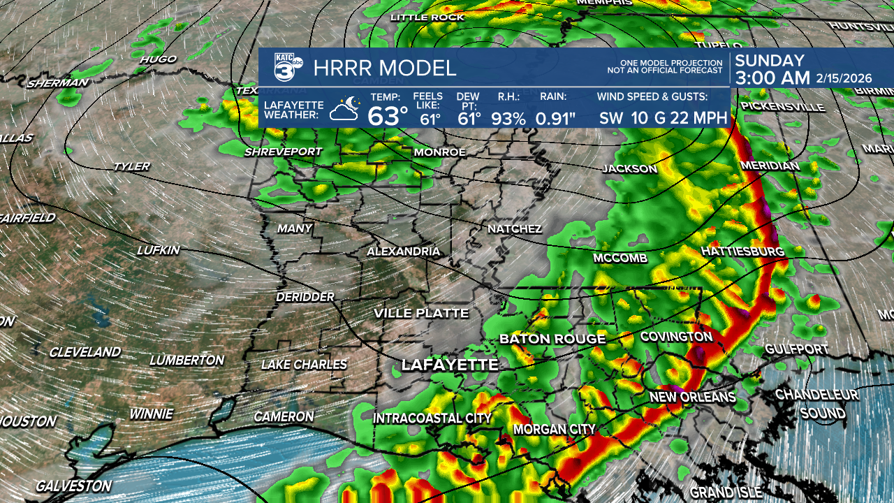
Be cautious, as some areas could experience wind gusts between 40 and 50 mph. Also, stay weather aware if any watches or warnings are issued.
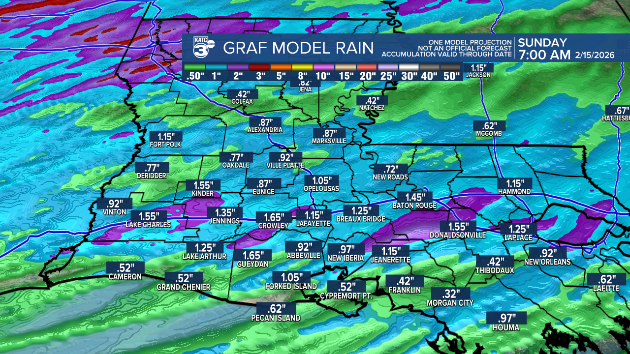
Rainfall amounts could range from a quarter-inch to 2 inches, with isolated higher totals possible. While heavy rainfall may cause some ponding on the roadways, flooding isn’t anticipated.
So, late Saturday night plans might be a wash for some of you. But don’t worry – the weather looks fantastic for Lundi and Mardi Gras next week.
Follow Meteorologist Breyanna Lewis for further updates.
See the KATC 10 Day Forecast for the latest.
