


10 AM ADVISORY FOR TROPICAL STORM BERTHA:
Tropical Storm Bertha has gained a bit of organization and strength, with sustained winds now at 60 mph.
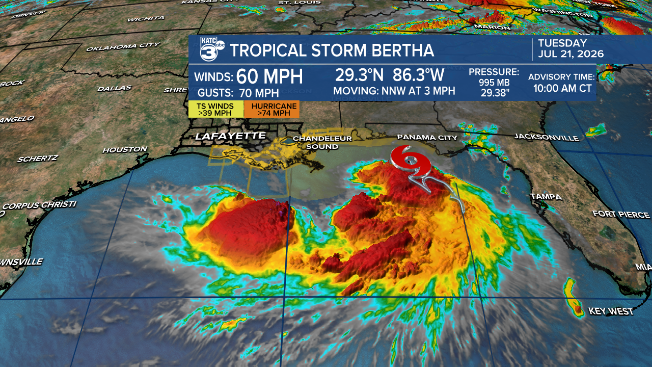
It's currently positioned about 70 miles southwest of Panama City, Florida, and has slowed down to a speed of 3 mph, moving toward the north-northwest.
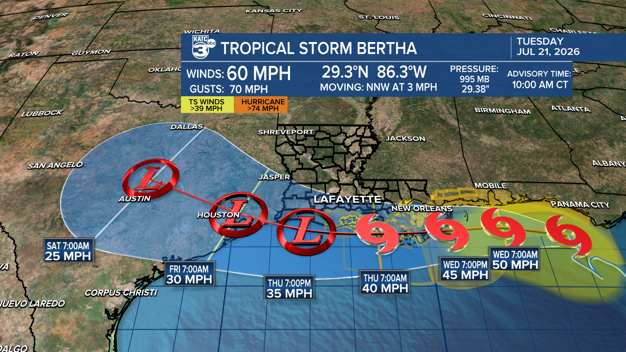
Later today, we expect Bertha to turn west-northwest and continue its journey westward, taking the scenic route along the Gulf Coast. Little change in strength is expected today, followed by gradual weakening from land interaction, wind shear, and dry air.
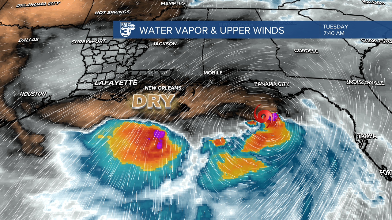
Bertha remains an asymmetric tropical storm, with most of the heaviest rainfall and strongest winds occurring to the south and east of the center. Strong northeasterly vertical wind shear is also expected to continue today and tomorrow, which poses challenges for further strengthening.
As we keep an eye on Bertha, the extent of its weakening will depend on how much it interacts with land over the next couple of days. There is even a possibility that it could lose its storm structure sooner than projected due to the unfavorable environmental conditions further west.
A TROPICAL STORM WATCH in effect for Lower Iberia, Lower St. Mary, and Lower Vermilion. Tropical Storm Bertha is approximately 290 miles east of Morgan City.
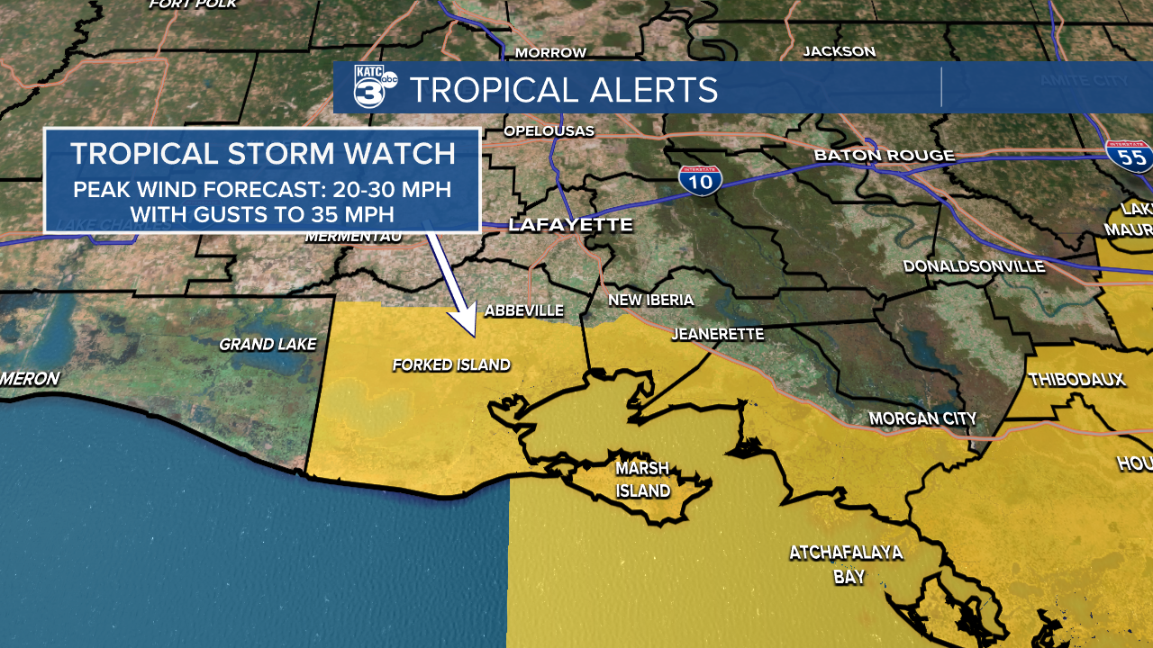
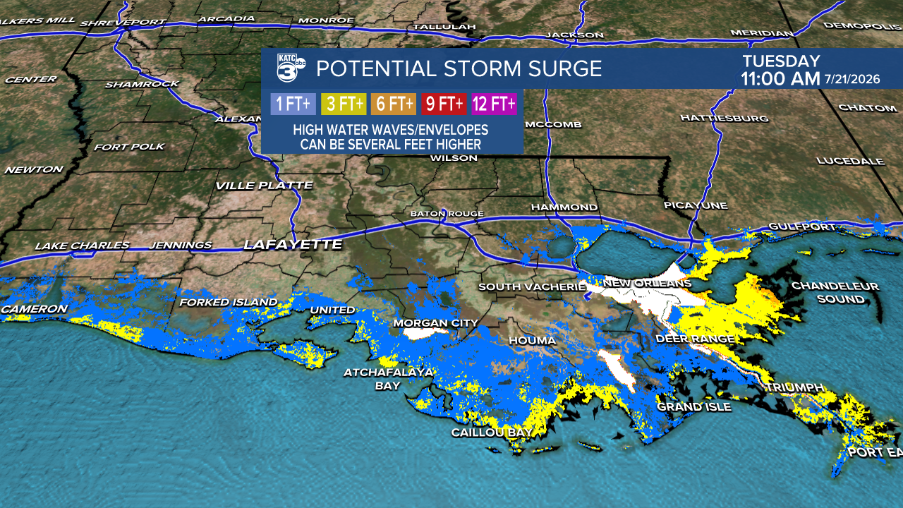
Residents can expect tropical storm-force gusts and locally heavy rainfall in areas south of I-10. Please be aware that storm surge of up to 3 feet is possible. Tornadoes are not anticipated at this time.
Per the NHC, "CHANGES WITH THIS ADVISORY:
The Tropical Storm Watch has been upgraded to a Tropical Storm
Warning from the Florida/Alabama border eastward to the Bay/Gulf
County Line.
The Tropical Storm Warning has been extended westward to the
Terrebonne/Lafourche Parish Line.
The TROPICAL STORM WATCH (winds greater than 39 mph) has been extended westward from Morgan City, Louisiana, to the Vermilion/Cameron Parish Line.
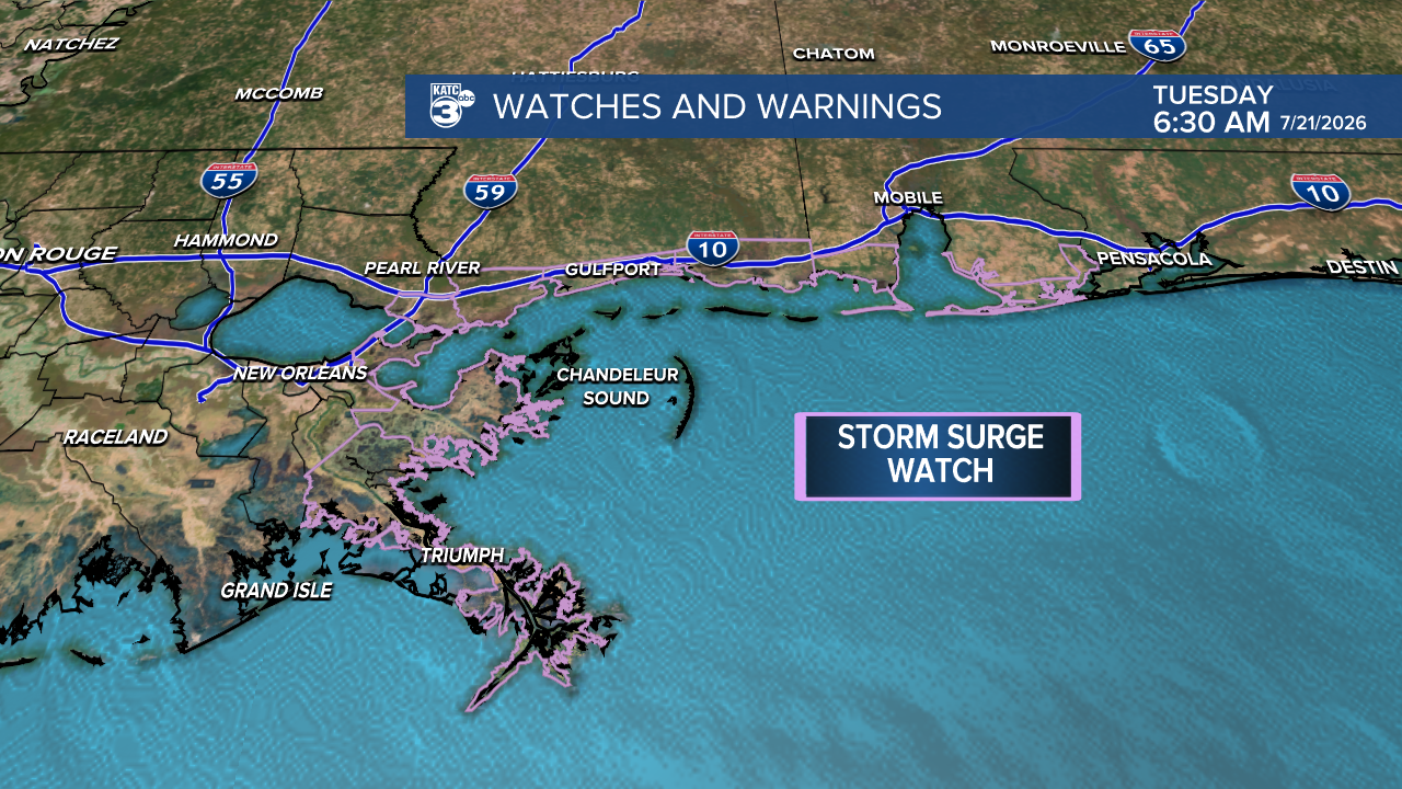
The Storm Surge Watch has been discontinued along the northern Gulf Coast. A Coastal Flood Warning has been issued by the National Weather Service for portions of the southeastern Louisiana and Mississippi coastline."
————————
Acadiana has another batch of heat advisories today.
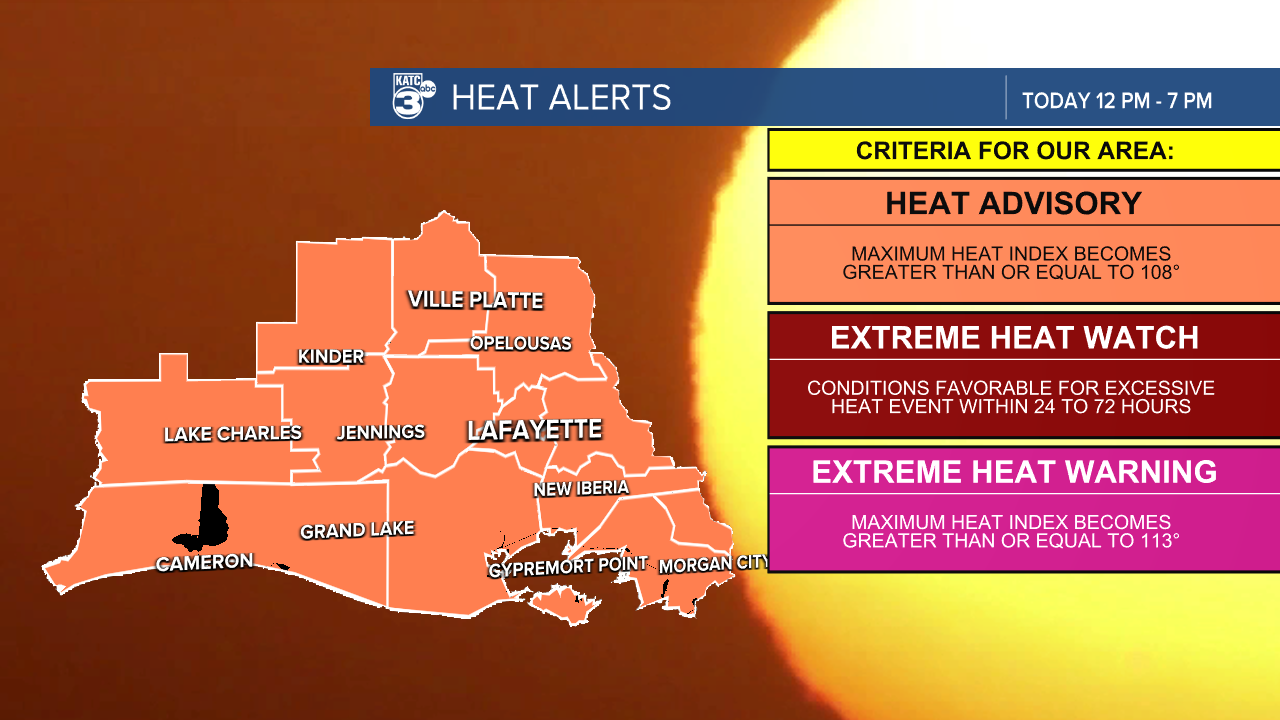
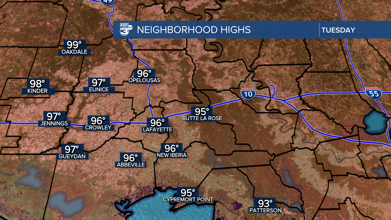
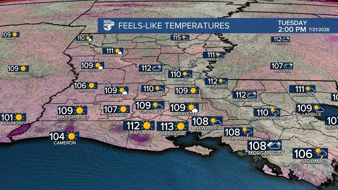
Afternoon highs are expected to be between 93°-99°, and heat indices rise up to 113°.
HEAT SAFETY TIPS:
- Wear lightweight, loose-fitting clothing
- Limit strenuous outdoor activities to the early morning or evening hours.
- Be vigilant for symptoms of heat exhaustion or heat stroke and take immediate action if you or someone you’re with experiences these issues.
SIGNS OF HEAT EXHAUSTION/HEAT STROKE:
- Heavy sweating
- Cool and clammy skin
- Intense thirst
- Dizziness or headache
- Nausea
- Rapid pulse
Tropical Storm Bertha is brewing in the Gulf with sustained winds of 50 mph and a central pressure of 997 millibars.
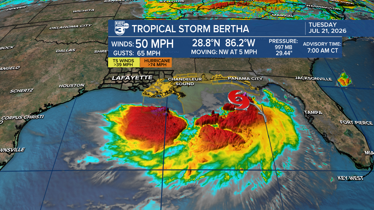
Currently located about 175 miles southeast of Mobile, Alabama, Bertha is moving northwest at 5 mph.
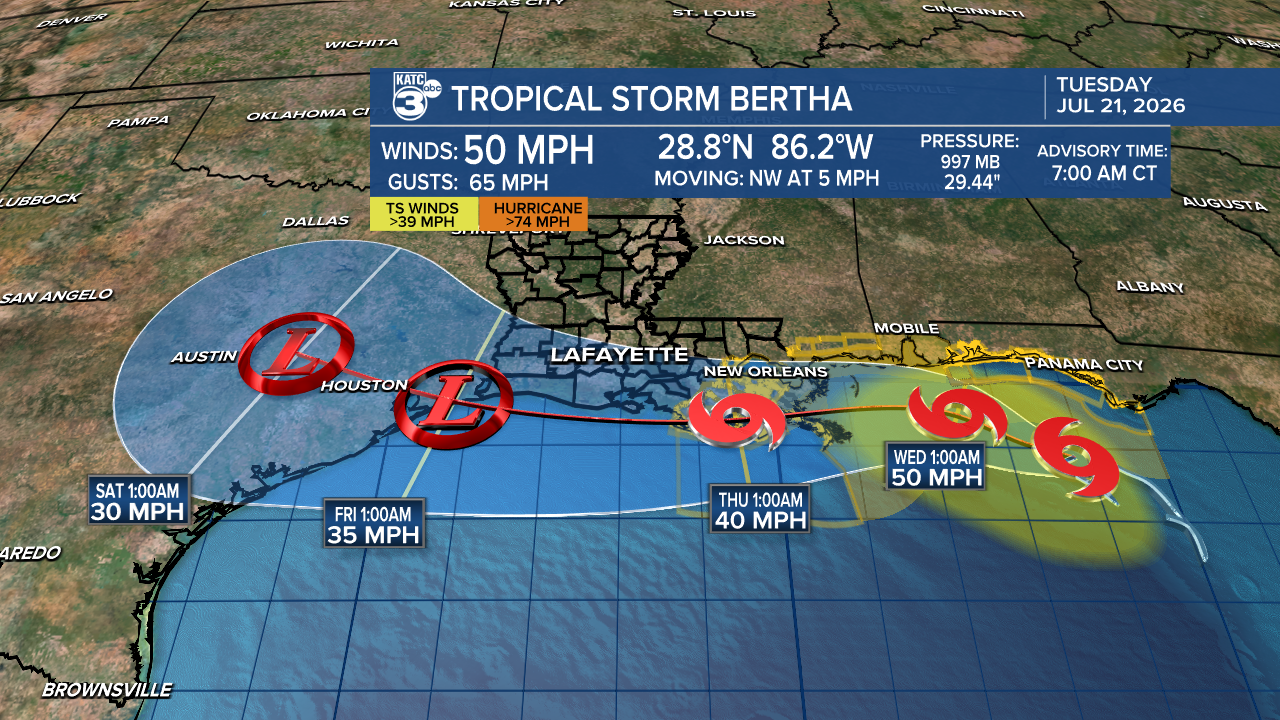
Bertha remains a highly sheared system with most of its convection on the southwestern side. Land interaction, increased shear, and dry air are likely to weaken the storm as it moves west closer to Louisiana.
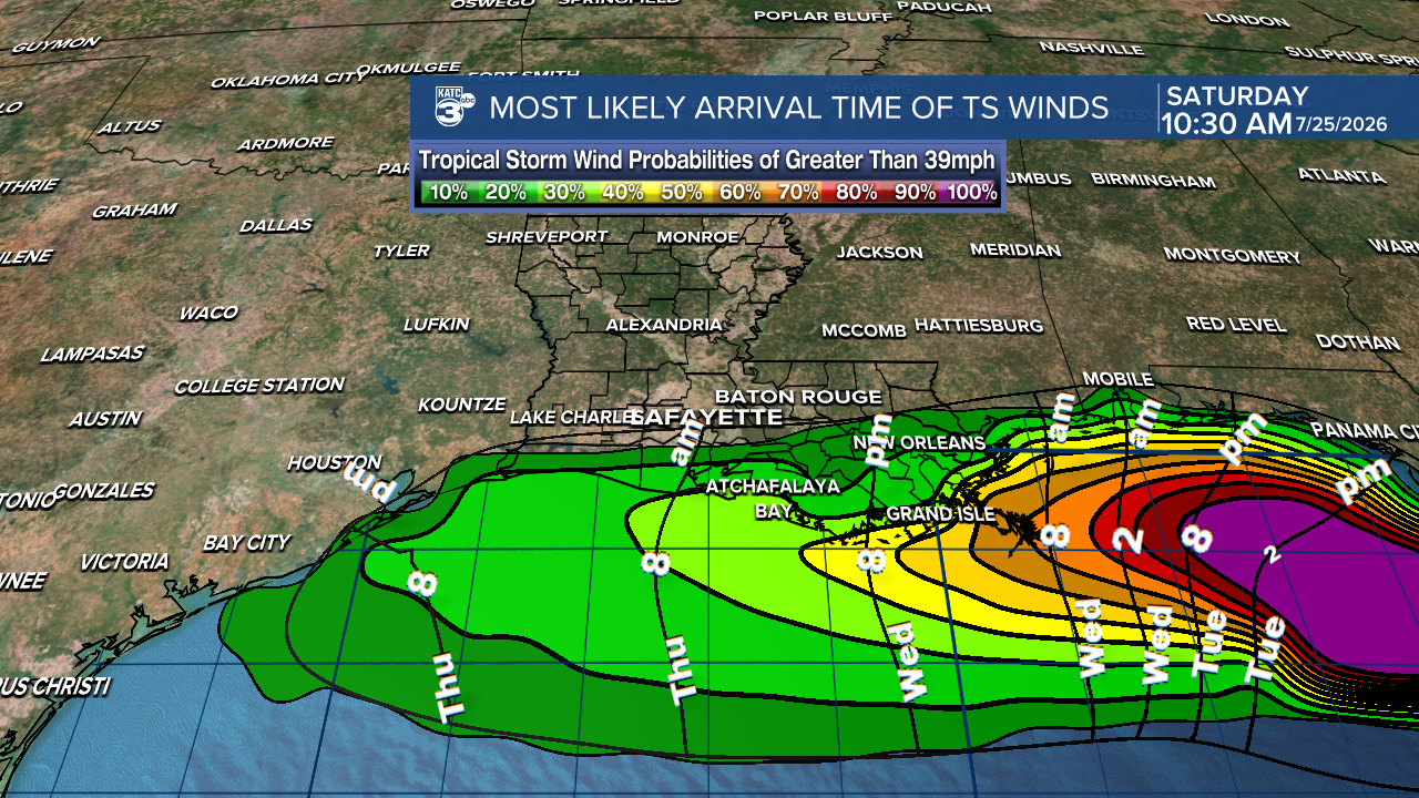
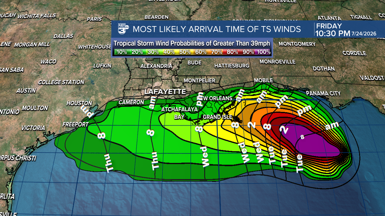
The probability of tropical storm force winds is up to 25% along the Gulf Coast Wednesday into Thursday morning.
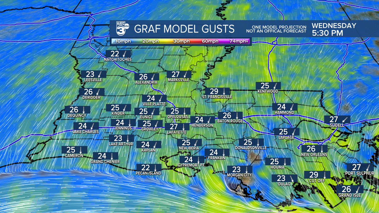
Expect breezy to windy conditions throughout Acadiana, with gusts up to 30 mph. A wind advisory may be issued.
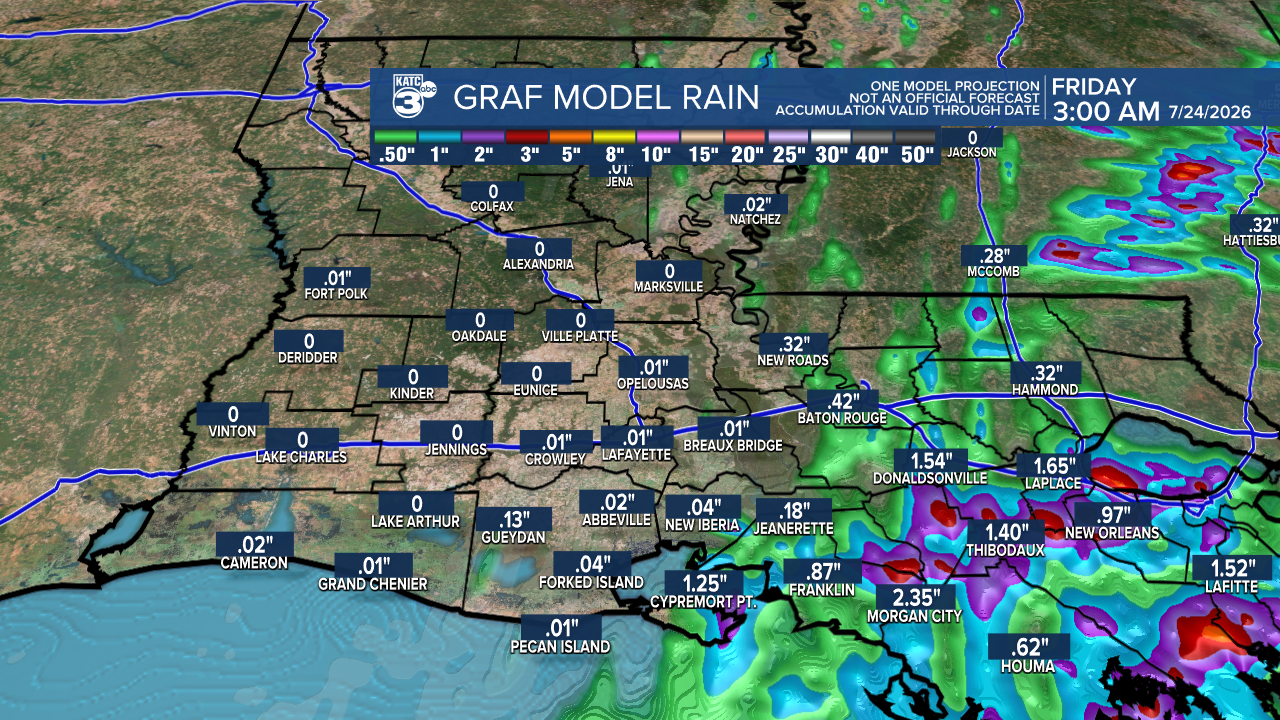
With Bertha's lopsided structure, rainfall amounts are expected to remain manageable—less than one inch for most areas, and localized flash flooding is a possibility, especially along the coast. Some areas may see up to 3 inches of rain.
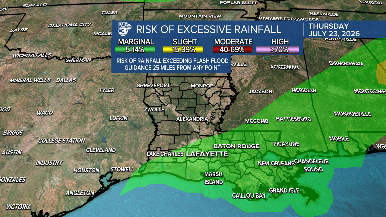
The risk for flash flooding has downgraded to a marginal (1/4) tomorrow and Thursday. This will be mainly confined to coastal areas. Severe weather is not expected!

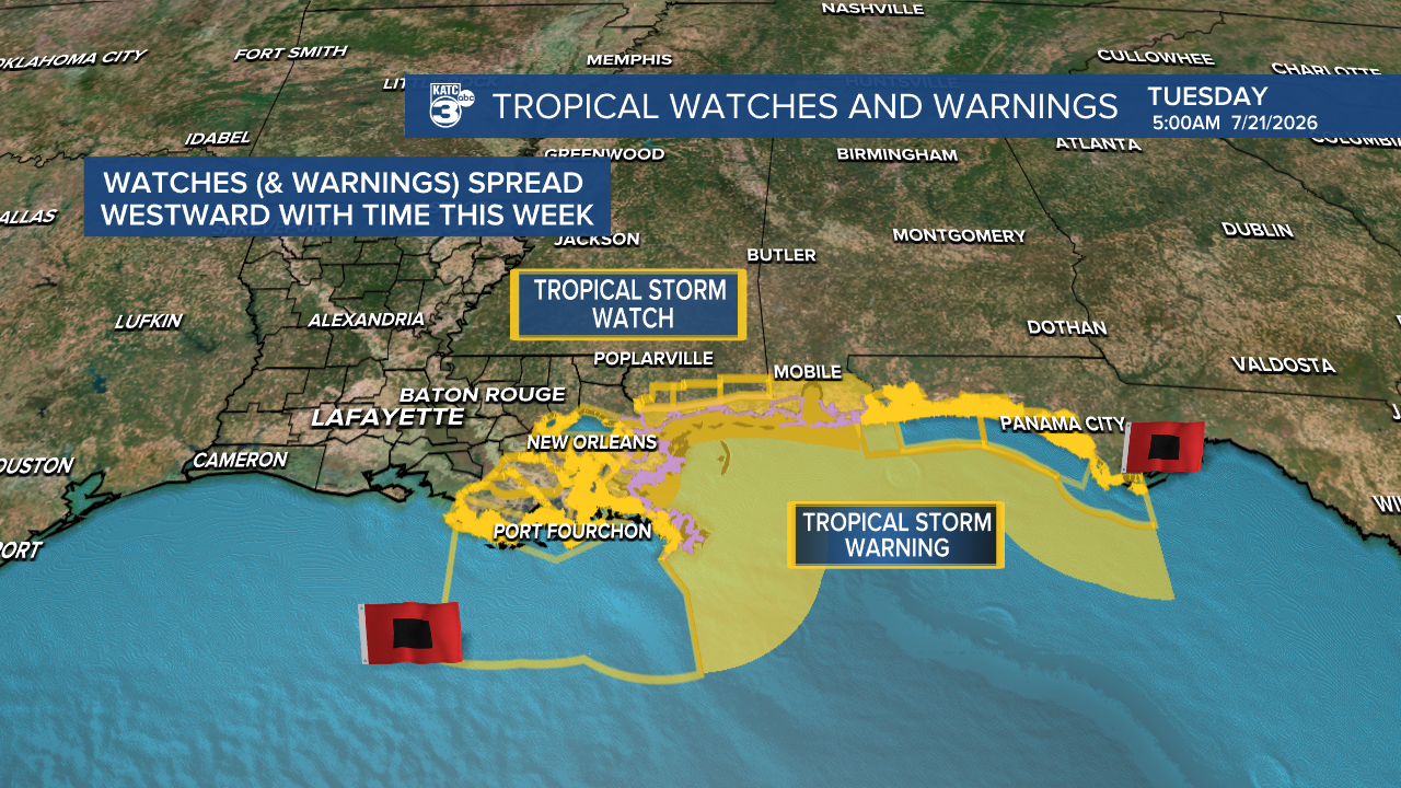
Tropical Storm Warnings are in effect from Alabama to Plaquemines Parish, with a watch extending to the St. Mary Parish border. Stay tuned for further updates as the watch may expand west into Acadiana.
Storm Surge Watches are also in place for Alabama, Mississippi, and southeast Louisiana, where life-threatening surge is possible. Peak surge values are between 103 feet from Morgan City to the Mouth of the Mississippi. Lesser storm surge west of Morgan City.
Stay alert for updates! Secure any loose items outdoors as winds pick up, and be cautious of localized flooding in coastal areas. TS Bertha will likely bring choppy seas, increasing the risk of rip currents along the Gulf Coast.
Follow Meteorologist Breyanna Lewis for further updates.
See the KATC 10 Day Forecast for the latest.

