

January has truly put on a show this year! Nearly every week in the South, we’ve been faced with winter weather and chilly temperatures. As we welcome February, a strong cold front is bringing intensely cold Arctic air this weekend. Expect hard freezes each night, making those mornings extra frosty! Protect all 4 P's!
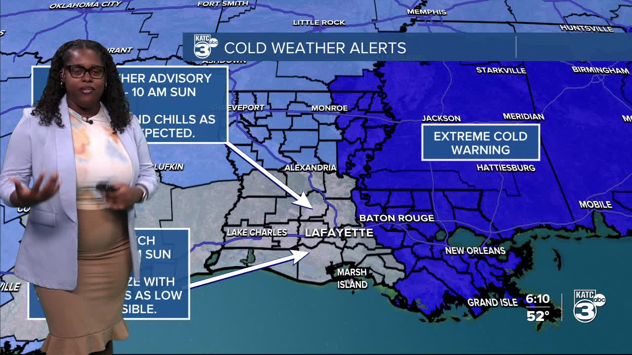
This weekend, we’ll also see multiple cold weather alerts in effect, including a COLD WEATHER ADVISORY and FREEZE WATCH.

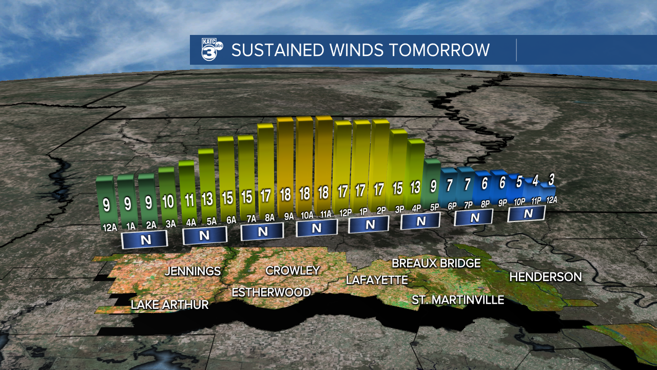
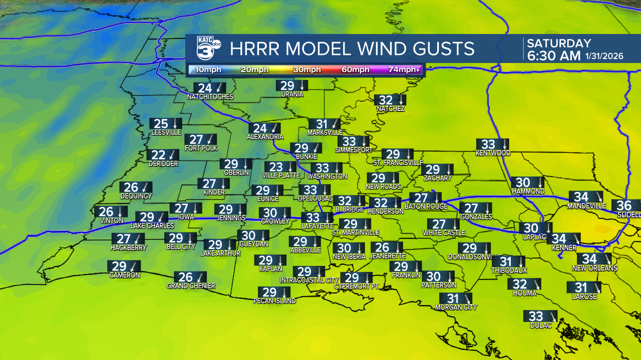
The winds begin to increase tonight, prompting a WIND ADVISORY in the morning.
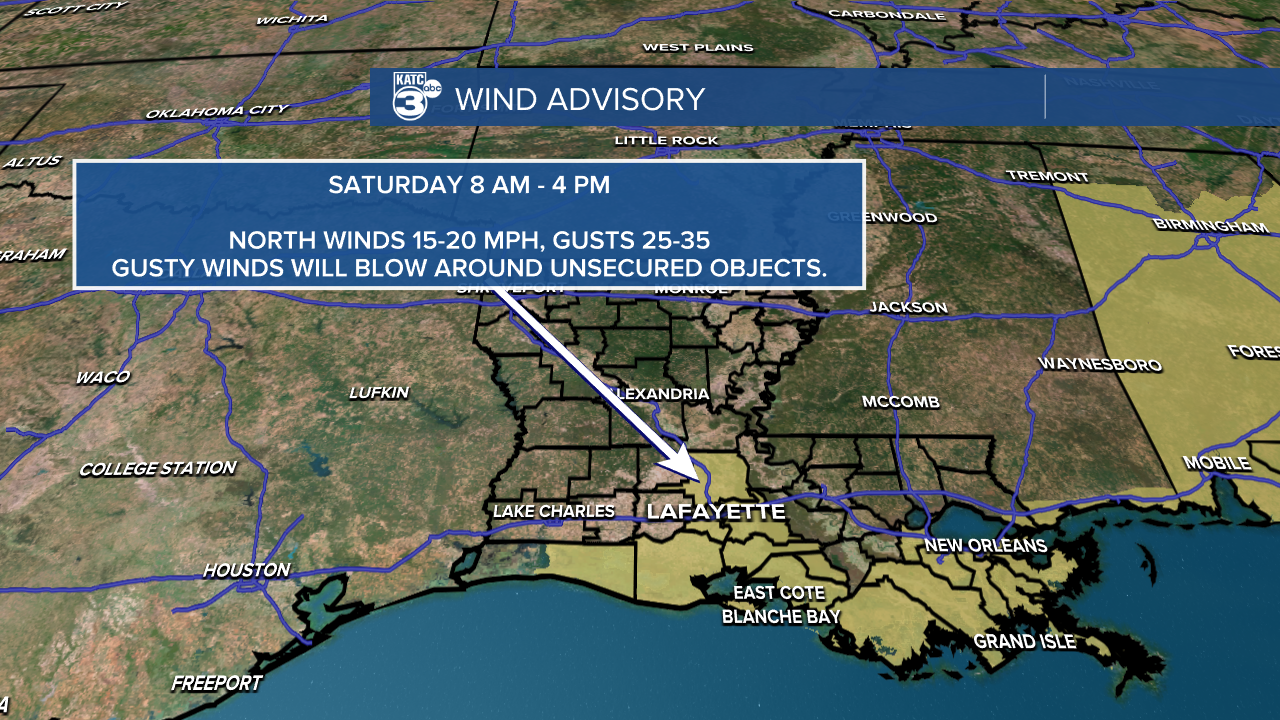
Expect north winds up to 20 mph and gusts between 25 and 35 mph. If you're outside of the advisory area, expect breezy conditions.
The Cold Weather Advisory is in effect for wind chills as low as 11 tonight and Saturday night due to elevated winds.

We’re looking at subfreezing temperatures for about 3 to 12 hours, with overnight temperatures in the 20s.


Highs tomorrow top out in the mid-30s to low 40s near the coast.

Due to the winds on Saturday afternoon, it'll still feel like the twenties.

As we head into Sunday morning, the winds will start to calm down, but in the meantime, secure any loose items to avoid them being blown around.
The Freeze Watch is for the temperature dropping as low as 18° on Saturday night.
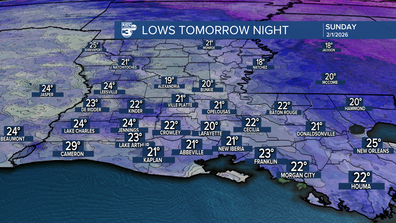
This will be the coldest night out of the 10-Day forecast. It will likely feel like teens and twenties.

A few isolated flurries may squeeze out in Central Louisiana during the morning. No accumulations are expected.

Sunday will offer a chilly high in the 40s, paired with a mix of sun and clouds.

Starting next week, temperatures will start returning to normal, with daytime highs in the 60s and nighttime lows in the 40s.
Follow Meteorologist Breyanna Lewis for further updates.
See the KATC 10 Day Forecast for the latest.
