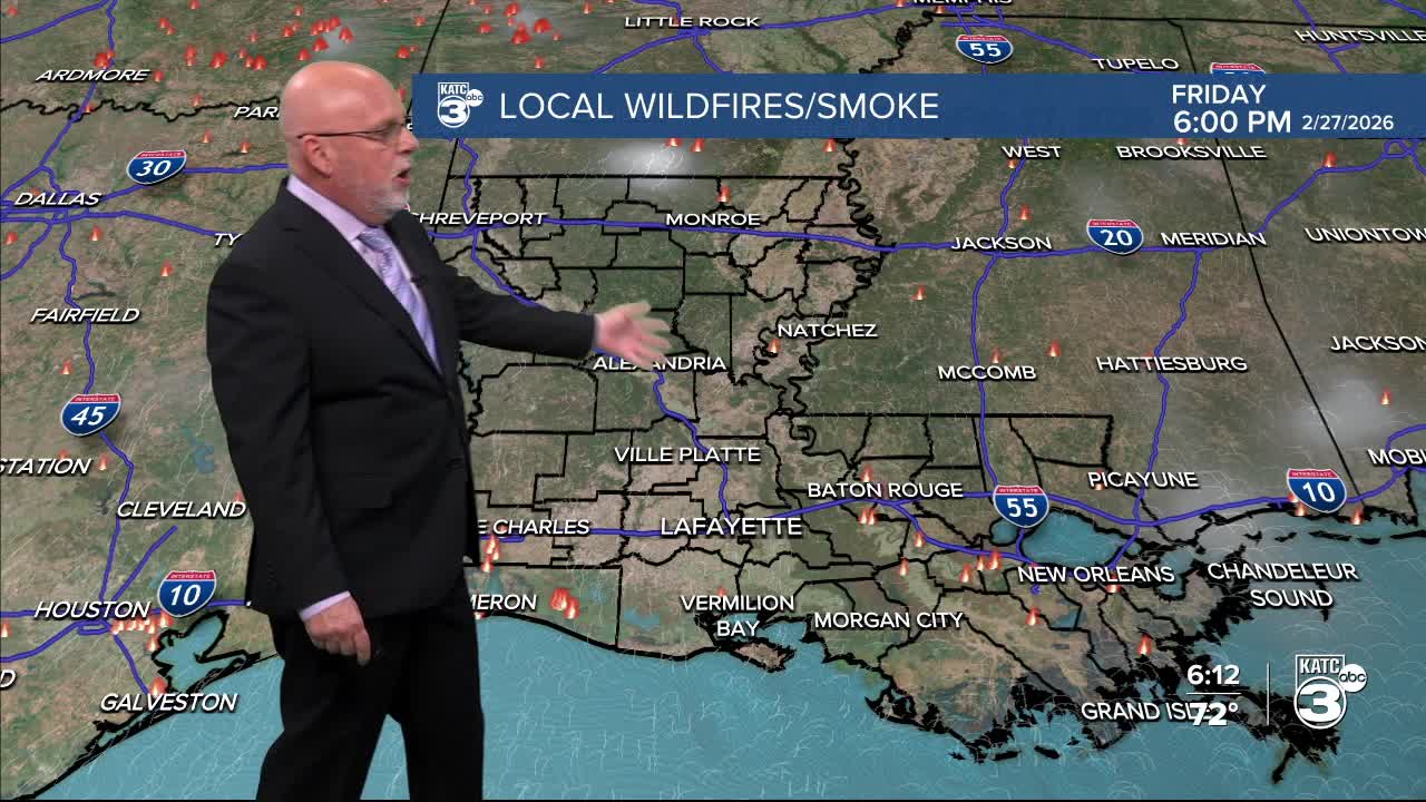


The fire danger looms overhead as multiple parishes are currently under burn bans. This is primarily fueled by breezy winds, dry vegetation, and insufficient rainfall. While the humidity has increased, it's still not enough to significantly reduce the fire danger.

As it stands, the burn bans are expanding across Louisiana, with only Evangeline, Lafayette, and St. Mary parishes remaining unaffected for now.
Currently, 8% of the state is facing extreme drought conditions. Although a small part of Acadiana remains drought-free, that too may soon shift.

Fortunately, the upcoming forecast shows promise with higher chances of rain, which could bring much-needed relief.
Let's do our part to prevent any potential fires.
After a few showers today, we're still seeing some light showers this evening.
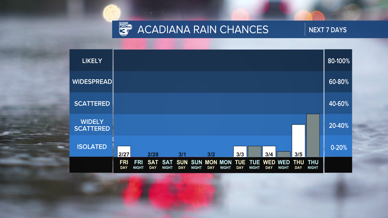
With just a 10% chance of rain early tomorrow, we can look forward to a beautiful weekend ahead!

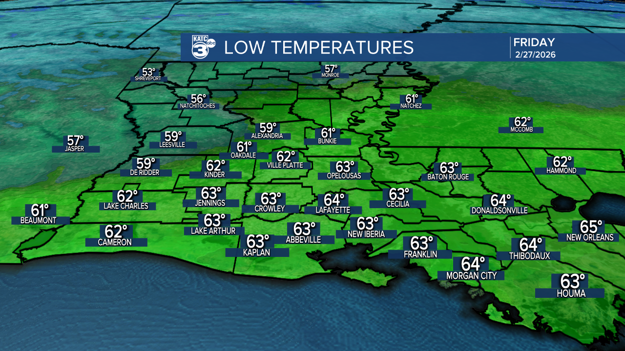
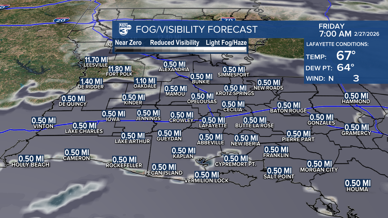
Expect a mild night with temperatures in the low 60s, along with patchy to dense fog after 9 PM.
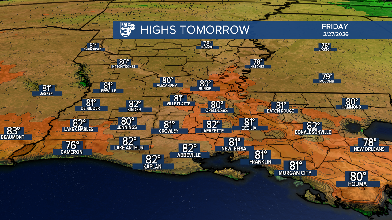
Tomorrow, we’re warming up into the low 80s—possibly breaking some records! Highs will stay in the low 80s through the first day of March.
Follow Meteorologist Breyanna Lewis for further updates.
See the KATC 10 Day Forecast for the latest.
