
Today, a cold front swept through our area, bringing pleasant conditions that will stick around until Monday! However, we have a stronger cold front heading our way early Tuesday morning.

Be prepared for showers and storms, along with a chance of isolated severe storms, particularly in northern and Central Louisiana. Currently, there's a marginal (1/5) risk for areas from Vernon to La Salle parishes and a slight (2/5) risk extending across a large portion of Texas and northwest Louisiana.

While Acadiana isn't under a severe threat now, that could change in the coming days. Stay tuned for updates!
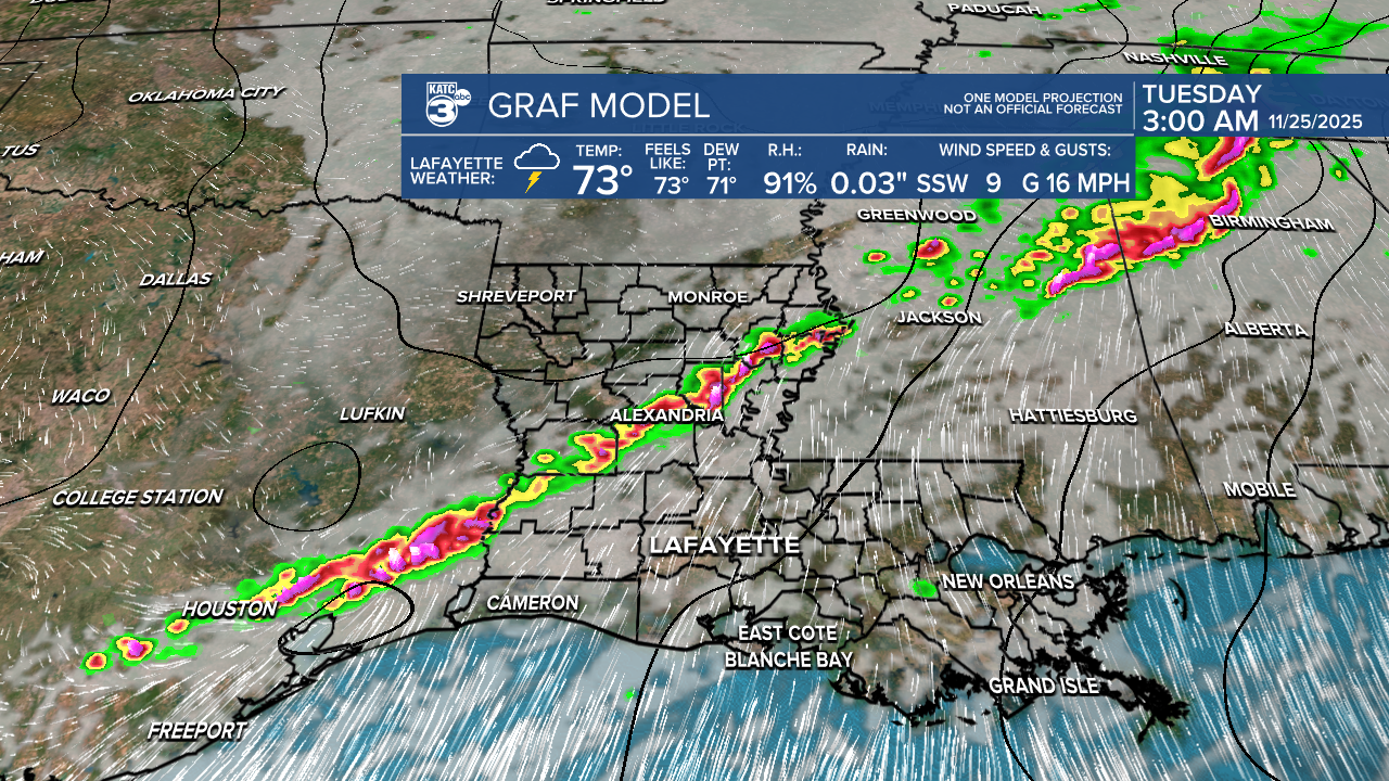
According to the GRAF model, we might see a few scattered showers on Monday, with the main line of storms expected to move through Louisiana after midnight, reaching Acadiana around daybreak.

The good news? After the front passes, we can look forward to cooler, more seasonable temperatures just in time for Thanksgiving ! It'll be a chilly Thanksgiving morning in the 40s, but expect a lovely afternoon warming up to the 60s with beautiful sunny skies. No rain in sight for the holiday!

Tonight, temperatures are expected to drop into the mid-50s, which is about a 10° to 15° decrease from last night.

Tomorrow will still be warm, with temperatures in the 80s.

Follow Meteorologist Breyanna Lewis for further updates.
See the KATC 10 Day Forecast for the latest.
