

The drought continues to expand across our state! The extreme drought has nearly doubled over the last week, increasing from 24% to 44%. This affects a significant portion of CENLA and Southeast Louisiana. Severe drought conditions have expanded into parts of Jeff Davis, Acadia, Iberia, and St. Mary Parishes.

However, there is hope on the horizon! Over the next week, we expect some relief, with rainfall amounts ranging from a quarter of an inch to as much as two inches in certain areas.

While we look forward to this potential relief, it’s important to note that, for now, there are no burn bans in place for Acadiana.
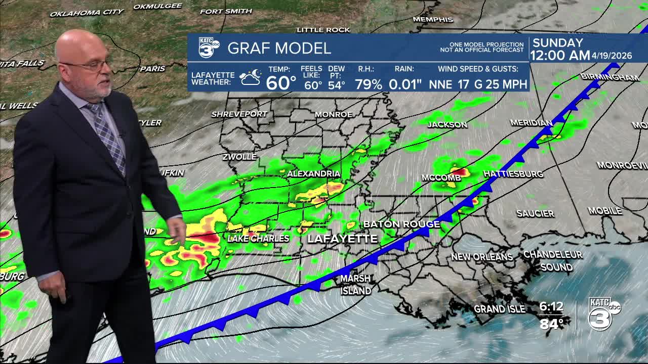
We're still forecasting a cold front to arrive Saturday night, bringing along some showers and a few isolated thunderstorms. While severe weather isn’t anticipated, we could see a strong storm or two pop up.

The expected rainfall amounts vary depending on your location.
- North of HWY 90: Expect between 1-2 inches of rain, with some isolated spots possibly exceeding 2 inches.
- South of I-10: Rainfall will be lighter, mostly ranging from a tenth of an inch to 1 inch. We might even experience a few heavy downpours at times.

This rain will offer some much-needed relief to our ongoing drought concerns! After the front passes, cooler air filters in, with temperatures dipping into the low 50s Sunday morning.

As for tonight, we’re looking at the upper 60s with some patchy fog.

Tomorrow’s highs will reach the mid-80s. With an upper-level ridge in place that will likely cap any precipitation, but a small shower or two may manage to squeeze out during the afternoon.

Follow Meteorologist Breyanna Lewis for further updates.
See the KATC 10 Day Forecast for the latest.
