

It's been a chilly day! Just yesterday, we were enjoying highs in the mid-60s and 70s, but today we're seeing a significant drop with highs only reaching the 40s and 50s—about a 15°-25° difference!

The next few days don’t look any warmer, so make sure to bundle up with your hats and winter coats! Tonight, we’re expecting lows in the 30s and 40s across most of the state.

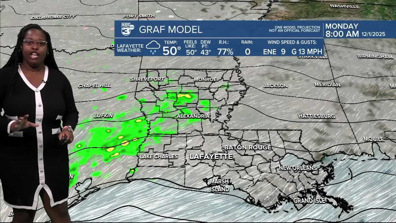
Tomorrow’s forecast? Similar chilly vibes with temperatures only reaching the 40s and 50s again. St. Mary Parish is expected to be the warmest in the 60s.

By Tuesday morning, we might even see some areas dipping at or below freezing. While folks south of I-10 will stay just above freezing in the upper 30s.


By night, colder temperatures are on the horizon, with much of Acadiana nearing those freezing temps.
Stay warm and cozy, everyone, and don’t forget to stock up on hot chocolate!
Earlier today, we had a decent amount of rainfall across Acadiana, with the airport reporting 1 inch. Most areas saw anywhere from a quarter inch to just over 1 inch of rain—no storms in sight, as those stronger systems stayed mostly in Texas.

Tomorrow, we're expecting another wave of rain as a coastal low develops. This could bring heavier showers since the WPC outlined us under a marginal (1/5) risk for flash flooding.

We could see an additional half inch to 2 inches of rain, and possibly higher amounts of 3-4 inches in some spots. No severe weather is expected, but a few stronger storms may pop up. A cold front finally rolls in early Tuesday, putting an end to the rain.

We'll get a breather as drier air rolls in with a high-pressure system, giving us a nice pause on Tuesday and Wednesday. But be prepared, as another round of rain is set to return on Thursday.

Follow Meteorologist Breyanna Lewis for further updates.
See the KATC 10 Day Forecast for the latest.
