
Tonight marks our last night with patchy to dense fog here in Acadiana.

It'll be mild tonight in the low 60s.

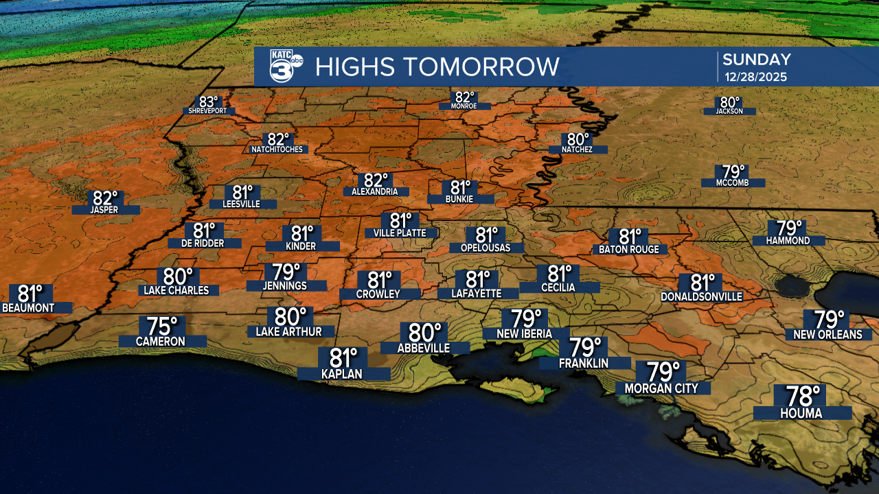
Tomorrow's highs will approach the record again in the low 80s.
However, cold temperatures are heading our way! My cold-weather lovers, your time to shine is coming. A cold front arrives Sunday night, bringing a drier and colder airmass. Overnight lows will dip into the 40s and 50s, with Monday's highs only reaching the 50s.


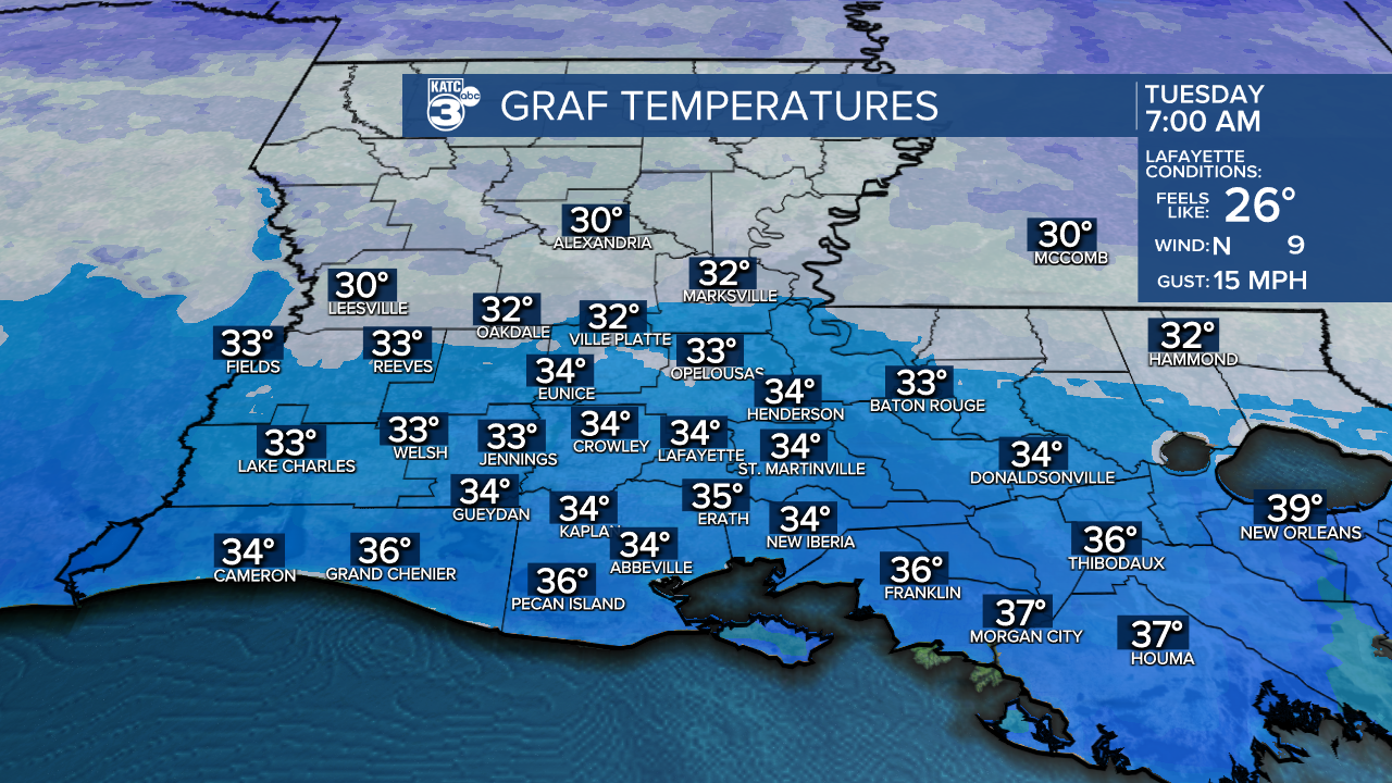
Prepare for a cold start Tuesday, as we'll have lows in the low to mid-30s—time to break out the winter gear!
Looking ahead to New Year's Eve, expect a frosty start with temperatures in the mid-30s. By the afternoon, we’ll warm up to the mid-60s and enjoy mostly sunny skies.
As we head into Sunday night, a cold front makes an appearance.

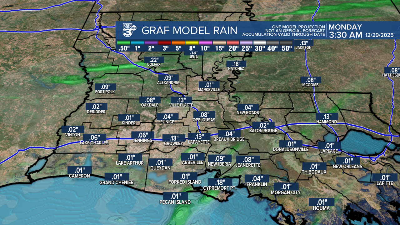
Expect light scattered showers before the front passes. More showers are likely after midnight as the front moves through.

We’re not anticipating a heavy rain event—total rainfall should remain around 0.10 inches.
Winds are also expected to pick up for most of Monday. After that, high-pressure will establish itself, bringing much drier conditions to Louisiana as we head into the new year.
Follow Meteorologist Breyanna Lewis for further updates.
See the KATC 10 Day Forecast for the latest.
