

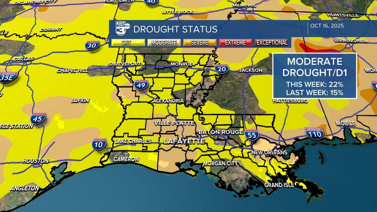
We have a JAM-packed weekend ahead with various events happening. Before we get to the weekend forecast, the latest drought monitor is out! As expected, moderate drought has now increased to 21%, due to the dry spell we've faced over the last 10 days. But, there is some good news—rain is on the way not for everyone through.
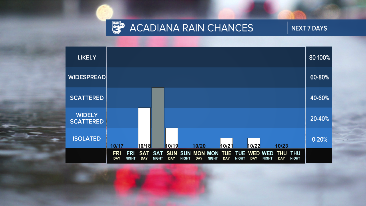
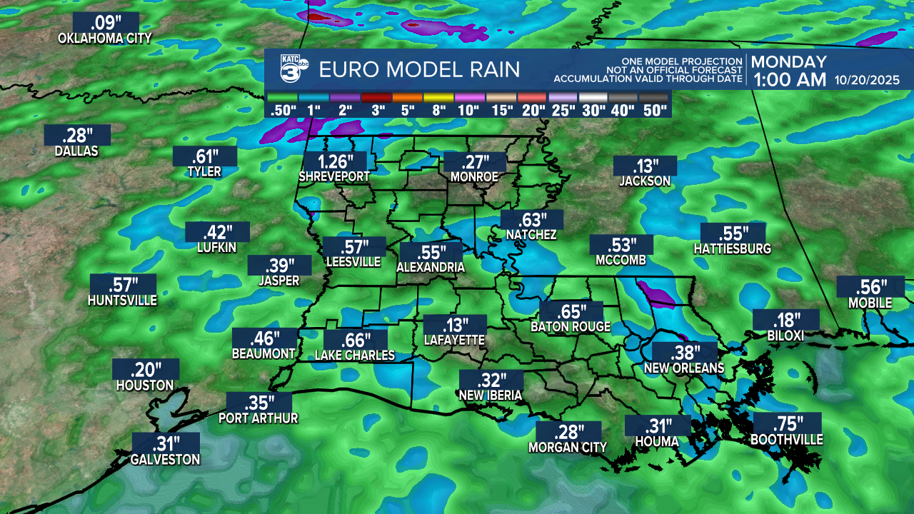
An upper-level trough combined with a cold front is set to bring increased rain chances to northern Acadiana this weekend.
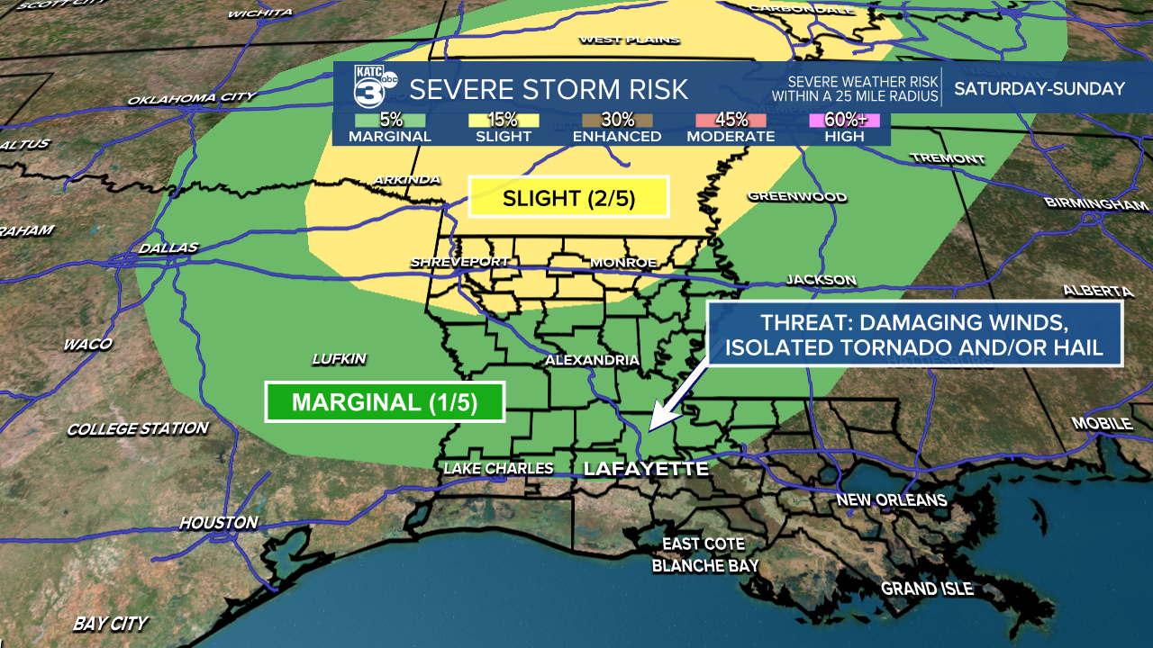
There’s a low-end severe weather threat with this system for areas north of I-10 Saturday through early Sunday. Northern Louisiana is under a slight risk (2/5), while Central Louisiana has a marginal risk (1/5). Isolated severe storms are possible, which include damaging winds, a brief spin-up tornado, or hail. Areas south of I-10 should remain fairly dry.
Expect rain amounts to be relatively low, ranging from a tenth of an inch to one inch, but higher amounts are possible. Once the front moves out early Sunday, we’ll return to dry conditions to wrap up the weekend.
As for weekend plans, let's highlight two exciting events: the International Rice Festival in Crowley and UL's homecoming!
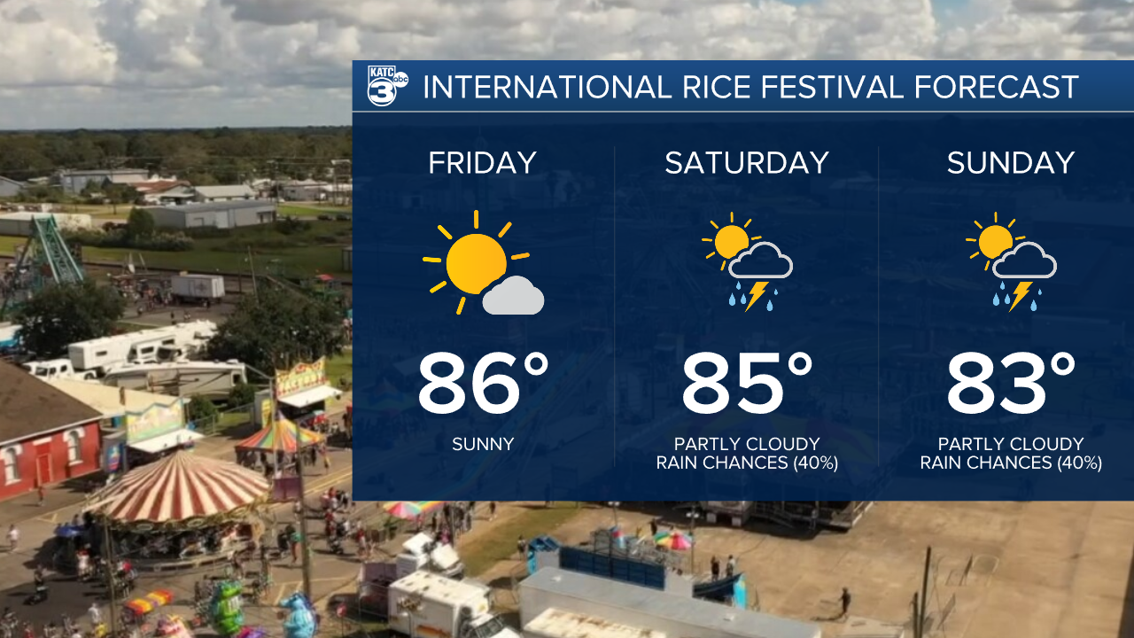
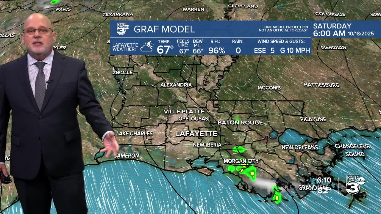
For both events, there might be a few scattered showers and storms during the afternoon going into the evening. It might be a good idea to pack the rain gear just in case.
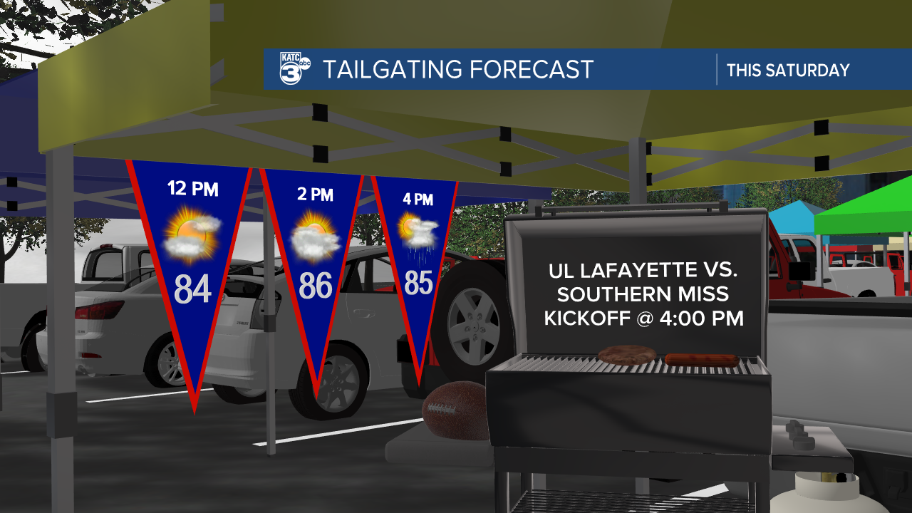
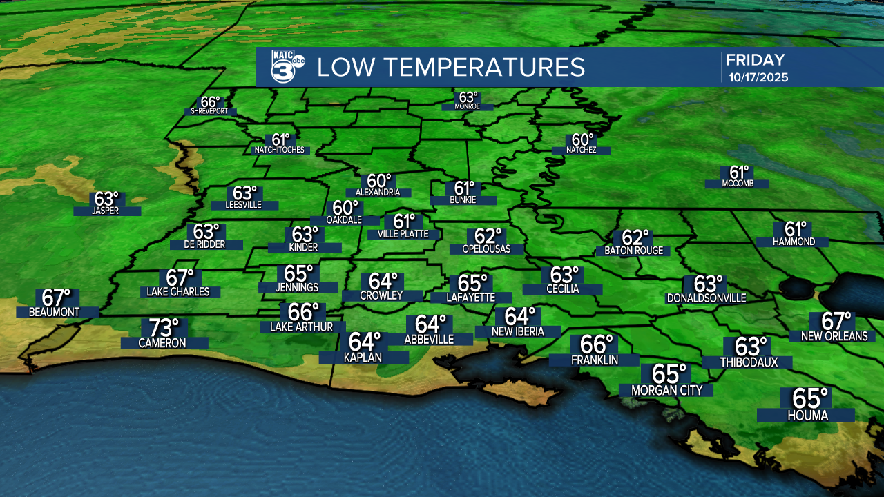
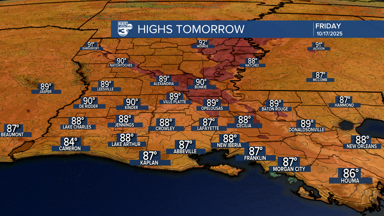
But tonight and tomorrow? Enjoy some nice, and quiet weather! Expect lows in the 60s and highs in the mid to upper 80s. Let’s make the most of the weekend, rain or shine!
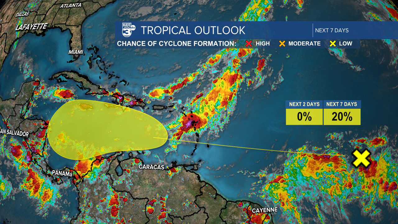
Look at what we have brewing in the tropics: a tropical wave! It's messy right now, but it's expected to gradually develop as it heads towards the central Caribbean Sea around the middle of next week. Stay tuned for updates!
See the KATC 10 Day Forecast for the latest.
