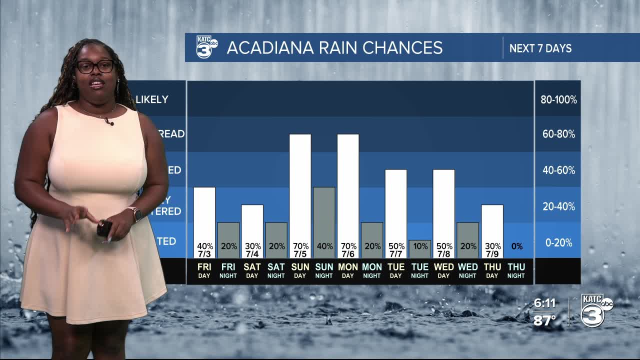


Summer is in full swing with hot temperatures and some afternoon showers and thunderstorms popping up.

Looking ahead, we’re expecting rain chances to ramp up significantly on Sunday and Monday—up to 70%. We’ll still have elevated rain chances throughout the holiday weekend, with each day bringing opportunities for showers and storms.
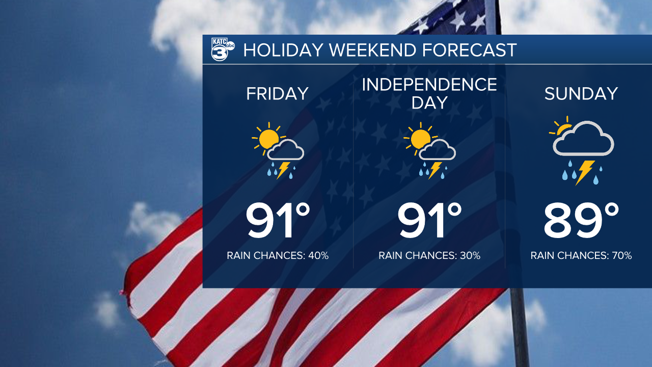
The good news? Most rain and storms should wrap up around sunset with the loss of daytime heating. We’re anticipating rainfall totals of up to 1 inch, with some areas possibly seeing up to 3 inches.

Highs will be in the upper 80s to low 90s, but with the heat index, it could feel as hot as 101°.


So, as we gear up for holiday celebrations, make sure to stay hydrated, take breaks, and remember: if you hear thunder, it’s time to head indoors!
Our state is looking much better, as we’ve officially moved past severe drought conditions. While we still have some abnormally dry and moderate drought areas in northern and southeastern Louisiana, the overall outlook is promising. We'll continue our summer pattern of afternoon showers and storms.

Follow Meteorologist Breyanna Lewis for further updates.
See the KATC 10 Day Forecast for the latest.
