


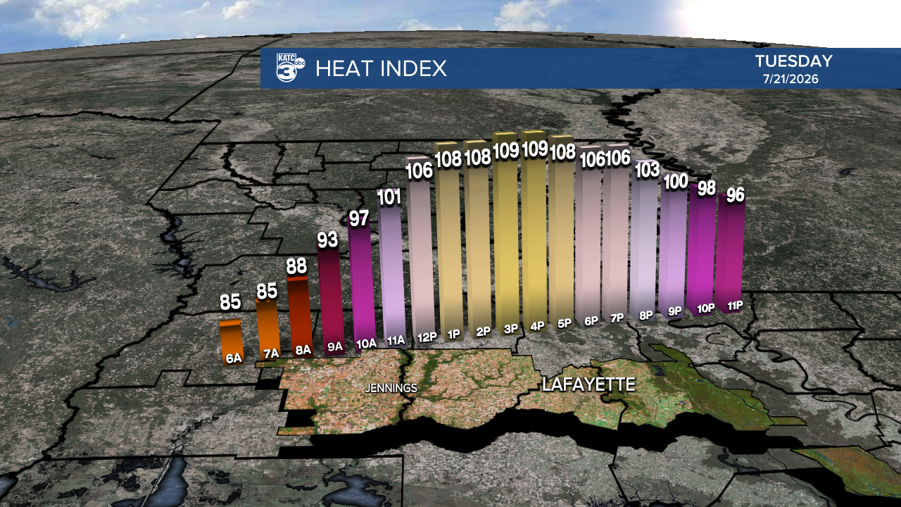
Before we dive into the tropics, let's talk about the heat we're facing! This summer's hottest days are upon us, with temperatures soaring into the low to upper 90s.
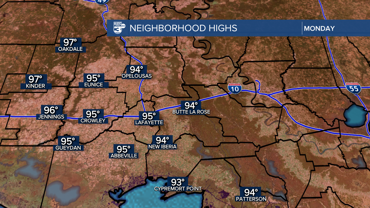
Some areas are expected to hit the century mark tomorrow and Wednesday.
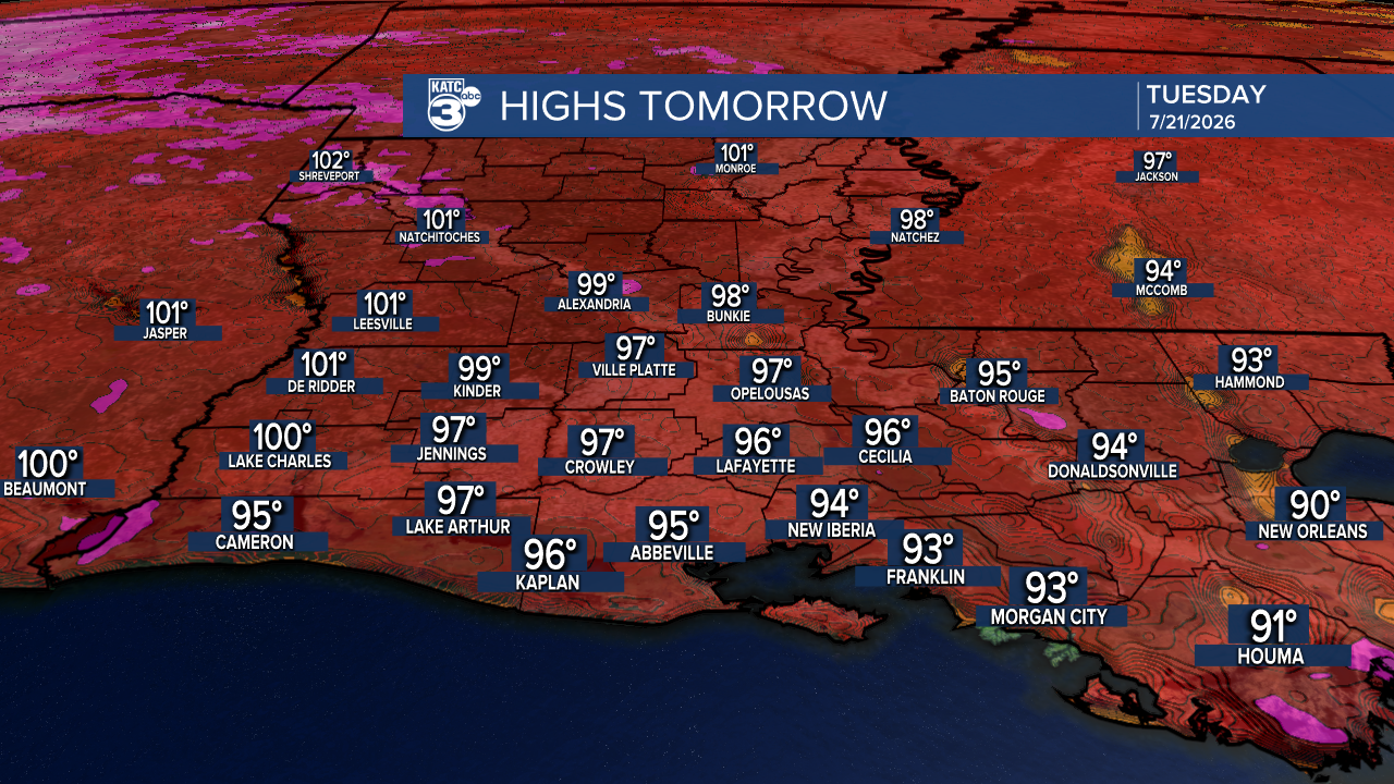
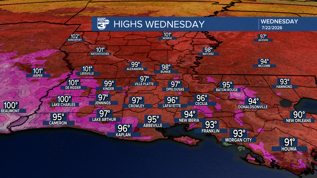
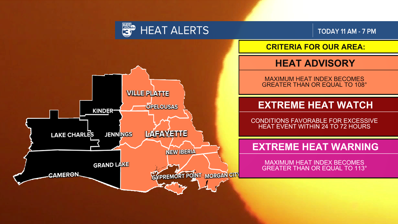
A HEAT ADVISORY goes into effect for most of Acadiana later this morning, with heat indices reaching a sweltering 108°-112°. We expect another batch of heat advisories for tomorrow and Wednesday.
HEAT SAFETY TIPS:
- Wear lightweight, loose-fitting clothing.
- Limit strenuous outdoor activities to the early morning or evening hours.
- Be vigilant and take immediate action if you notice symptoms of heat exhaustion or heat stroke.
Stay hydrated and look out for one another!
Tropical Depression Two is still brewing in the Northern Gulf, currently with sustained winds of 35 mph and moving northeast at 3 mph. It's positioned about 110 miles south of Panama City, Florida.
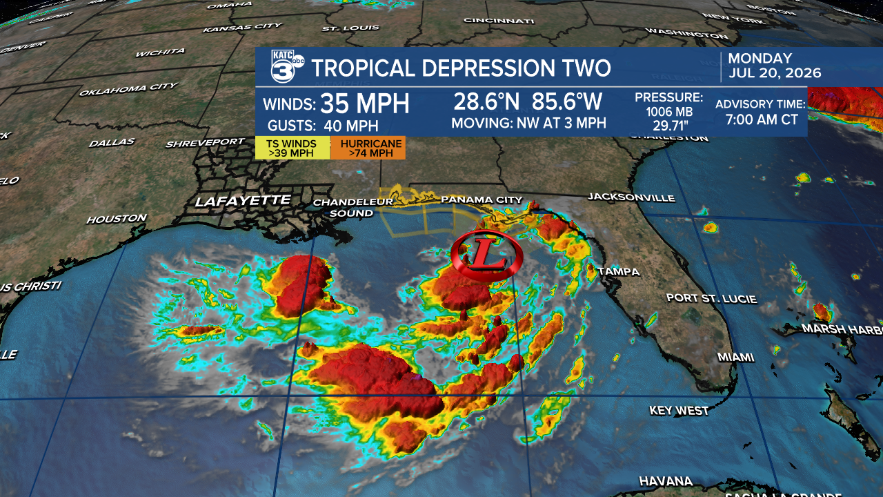
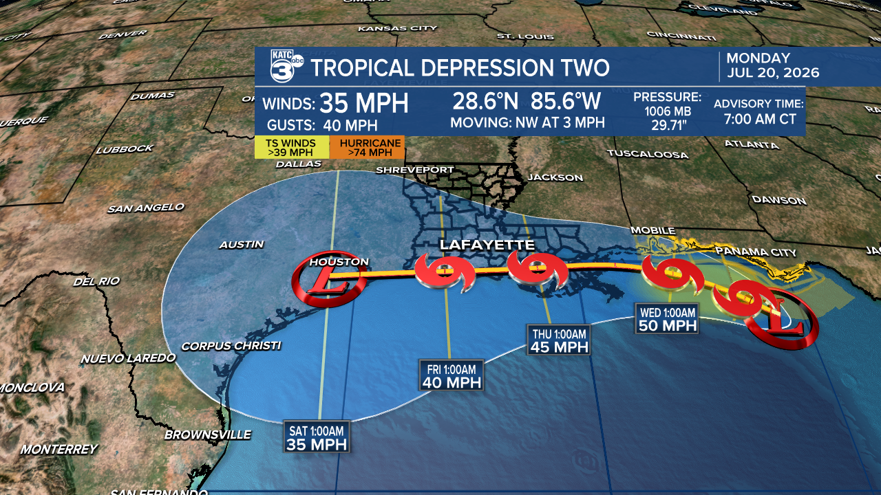
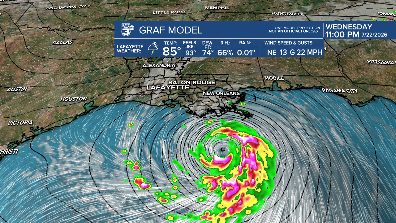
With slow development, TD 2 is likely to become Tropical Storm Bertha sometime today. However, it's facing challenges with dry air and shear that could limit intensification. This system moves inland over South Louisiana between Wednesday and Thursday, though its exact path may vary. Nonetheless, the system is expected to weaken as it moves across the state.
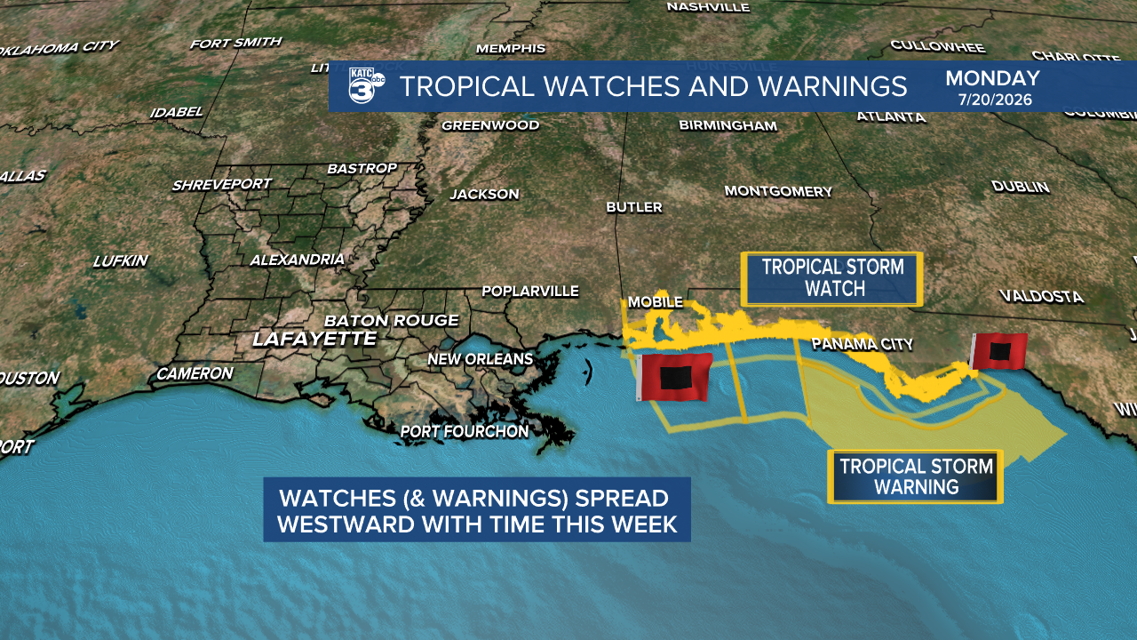
Watches are in effect for Florida’s Panhandle and the Alabama Gulf Coast, with additional watches or warnings likely as the storm progresses.
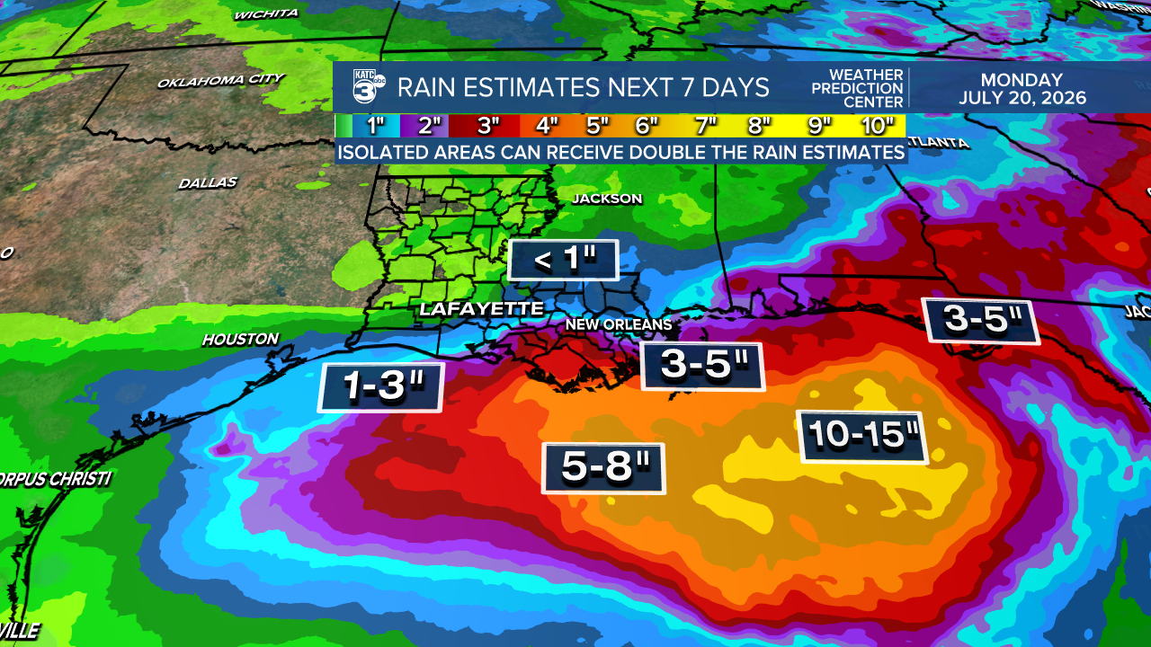
The main rainfall is expected south of I-10 on Wednesday and Thursday, with rainfall amounts up to 3" especially around St. Mary Parish.
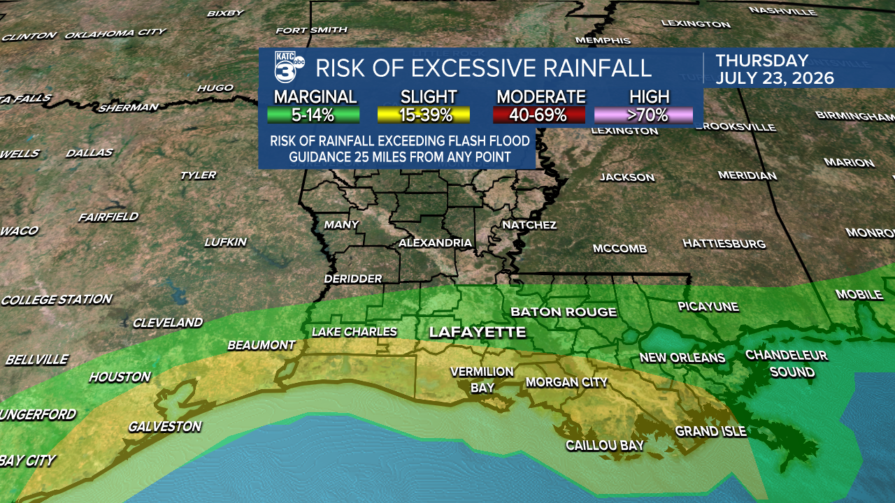
A marginal (1/4) to slight (2/4) risk of flash flooding is present in Acadiana on Thursday. The heaviest downpours remain offshore. We may see some storm surge once the system passes west. At this point, severe weather is not anticipated.
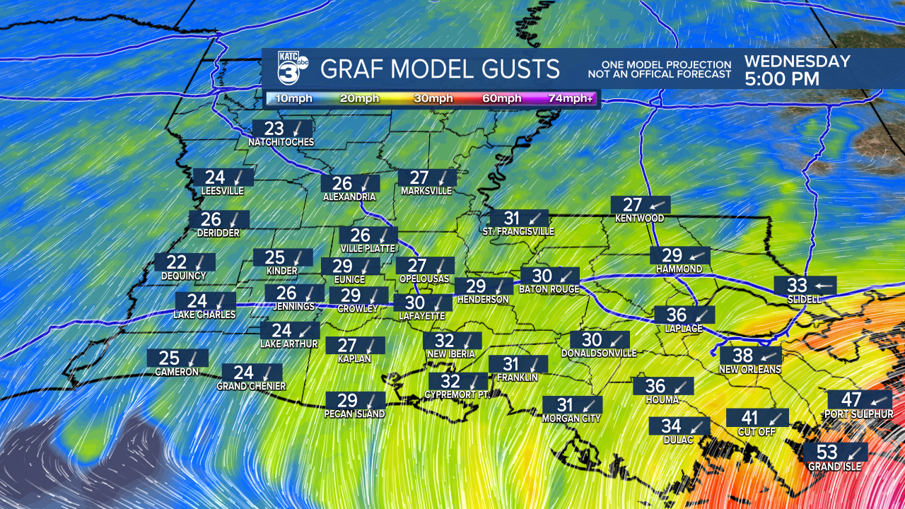
The best chance for tropical storm-force winds is along the Gulf Coast, with gusts near 50 mph and inland gusts between 25-35 mph.
For now, most activity will stay over open water, but be prepared for possible breezy to windy conditions and occasional scattered showers or storms. Widespread activity isn't expected. Stay alert for new updates, and take it day by day!
Follow Meteorologist Breyanna Lewis for further updates.
See the KATC 10 Day Forecast for the latest.

