


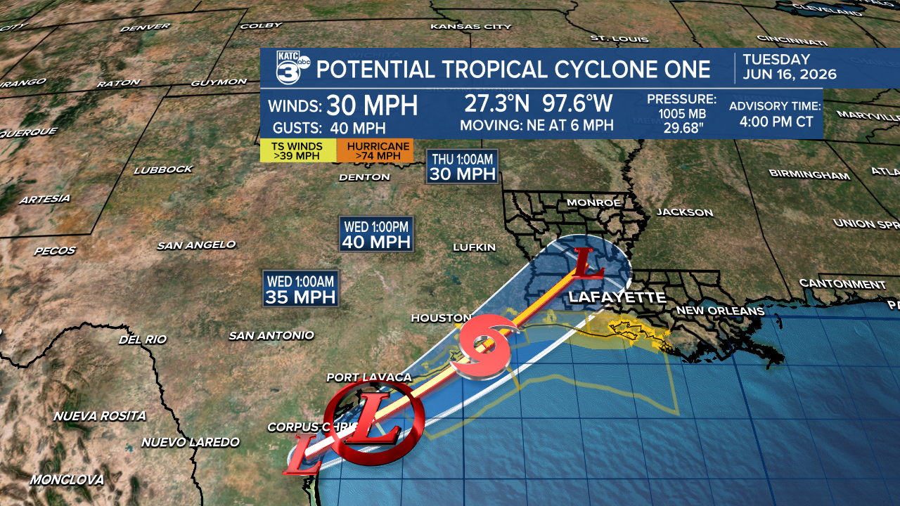
Potential Tropical Cyclone One has formed over southern Texas and is set to become the first tropical storm of the Atlantic Hurricane Season, named Arthur! Currently located about 35 miles south-southwest of Corpus Christi, Texas, and 330 miles southwest of Lake Charles, PTC One has sustained winds of 30 mph and is slowly moving northeast at 6 mph.

We expect soon-to-be Tropical Storm Arthur to develop sometime Wednesday morning. While it may be a short-lived storm, its impacts could still be significant.
Tropical Storm Warnings are in effect for the Louisiana coastline, meaning tropical storm conditions are expected in the next 12-24 hours. Here’s what you need to know:
- Tropical-storm force winds are possible within the next 24 hours, with peak winds forecasted at 25-35 mph and gusts reaching up to 40 mph or higher.
- Be prepared for potential wind damage to structures like porches, carports, and fences, along with possible tree damage.
- A few roads may become impassable due to debris or heavy rain, so stay cautious.
- Storm surge of 2 to 4 feet is possible in coastal areas.

We still have a Flood Watch in effect through Thursday morning. A Coastal Flood Warning is in effect for Cameron, Vermilion, Iberia, and St. Mary parishes starting tonight. According to the NWS in Lake Charles, "Numerous roads may be closed. Low-lying property, including homes, businesses, and some critical infrastructure, will be inundated. Some shoreline erosion will occur." Please take precautions to protect flood-prone properties.

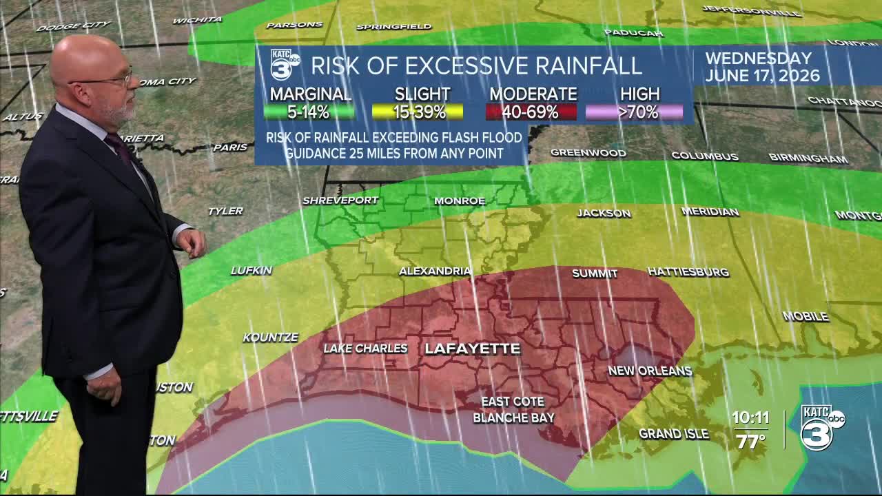
Much of Acadiana is under a marginal (1/4) to moderate (3/4) risk of flooding due to a stalled boundary combined with a tropical system in the Gulf. Expect soggy conditions by the end of the week.


Widespread showers and thunderstorms are likely to produce rainfall rates of 1.5 to 3" per hour. Intense rainfall is expected to intensify on Thursday as PTC 1, or soon-to-be Tropical Storm Arthur, arrives. Overall, Acadiana has averaged about 3.5" of rainfall. Both the GRAF and HRRR have pushed the highest amounts into East Louisiana.


Several rounds of heavy rain continue through the rest of today into the night. The next wave of tropical-like rainfall will arrive tomorrow as PTC One or soon-to-be Tropical Storm Arthur approaches land near Sabine Pass.
In addition to the tropical weather, there is a low-end severe weather threat over the next several days. Today's concerns included isolated tornadoes and damaging winds. Tomorrow is damaging winds, and on Thursday, both damaging winds and isolated tornadoes are possible. Either way, stay alert for watches and warnings this week!


Follow Meteorologist Breyanna Lewis for further updates.
See the KATC 10 Day Forecast for the latest.
