


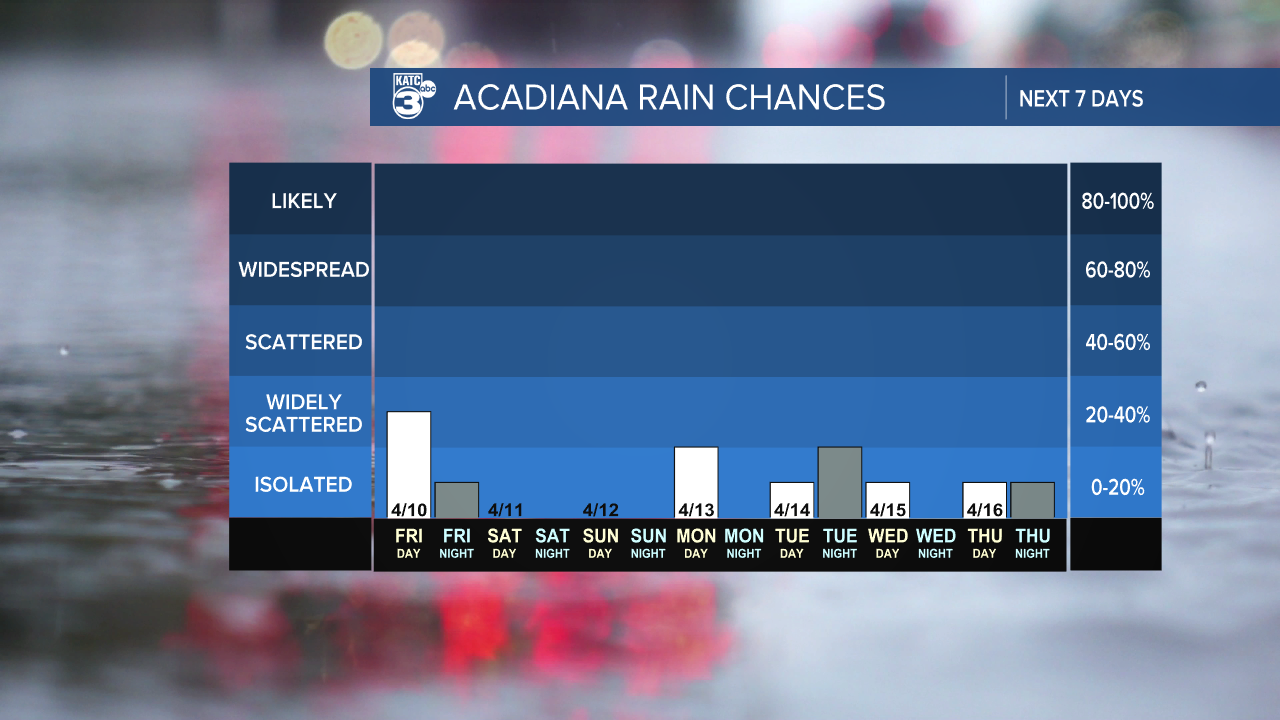
It looks like our rain chances are still pretty slim here in the state. We're expecting our highest chances tomorrow at around 30%, mainly in the afternoon as a weak upper-level disturbance rolls through.
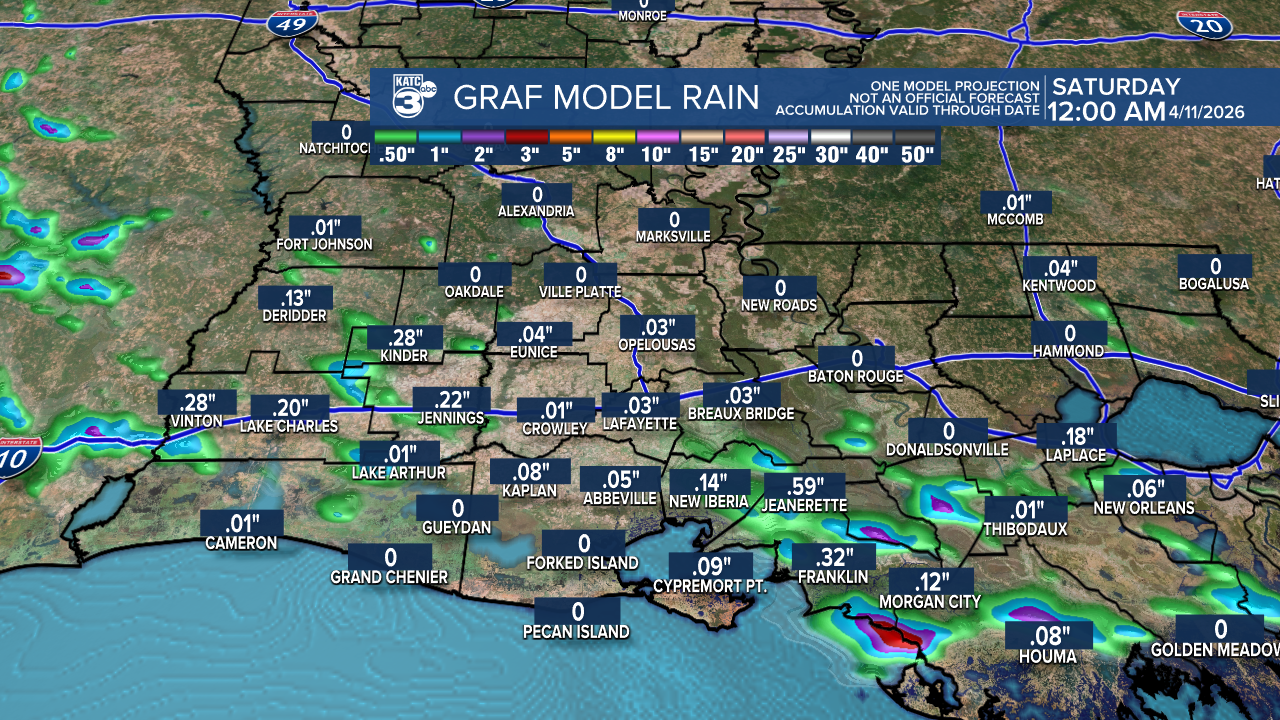
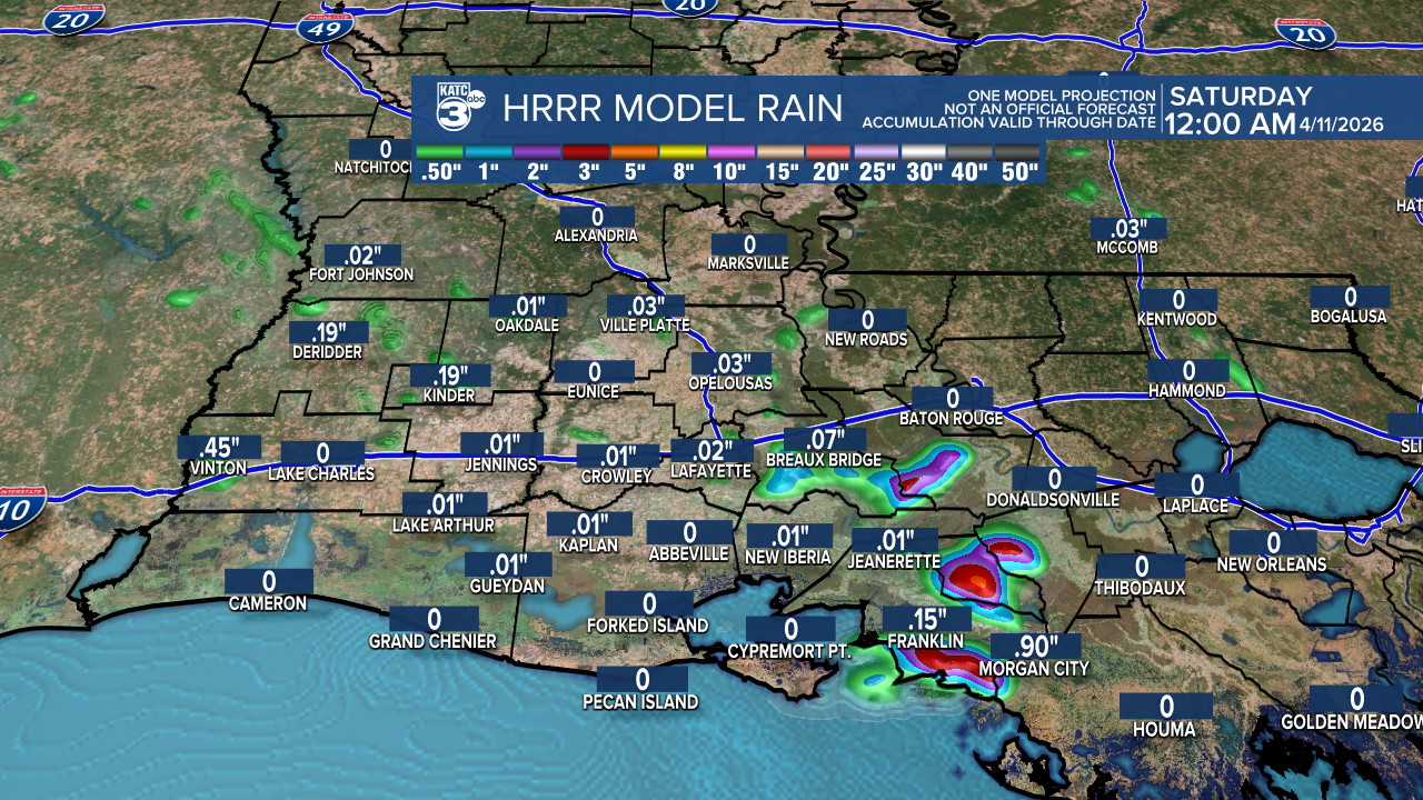
️The GRAF and HRRR models are a bit divided on rainfall amounts—while some areas will likely stay dry, others could see up to an inch!
Looking ahead to next week, rain chances have lowered slightly to 10%-20%. The SPC has outlined a slight risk (2/5) for a small portion of CENLA from Wednesday to Thursday.

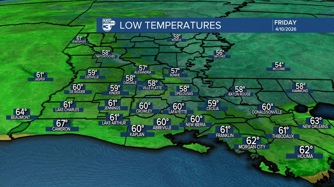
As for temperatures, we’re looking at 50s tonight and warming up to the 80s tomorrow.

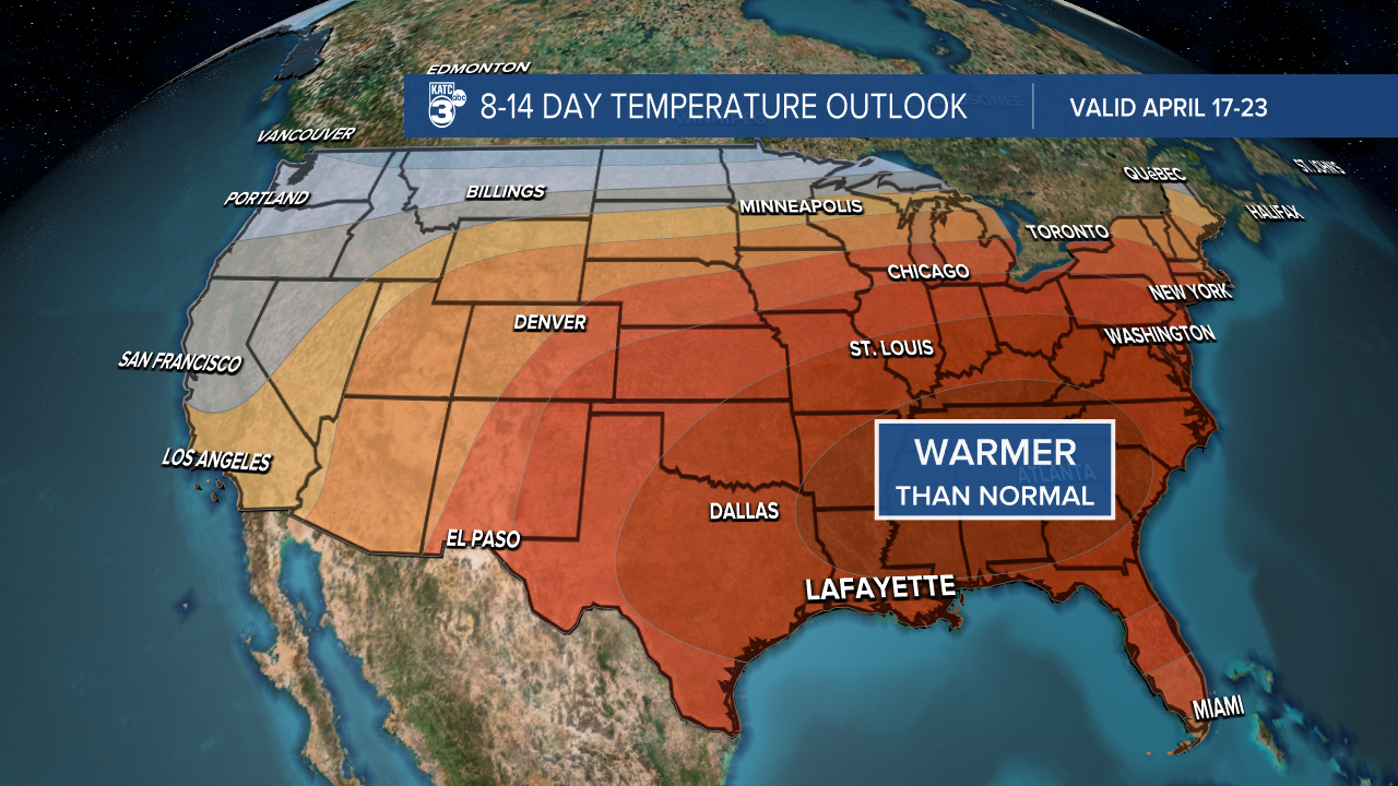
Warmer than normal temperatures continue through the end of April.
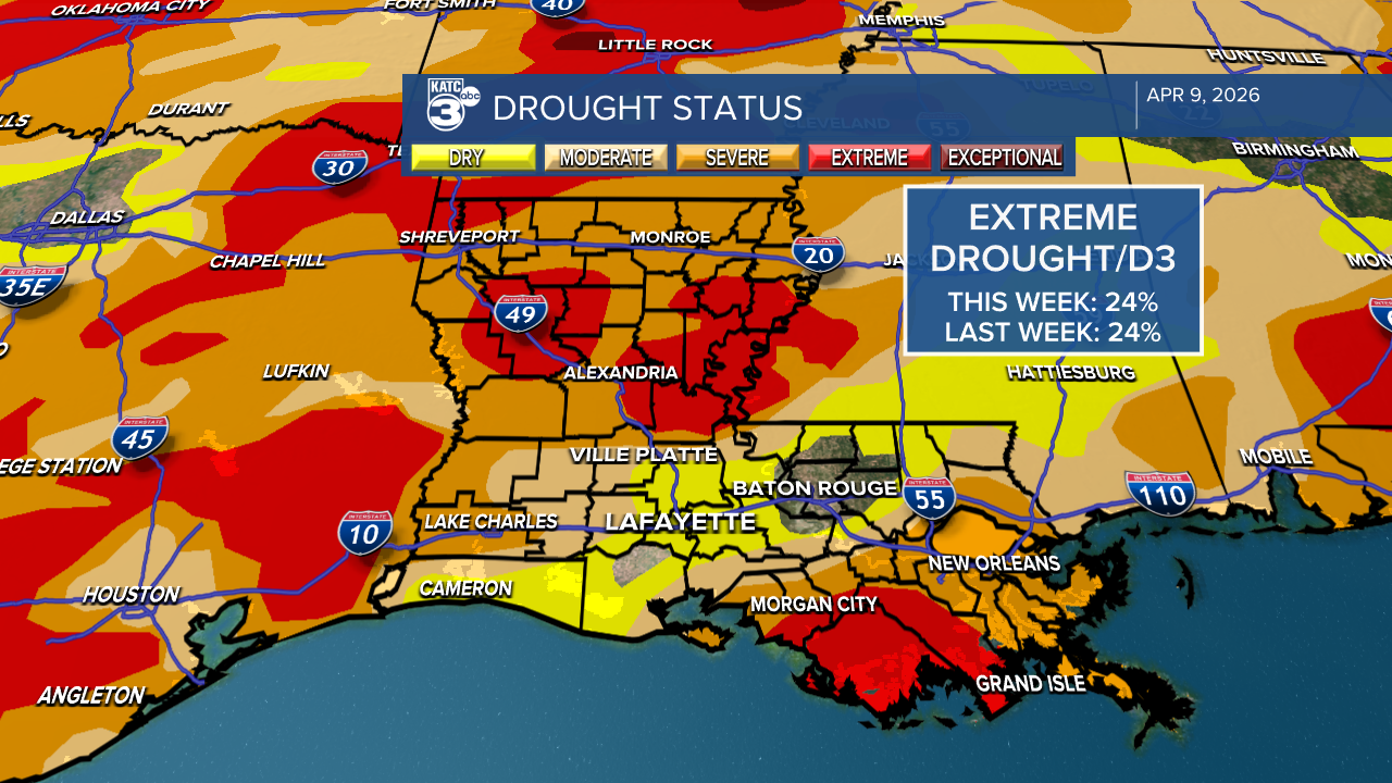
As of this week, our drought conditions haven't changed much. Here’s a quick overview:
- Extreme: 24%
- Severe: 69%
- Moderate: 82%
- Abnormally Dry: 95%
Unfortunately, it looks like these conditions will continue, as we’re not expecting any significant rainfall in the near future.
Colorado State University has released its summary for the 2026 Hurricane Season, predicting a below-normal year with 13 named storms, 6 hurricanes, and 2 major hurricanes.
Current weak La Niña conditions are expected to transition to El Niño in the coming months. While sea surface temperatures are warmer than normal in the western tropical Atlantic, they are somewhat cooler in the eastern and central regions. Typically, El Niño leads to increased vertical wind shear across the Atlantic Basin, which can inhibit storm development; however, storms can still occur.
Stay informed and prepared as we enter the hurricane season starting June 1st.

Follow Meteorologist Breyanna Lewis for further updates.
See the KATC 10 Day Forecast for the latest.
